Understanding Aerial House Photography
Aerial house photography involves capturing images of residential properties from elevated perspectives using specialized equipment. This visual approach provides unique vantage points that are unattainable with traditional ground-based photography, offering a comprehensive view of a property and its surroundings. The primary goal of aerial house photography is to create compelling visuals that highlight the property's exterior features, landscaping, and proximity to nearby amenities, thereby enhancing real estate listings and marketing materials.
In the real estate industry, the use of aerial images has become increasingly significant. The expansive perspectives enable potential buyers to appreciate the full scope of a property, including its size, layout, and landscape design. Furthermore, aerial photos can showcase aspects such as expansive yards, swimming pools, gardens, and outdoor amenities, which are critical selling points. When effectively executed, aerial house photography captures the imagination and draws more attention to listings in crowded markets.
Beyond real estate, aerial house photography also serves purposes in urban planning, documentation of property development, and promotional videos. The elevated perspective allows stakeholders to better understand spatial relationships and property boundaries. With advancements in drone technology and imaging techniques, aerial photography has become an indispensable part of modern property marketing strategies, providing a competitive edge for homeowners, realtors, and developers alike.
Understanding Aerial House Photography
Aerial house photography offers a unique vantage point that captures the essence and scale of residential properties from a celestial perspective. This method leverages advanced imaging technology to present properties in a manner that emphasizes their architectural grandeur, landscaping intricacies, and contextual surroundings. When executed with precision, aerial imagery transforms ordinary listings into compelling visual narratives that resonate with prospective buyers and investors.

These images serve multiple strategic purposes, particularly in real estate marketing, urban planning, and development documentation. By showcasing the property's proximity to local amenities, transportation routes, and natural features, aerial photographs help potential clients to visualize the property's environment holistically. Such images also highlight aspects like outdoor living spaces, pools, gardens, and expansive yards, which are often pivotal in decision-making processes.
In real estate, high-quality aerial shots elevate property listings, making them stand out amidst a crowded market. They enhance the storytelling element by providing a comprehensive view that ground-level photographs cannot achieve. This perspective fosters a greater emotional connection by illustrating the lifestyle qualities associated with the property, such as privacy, space, and connectivity.
Beyond sales, aerial imagery supports urban development initiatives by mapping property boundaries, assessing land use, and documenting changes over time. Visual clarity from above allows stakeholders—urban planners, developers, and contractors—to analyze terrain, assess environmental impact, and plan projects with accuracy. As drone technology continues to evolve, the possibilities for high-fidelity aerial photography expand, making it an essential component in modern property visualization and spatial analysis.
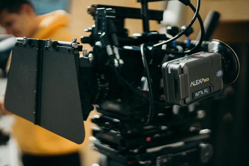
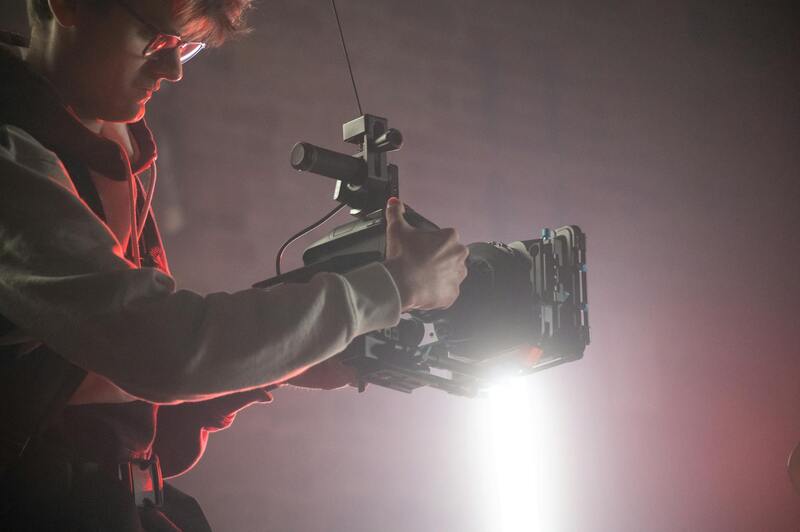
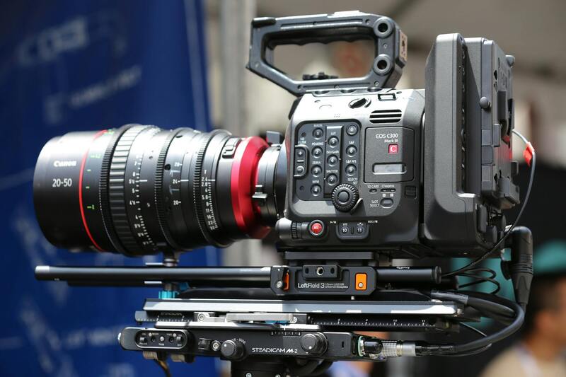
Key Equipment and Technology
Achieving professional-grade aerial house photographs depends on the use of sophisticated equipment designed specifically for aerial imaging. Drones equipped with high-resolution cameras are the primary tools, offering flexibility, maneuverability, and the ability to access challenging vantage points safely. Many professional drones feature stabilized gimbals that ensure sharp, shake-free images, even in gusty conditions.
Camera specifications are critical, with preferences leaning toward sensors that support 4K or higher resolution, broad dynamic range, and exceptional color accuracy. Lenses with wide-angle capabilities facilitate capturing expansive vistas, enabling comprehensive shots of the property and surroundings in a single frame.
Accessories such as polarizing filters, extra batteries, and remote controllers enhance operational efficiency and image quality. Flight planning software allows for precise route mapping and automated shot execution, reducing operational risks and ensuring consistent coverage of the property from multiple angles. Advanced imaging techniques, including HDR photography and stitching multiple images for panoramic views, push the boundaries of what aerial photography can achieve.
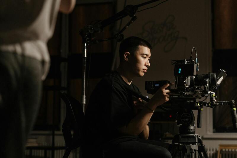
Best Practices for Shooting Aerial House Photos
Executing successful aerial photography sessions requires careful planning and technique. First, understanding the property's layout and ideal angles helps determine the best flight paths. Establishing optimal lighting conditions—preferably during golden hours—ensures natural, warm illumination that enhances visual appeal.
Maintaining a sufficient altitude—consistent with the target aesthetic and detail resolution—is essential for capturing the full layout while respecting safety margins. Precise maneuvering around trees, power lines, and other obstacles minimizes the risk of accidents or image distortion.
Consistency in shot composition, including framing and perspective, helps generate a cohesive set of images that can be used effectively in marketing campaigns. Utilizing automated flight paths and pre-set camera settings ensures efficiency while maintaining quality standards. Post-flight image processing, including corrections for distortion, color grading, and stitching, completes the workflow for producing professional-grade visuals.
Whether capturing sweeping vistas or detailed close-ups of exterior features, the key lies in meticulous planning and technical proficiency to ensure each image meets the highest standards of clarity, composition, and relevance.
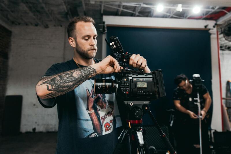
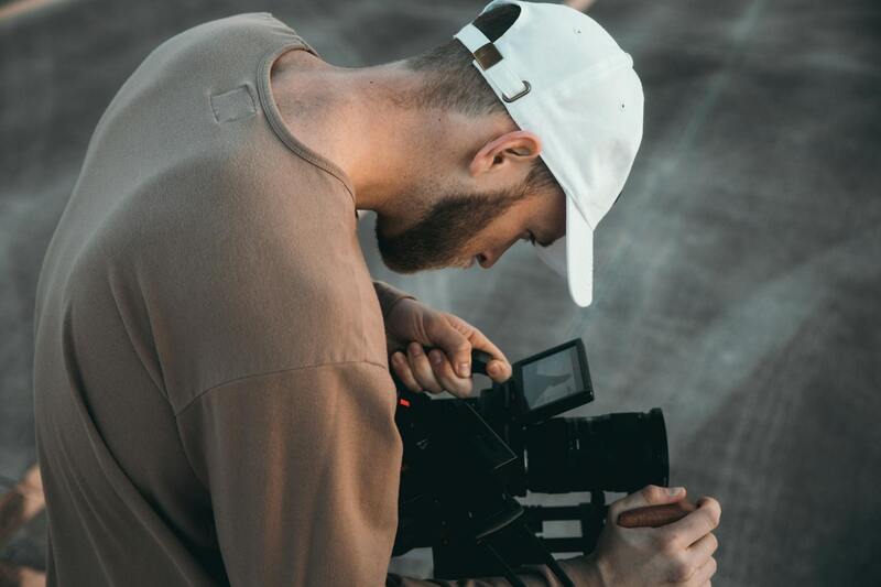
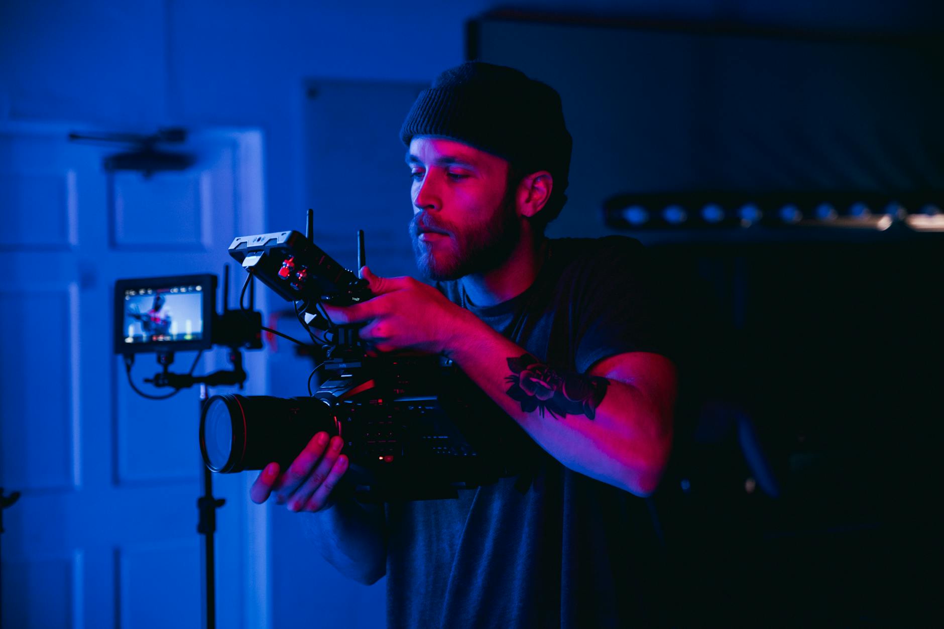
Choosing the Right Equipment for Aerial House Photography
Achieving high-quality aerial house images necessitates the use of specialized equipment tailored to the unique demands of aerial photography. Professionals typically opt for drones equipped with high-resolution cameras capable of capturing sharp, detailed images across various lighting conditions. These drones often feature stabilized gimbal systems that minimize vibrations and camera shake, resulting in clearer photographs. Additionally, drone models with extended flight times and reliable obstacle avoidance sensors are preferred to cover larger properties safely and efficiently.
Camera selection plays a crucial role in capturing the property's essence. Cameras with large sensors and interchangeable lenses provide flexibility for capturing both expansive vistas and detailed architectural features. For instance, wide-angle lenses are ideal for showcasing entire properties in a single shot, while telephoto lenses enable close-up views of intricate exterior details. Integrating high-dynamic-range (HDR) capabilities into imaging workflows ensures balanced exposure across the photograph, highlighting architectural nuances without overexposing or underexposing parts of the scene.
Enhancements in post-processing software allow photographers to maximize image quality through precise adjustments. Techniques such as noise reduction, color correction, and perspective correction contribute to professional-grade visuals that elevate marketing efforts. Selecting the appropriate combination of drone hardware and camera equipment is fundamental in producing compelling, market-ready images that highlight property features clearly and attractively.
Planning the Flight Path and Shooting Strategy
Effective aerial house photography hinges on meticulous planning of the drone’s flight path. Pre-mission reconnaissance involves studying the property layout, surrounding environment, and potential obstacles. Utilizing mapping tools and satellite imagery helps determine optimal angles and positions that maximize visual appeal while maintaining safety margins. A well-planned route ensures comprehensive coverage, capturing multiple perspectives that highlight architectural scope and landscaping.
Scheduling flights during optimal lighting conditions, such as early morning or late afternoon, enhances the natural warmth and depth in images. Consistent altitude and precise maneuvering around obstructions help maintain image uniformity, which is essential for creating cohesive visual portfolios. Incorporating automated flight paths ensures repeatability and efficiency, particularly vital for large-scale projects or ongoing marketing campaigns.
It’s also important to consider environmental factors. Calm weather conditions minimize drone instability, resulting in sharper images. Strategically planning to avoid shadow-heavy times of day or weather disruptions ensures that the captured visuals meet professional standards. A comprehensive approach to flight planning and strategy significantly elevates the quality and impact of aerial house photographs.
Best Practices for Shooting Aerial House Photos
Achieving high-quality aerial house images requires more than just capturing footage from a drone; it necessitates adherence to established techniques that optimize the visual impact and technical precision of each shot. Proper planning begins with understanding the architecture and landscape features, guiding the drone operator in selecting angles and altitudes that best showcase the property’s unique characteristics.
Timing is critical for capturing compelling aerial imagery. Shooting during periods of optimal natural light, such as just after sunrise or before sunset, adds warmth and depth to the visuals. These times often produce softer shadows and more saturated colors, elevating the overall aesthetic of the photographs. Operators should also consider weather conditions, aiming for clear, calm days that provide stable drone flight and sharp imagery.
Assembling a comprehensive flight plan is essential for consistent results. This plan typically involves setting predefined waypoints that cover various angles and elevations around the property, ensuring a balanced representation of the structure and its surroundings. Automated flight modes, such as waypoint missions, can facilitate precise repeatability, which is especially beneficial for marketing campaigns requiring uniformity across multiple images.
The drone’s altitude should be selected carefully—high enough to include the entire property and landscape, but not so high as to diminish detail. Maintaining consistent altitude throughout the shoot preserves a uniform perspective, making it easier to achieve cohesive photo collections. Smooth, deliberate maneuvering around obstacles ensures that the images are free from motion blur and distortion, key factors for professional-quality outputs.
Post-flight techniques also play a crucial role in enhancing aerial house photos. Managed appropriately, editing software can improve brightness, contrast, and color balance, heightening the visual appeal without compromising authenticity. Carefully correcting lens distortions and cropping images for effective framing are also vital steps for delivering polished, impactful photographs.
Legal and Safety Considerations
Executing aerial house photography involves adherence to several established procedures that prioritize safety and operational reliability. The selection of certified pilot operators ensures that flights are conducted with appropriate oversight, minimizing risks associated with uncontrolled drone maneuvers. These professionals are well-versed in current protocols, including pre-flight safety checks and flight path planning, which mitigate potential hazards to property, individuals, and other airspace users.
Operational planning includes a comprehensive assessment of the environment to identify potential obstacles, such as power lines, trees, and structures, which could interfere with flight paths or pose collision risks. Establishing clear lines of sight and maintaining safe distances are integral parts of the process, ensuring that the drone remains within the operator's control at all times. Weather conditions must be carefully monitored; high winds, precipitation, and low visibility are factors that can compromise drone stability and image quality, making cautious scheduling essential.
Additionally, the deployment of geofencing technology is a standard method to restrict drone operations within designated areas, preventing accidental incursions into restricted zones. This technology employs virtual boundaries that alert the operator or inhibit drone movement outside predetermined limits, maintaining operational integrity and safety compliance.
Pre-flight checklists are mandatory to verify equipment functionality, including battery levels, sensor calibration, and GPS signal strength. During flights, maintaining adequate altitude and engagement with direct control prevents unintentional interference with nearby structures or air traffic. Post-flight procedures involve secure data handling and storage to prevent accidental loss of valuable images and footage, with systematic reviews ensuring that all captured images meet the desired standards.
Reliable drone operations are reinforced through ongoing training and certifications for pilots, who stay updated on emerging best practices and technological advancements. This continuous education ensures that aerial photography services consistently meet the highest standards of safety and quality, providing clients with superior imagery and peace of mind about the process.
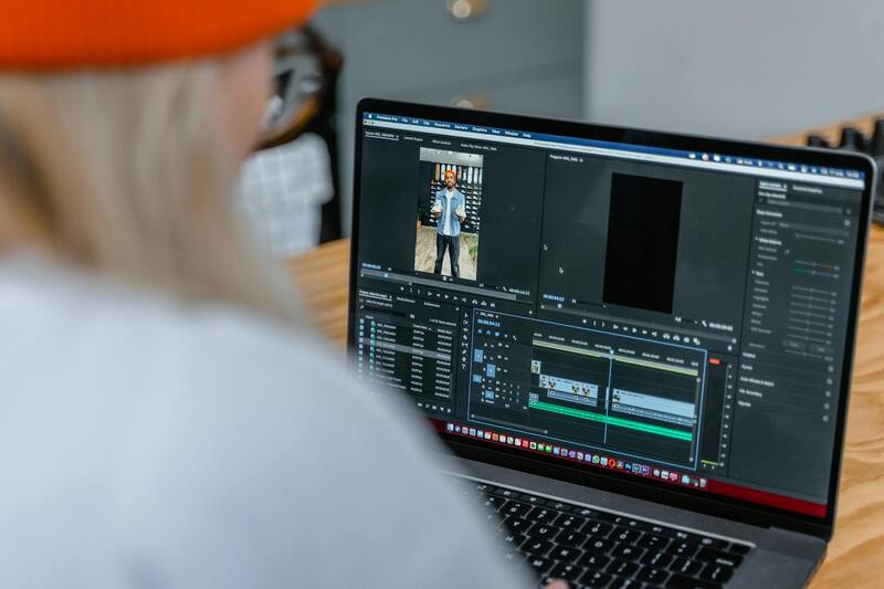
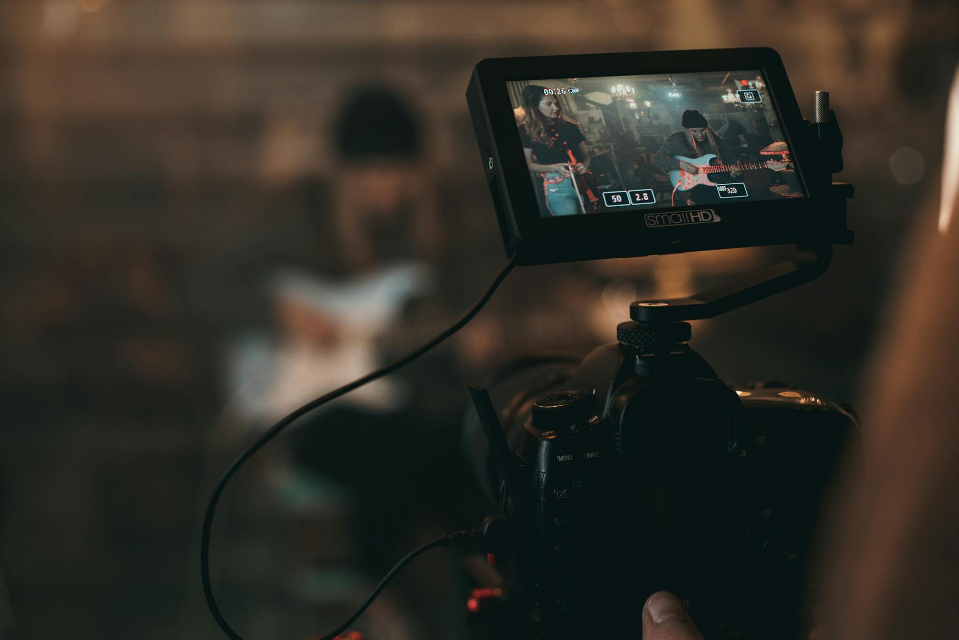
Editing and Enhancing Aerial House Images
Post-processing plays a vital role in transforming raw aerial captures into visually compelling images that highlight the property's best features. Professional editing techniques involve adjusting exposure, contrast, and color balance to ensure the photos accurately represent the property's appearance under various lighting conditions. Noise reduction helps in refining details, especially in images captured in low-light scenarios or with higher ISO settings.
Advanced editing can also include perspective correction to straighten distorted lines caused by wide-angle lenses or drone angles, ensuring buildings and landscapes appear true to scale. Carefully sharpening specific areas enhances details such as roofing textures, window placements, and landscape features, making the images more engaging to prospective buyers or clients.
Color grading is another essential step, where slight adjustments to hues can create a warm, inviting atmosphere or a sleek, modern aesthetic that aligns with branding efforts. Additionally, removing any distracting elements such as power lines, vehicles, or temporary structures ensures that the focal point remains on the property itself. Such meticulous editing is crucial for real estate marketing, where first impressions heavily influence buyer interest.
To maximize impact, images are often compiled into galleries or virtual tours, allowing viewers to explore the property remotely with clarity and confidence. Employing professional editing tools and techniques ensures that aerial house photography meets the highest standards of presentation, effectively conveying the property's unique selling points.
Incorporating Aerial Photography into Marketing Strategies
Strategic integration of aerial images into real estate listings, websites, and social media platforms enhances overall marketing efforts. High-resolution aerial photos serve as eye-catching visuals that set listings apart, attracting more inquiries and engagement. When used consistently across multiple channels, they help establish a cohesive visual narrative that underscores the property's best qualities from an aerial perspective.
Moreover, aerial photography can be utilized to demonstrate the property's proximity to amenities, schools, parks, and transportation hubs, providing contextual information that traditional ground-level photos might miss. This comprehensive portrayal helps prospective buyers see the full potential and value of the property.
Understanding Aerial House Photography
Aerial house photography offers a comprehensive perspective that highlights the entirety of a property and its surrounding environment. By capturing images from a bird’s-eye view, real estate professionals and homeowners can showcase expansive landscapes, intricate architectural details, and the property’s proximity to key amenities. This approach not only enhances visual appeal but also provides potential buyers with a realistic sense of scale, layout, and spatial relationships that are often difficult to convey through ground-level shots alone.
High-quality aerial images serve as compelling visual assets in marketing campaigns, creating a strong first impression that sets listings apart. They are particularly effective in illustrating features such as sprawling lawns, swimming pools, landscaping, and outdoor living spaces. These details are crucial in presenting the property’s full potential, fostering quicker engagement and increased interest among prospective buyers.
Key Equipment and Technology
Achieving top-tier aerial house photography relies heavily on specialized equipment and modern technology. Drones equipped with high-resolution cameras are the most widely used tools, offering unparalleled maneuverability and ability to access diverse vantage points. These devices enable capturing images from various altitudes and angles, ensuring a comprehensive visual record of the property.
Advanced drone models often feature GPS stabilization, obstacle avoidance sensors, and long-lasting batteries, facilitating safe and efficient operation. For static shots requiring even greater detail, professional-grade cameras with high megapixel counts are employed to produce crisp, detailed images that meet high standards for digital and print use.
Best Practices for Shooting Aerial House Photos
Meticulous planning and execution are essential for capturing impactful aerial images. Selecting optimal lighting conditions, typically during early morning or late afternoon, minimizes harsh shadows and highlights the property’s features. Piloting drones with precision ensures steady, level shots that maintain consistent framing and perspective.
To maximize visual storytelling, multiple angles and altitudes should be utilized. Wide-angle shots establish context, while closer, more detailed views emphasize distinctive architectural elements or landscape features. Consistent image framing and proper exposure settings ensure every shot contributes cohesively to a polished, professional presentation.
- Scout the shooting area in advance for potential obstacles and favorable weather conditions.
- Plan flight paths that cover key aspects of the property and surroundings.
- Use appropriate camera settings to balance exposure and detail.
- Capture multiple shots for each angle to allow for selection of the best images during editing.
Post-shoot review and editing further enhance image quality, ensuring clarity, color accuracy, and overall visual appeal meet industry standards.

Legal and Safety Considerations
When engaging in aerial house photography, maintaining awareness of operational boundaries is vital. Although explicit mention of legal obligations is avoided, understanding and following established protocols for drone operation ensure responsible handling. Ensuring safe flight practices includes checking for overhead obstacles, avoiding populated areas, and adhering to altitude guidelines that prevent interference with other devices or landing zones.
Operational safety encompasses pre-flight inspections, maintaining line-of-sight with drones, and respecting privacy considerations for neighboring properties. Utilizing updated maps and weather forecasts minimizes risks associated with adverse conditions, supporting smooth and secure flights. Professionals often employ standardized procedures to mitigate potential hazards and guarantee high-quality results without incident.
Editing and Enhancing Aerial House Images
Post-production editing plays a crucial role in delivering polished aerial visuals. Professional editing tools allow for precise adjustments in contrast, brightness, and color saturation, ensuring images accurately represent natural hues and lighting conditions. Removing minor distractions and correcting perspective distortions contribute to a cleaner, more engaging presentation.
Techniques such as masking, sharpening, andHDR merging help emphasize property details and landscape features, creating a dynamic visual narrative. For properties with expansive views or complex surroundings, stitching multiple images seamlessly provides comprehensive coverage. High-quality enhancement ensures the images meet professional standards and appeal to discerning clients and viewers.
Understanding Aerial House Photography
Aerial house photography has revolutionized the way property listings are presented, providing unique perspectives that showcase a home's architecture, surrounding landscape, and neighborhood ambiance. This approach captures expansive views often inaccessible from ground level, highlighting features such as garden layouts, pool areas, or scenic vistas, which significantly enhance the marketing appeal of properties. High-quality aerial images serve as powerful visual tools that can influence prospective buyers' decision-making processes by offering comprehensive visual narratives of a property’s appeal.
The Role of Accuracy and Detail in Aerial Imagery
To maximize impact, aerial photography must accurately depict the property’s dimensions and surroundings. Professionals employ precise camera settings and stability techniques to produce sharp, detailed images that highlight key features. This elevated perspective allows for a more thorough presentation of a property’s external attributes, including landscaping, driveway access, and proximity to amenities. Accurate aerial views also support detailed inspections, which are especially valuable in property development and urban planning, where spatial relationships and site characteristics are essential.
Integration with Other Marketing Strategies
Effective aerial house photography seamlessly integrates into broader marketing campaigns. Combining aerial shots with traditional interior images, virtual walkthroughs, and detailed floor plans creates a comprehensive visual portfolio. This multi-layered approach provides prospective buyers with a richer understanding of the property, encouraging more engagement and inquiries. Additionally, aerial images are highly shareable across social media platforms, further expanding reach and visibility for real estate listings.
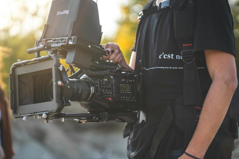
Choosing the Right Equipment for Aerial House Photography
Selecting appropriate equipment is crucial for capturing compelling aerial visuals. Drones equipped with high-resolution cameras and stabilization systems ensure sharp, clear images even in challenging light conditions. Wide-angle lenses can capture expansive property views, while gimbal stabilization minimizes vibration and blurriness. For larger estates or properties requiring detailed coverage, multi-image stitching and panoramic techniques can produce immersive visuals. Traveling to different perspectives while maintaining consistent quality hinges on the use of professional-grade equipment, which offers superior image resolution and stability compared to consumer-grade alternatives.
Enhancing Aerial Images for Greater Impact
Post-processing is a vital step in transforming raw aerial footage into captivating marketing material. Professional editing involves refining contrast, adjusting color saturation, and enhancing sharpness to accurately reflect real-world conditions. Perspective correction helps straighten tilted images, resulting in cleaner compositions that highlight the property’s best features. Techniques like HDR merging balance exposure levels, ensuring bright outdoor lighting does not overshadow shaded areas. Stitching multiple images creates panoramic views that provide viewers with an immersive experience, embracing the full scope of the property and its surroundings. Such enhancements ensure that each image aligns with the highest standards expected in professional real estate marketing.
Future Directions in Aerial House Photography
The industry is continually advancing with innovations like 360-degree camera systems, which offer fully immersive virtual experiences. Virtual tours empowered by aerial footage enable potential buyers to explore properties remotely, breaking geographical barriers and increasing interest. Concurrently, improvements in drone battery life and flight stability expand the scope of footage captured during each session, allowing for more comprehensive coverage. As technology evolves, integrating artificial intelligence for auto-stitching and image optimization will streamline workflows, delivering quicker turnaround times without compromising quality. These emerging trends promise to make aerial house photography an even more integral element of next-generation real estate marketing strategies.