Overview of Aerial Property Photography
Aerial property photography is a specialized imaging service that captures high-quality imagery from elevated viewpoints, primarily utilizing drone technology and other aerial platforms. This form of photography offers a unique perspective that enhances the visual appeal of properties, providing comprehensive views that are often unattainable with traditional ground-level photography. In the vibrant and competitive Miami real estate market, such imagery has become a critical tool for agents, developers, and marketers seeking to showcase properties in their best light.
Utilizing aerial property photography allows for detailed representation of large estates, commercial real estate, and waterfront properties, which are prevalent in Miami. It plays a crucial role in marketing campaigns by highlighting the property's surroundings, proximity to key amenities, and overall development context. This technique also aids urban planners and construction firms by providing clear visual data that supports design, planning, and promotional efforts.
The rising demand for high-quality, engaging visual content in Miami has significantly increased the reliance on aerial photography. It helps attract potential buyers, investors, and tenants by providing an immersive experience that traditional photography cannot deliver. Moreover, aerial visuals are essential for virtual tours, targeted marketing campaigns, and detailed property analysis, making them an invaluable component of modern real estate and development initiatives.
In addition to real estate, aerial property photography supports various other industries, including tourism, hospitality, and event planning. Its capacity to capture panoramic views of Miami’s iconic skyline, beaches, and natural landscapes makes it an indispensable tool for promotional and documentation purposes across multiple sectors. As Miami continues to grow and evolve, the importance of compelling aerial imagery only increases, providing businesses and developers with a competitive edge in a dynamic market.
Key Equipment and Technology
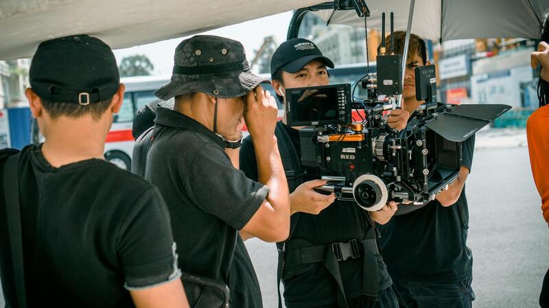
Successful aerial property photography relies heavily on the selection of appropriate equipment to produce high-quality visuals while adhering to operational standards. The most commonly used devices are multi-rotor drones equipped with advanced camera systems. These drones offer stability, precision, and versatility, enabling photographers to capture clear and detailed images from various altitudes and angles.
When choosing a drone for aerial property photography, considerations include battery life, camera resolution, gimbal stability, and flight automation capabilities. High-resolution cameras, often with 4K video support and RAW image capture, are essential for producing professional-grade visuals that highlight the property's features and surroundings effectively. Gimbal stabilization reduces vibrations, ensuring sharp images even in windy conditions common in Miami.
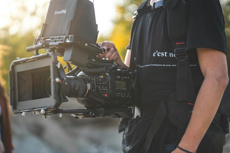
For image capturing, mirrorless or DSLR cameras mounted on drone gimbals are preferred to achieve optimal quality. These setups can capture wide-angle shots that encompass entire properties and adjacent landscapes, providing comprehensive visual information.
Concerning technology, flight planning software plays a crucial role in mapping out flight paths, ensuring consistent coverage, and complying with safety protocols. This software allows for pre-programmed missions, reducing the risk of accidents and maximizing efficiency. Moreover, live video transmission capabilities enable remote monitoring during flights, offering real-time feedback and adjustments.
Operating in Miami involves understanding local airspace regulations and restrictions. Drone operators must utilize equipment that supports geo-fencing and failsafe features to prevent incursions into restricted zones such as airport boundaries or sensitive areas. The integration of GPS and obstacle avoidance sensors enhances operational safety, especially when navigating urban environments or densely populated regions.
Legal and Safety Regulations
Adherence to established standards and protocols ensures that aerial property photography in Miami is conducted responsibly and without interruption. Operators must stay informed about designated airspace zones, including restricted areas and temporary flight restrictions, to plan missions accordingly. Prioritize thorough pre-flight assessments to identify potential obstacles, such as building heights, power lines, and other infrastructure, which can pose risks during drone operations.
Utilizing equipment equipped with geo-fencing technology helps prevent unauthorized entry into sensitive zones, aligning with established practices for safe drone flights. Incorporating automatic failsafe features and return-to-home functions adds an extra layer of security, ensuring drones can safely navigate back in case of signal loss or system errors. Consistent drone maintenance and regular calibration of sensors and cameras are also essential to uphold the quality and safety standards of aerial photography projects.
Maintaining open communication with local authorities and obtaining necessary flight authorizations or permits streamline operations and prevent any potential disruptions. This proactive approach helps build trust within the community and supports sustainable practices for aerial photography in densely populated areas like Miami.
Effective Shooting Techniques
Maximizing the quality of aerial property images hinges on refined shooting techniques tailored to the unique Miami landscape. It is essential to schedule shoots during optimal lighting conditions, typically during early mornings or late afternoons, when natural light emphasizes architectural details and landscape features without harsh shadows.
Strategically planning flight paths to capture multiple angles and heights from different elevations offers comprehensive visual content. Utilizing grid or orbit flight patterns ensures consistent coverage, especially for expansive properties or complex layouts. Employing panoramic and high-dynamic-range (HDR) imaging techniques can further enhance the visual impact, capturing detailed textures and varying light conditions efficiently.
Maintaining stable camera settings and using gimbal stabilizers greatly reduces motion blur and delivers sharp, professional-grade images. When photographing properties with adjacent features, such as pools or landscaped gardens, consider incorporating foreground elements to create depth and interest in the compositions.
Furthermore, integrating pre-planned shot lists and conducting briefings before each flight can ensure all critical aspects of the property are captured, aligning with client expectations and marketing goals.
Post-Processing and Image Editing
Post-processing is integral to refining aerial images and delivering visually compelling content. Techniques such as exposure correction, color grading, and perspective adjustments help in highlighting the property's best features while maintaining realistic representations.
HDR merging enhances detail retrieval from scenes with high contrast, common in Miami's vibrant sunlight and shaded areas. Noise reduction and sharpening processes can further improve image clarity and detail, especially when dealing with lower-resolution raw files.
Panoramic stitching allows for expansive wide-angle views, ideal for showcasing large estates or commercial properties. Utilizing advanced editing software enables fine-tuning aspects like saturation, contrast, and perspective distortion, resulting in impactful images ready for marketing use.
Consistent editing standards across projects elevate the quality of the portfolio, ensuring that each image aligns with the branding and aesthetic preferences of real estate professionals in Miami.
Legal and Safety Regulations
When conducting aerial property photography in Miami, adhering to established procedures and standards ensures a seamless and professional workflow. This involves understanding the comprehensive guidelines that govern drone operations within urban and residential environments to guarantee safety for both operators and the public. Maintaining clear flight plans and pre-mission checklists are essential practices that help in avoiding obstacles and unintended disturbances during shoots.
Operators are advised to coordinate with local authorities when planning aerial flights over densely populated neighborhoods or commercial districts. Such coordination not only fosters transparency but also facilitates smooth access to required permissions and designated flight zones. Utilizing real-time communication tools and situational awareness devices enhances the ability to respond swiftly to unexpected circumstances, thus preventing accidents or disruptions.
Employing robust safety protocols, such as setting operational geofences and maintaining visual line-of-sight (VLOS) at all times, reduces risks associated with drone flights around populated areas or sensitive structures. Pre-flight risk assessments should be conducted to identify potential hazards, including power lines, tall trees, and other aerial obstructions. Additionally, using high-quality equipment with fail-safe mechanisms, like automatic return-to-home features, further ensures that drone operations are both efficient and safe.
 igurecaption> illustration of safety protocols and flight planning for Miami aerial property shoots
Understanding local regulations specific to Miami, including city ordinances on drone usage and restricted airspace, is crucial. Many urban areas have unique restrictions that must be observed to maintain compliance. Drone operators should regularly update their knowledge through official channels and industry resources, ensuring that their practices align with the latest standards and recommendations.
In addition to legal compliance, implementing comprehensive safety protocols enhances the overall quality of the aerial property photography service. These practices contribute to maintaining professional integrity, fostering client trust, and avoiding potential liabilities that could arise from unsafe or non-compliant operations.
 igurecaption> visual representation of drone safety guidelines for real estate photography in Miami
Legal and Safety Regulations
Utilizing aerial property photography involves adherence to established protocols that prioritize safety and operational integrity. Comprehensive pre-flight planning is essential, including an assessment of the shoot environment to identify potential hazards such as power lines, tall structures, and other aerial obstacles. These assessments help in mapping out safe flight paths and establishing operational boundaries, thereby reducing unforeseen risks during drone operation.
Operational safety is further enhanced by using advanced drone equipment that incorporates fail-safe mechanisms. Features like automatic return-to-home (RTH), obstacle detection sensors, and geofencing capabilities are crucial components that support safe flight execution. They enable drones to avoid collisions automatically and return to designated points even in unexpected situations, ensuring continuous safety margins throughout the shoot.
Equally important are adherence to local airspace restrictions and city-specific ordinances. Miami, with its dynamic urban landscape, imposes specific guidelines that govern drone flights over certain zones. Drone operators should regularly review official updates from local authorities to stay informed about temporary restrictions or special considerations that might affect scheduling and flight paths.
Maintaining visual line-of-sight (VLOS) with the drone at all times is critical, especially in urban settings where obstacles and interference are common. This practice ensures better control over drone movements, facilitating the capture of precise aerial images while preventing unintended intrusions over private or sensitive areas.
Documenting safety procedures and flight plans not only facilitates operational efficiency but also demonstrates professional responsibility. Such documentation provides transparency for clients and partners, illustrating a commitment to high standards for aerial property photography services.
Effective Shooting Techniques
Achieving premium aerial property photographs requires meticulous planning and execution. Successful shooting begins with comprehensive pre-flight preparations, including detailed flight planning that considers the property layout, surrounding environment, and optimal angles to capture the property’s features. Drone operators should identify key focal points, such as architectural highlights, landscaping, and access points, to ensure these elements are prominently featured in the final images.
Choosing the appropriate time of day is crucial for capturing natural light that enhances the property’s aesthetic appeal. Photographers often prefer shooting during the golden hour—shortly after sunrise or before sunset—when the soft, warm lighting creates attractive shadows and highlights. This not only accentuates the property's best features but also produces visually captivating images.
Legal and Safety Regulations in Aerial Property Photography
Adherence to established procedures is critical for the successful execution of aerial property photography. Operators must ensure that they follow proper flight protocols to prevent disruptions and maintain professional standards. This includes obtaining necessary permissions from property owners and local authorities before deploying aerial equipment, as well as respecting designated flight zones to avoid interference with other airspace users.
Rigorous pre-flight planning involves reviewing local airspace restrictions, which are typically outlined by aviation authorities and municipal guidelines. This process helps identify any no-fly zones, restricted areas, or altitude limitations relevant to the Miami region, especially considering its dense urban landscape and proximity to protected areas like beaches and parks.
Safety measures are a cornerstone of responsible aerial photography. Operators should conduct thorough risk assessments to identify potential hazards such as power lines, tall structures, and bustling urban areas. Maintaining a safe distance from these hazards minimizes the risk of accidents. Weather conditions, including wind speed and sudden storms, must also be taken into account, as they directly impact drone stability and flight safety.
Compliance with operational standards involves routine equipment checks, such as verifying battery life, camera functionality, and signal integrity. Many professional operators use flight planning software to map automations that optimize coverage while avoiding obstacles. This technology assists in maintaining consistent quality and reducing the likelihood of mishaps during flight.
Training and certification also play a vital role. Certified drone pilots possess the necessary skills to handle complex scenarios, including emergency procedures and precise camera controls. Continued education helps pilots stay updated on evolving regulations and safety practices, ensuring that every aerial project adheres to the highest standards.
Impact of Miami’s Environmental and Urban Landscape
The unique environment of Miami influences operational considerations. Coastal winds, high humidity, and reflective surfaces such as water bodies and glass buildings require special attention during flight and image capture. Understanding local conditions enables pilots to adjust flight paths and camera settings, ensuring safety and high-quality results.
In addition to safety, environmental awareness supports sustainable practices. Minimizing noise disturbance and avoiding protected wildlife habitats can aid in maintaining harmony with the local ecosystem, reinforcing responsible stewardship of aerial operations.
Effective Shooting Techniques
Mastering the art of aerial property photography requires a strategic approach to capturing the most compelling images. Key techniques involve understanding optimal flight paths, camera angles, and lighting conditions. Aligning drone flight plans with specific property features ensures that each shot highlights the property’s best attributes, from expansive lawns to architectural details. Consistent altitude control helps maintain uniformity across images, making them suitable for both marketing presentations and detailed inspections.
Utilizing automated flight modes can facilitate complex shot sequences, especially for large properties or multifaceted landscapes. Pre-programming waypoints allows for precise control over camera orientation and movement, reducing the likelihood of missed angles or inconsistent framing. Furthermore, adjusting the drone’s shutter speed, ISO, and aperture in real-time enhances image clarity and exposure, particularly in varied lighting conditions during the golden hour or overcast days.
Ongoing training in advanced piloting techniques, including manual camera operation and dynamic shot composition, contributes significantly to professional-grade results. The calibration of equipment and the selection of appropriate lenses, such as wide-angle or panorama-capable setups, help in capturing sweeping views and intricate property details effectively. When combined with methodical flight planning and environmental awareness, these techniques ensure that each image aligns with marketing goals and showcases the property in its best light.
Post-Processing and Image Editing
Once the images are captured, meticulous post-processing enhances their visual impact. Adjustments to brightness, contrast, and color saturation can make property features stand out, while removing lens distortion or unwanted reflections helps achieve a polished, professional appearance. Advanced editing software allows for subtle corrections that preserve the authenticity of the property, emphasizing key visual elements without overprocessing.
Integrating HDR (High Dynamic Range) techniques can balance exposure levels across shots taken in challenging lighting scenarios, such as shadows cast by buildings or bright sky backgrounds. Stitching multiple images to create seamless panoramic views provides comprehensive visualizations of larger properties, ideal for marketing materials and virtual tours. Consistent editing standards ensure a cohesive portfolio of images that reinforce brand professionalism and attract prospective buyers.