Importance of Drone Footage in Real Estate Marketing
In the competitive landscape of real estate, capturing a property's essence through visual storytelling has become more crucial than ever. Drone footage offers an unparalleled vantage point, enabling realtors and property developers to showcase properties from stunning aerial perspectives that traditional photography cannot achieve. These high-quality videos serve as compelling tools to highlight a property's surrounding environment, landscape features, and architectural details from an elevated viewpoint, providing prospective buyers with a comprehensive understanding of the property’s scale and context.
Furthermore, drone videos significantly enhance online listings by making them stand out amidst a sea of static images. They evoke a powerful emotional response, often translating to increased viewer engagement and higher conversion rates. A well-produced drone video grants potential buyers a virtual tour experience, fostering a deeper connection and fascination with the property before they even step foot on-site. This immersive approach streamlines the decision-making process, attracting serious inquiries and reducing time on market.
Besides individual property listings, drone footage elevates promotional campaigns of entire developments or neighborhoods, giving viewers an expansive view of the area's amenities and environment. As digital consumption continues to dominate real estate marketing strategies, professionally produced drone videos have become a significant asset, setting property listings apart and appealing to a broader, more engaged audience.
Key Elements of High-Quality Real Estate Drone Videos
Producing high-caliber drone videos for real estate requires meticulous attention to several core elements that combine to create an engaging and professional presentation. A top-tier drone video not only captures stunning visuals but also adheres to technical excellence, ensuring that each shot contributes meaningfully to the property's story.
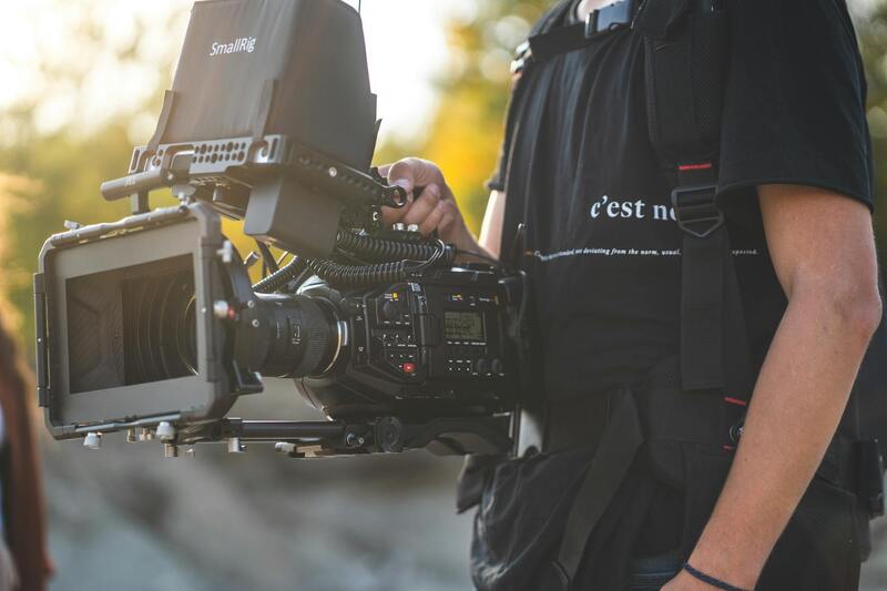
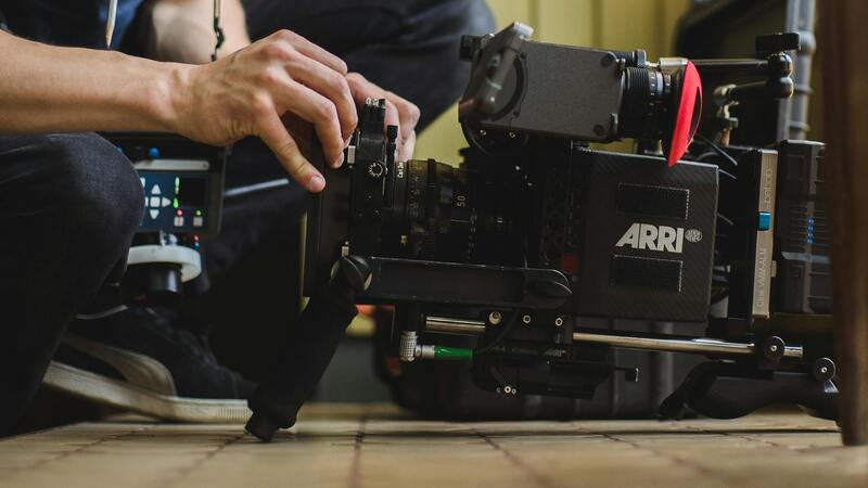
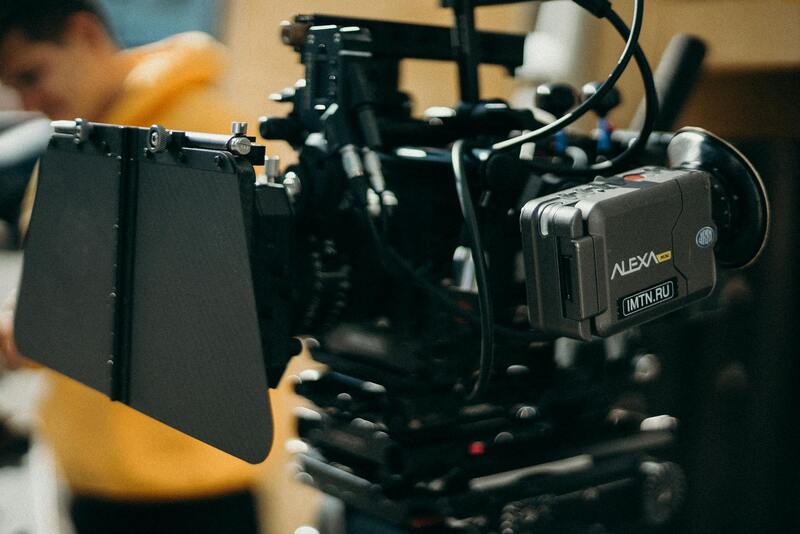
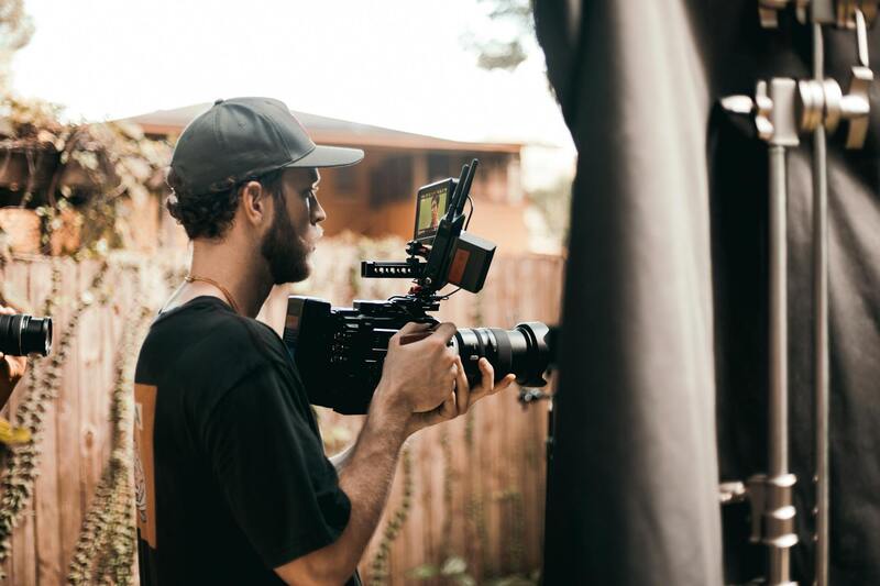
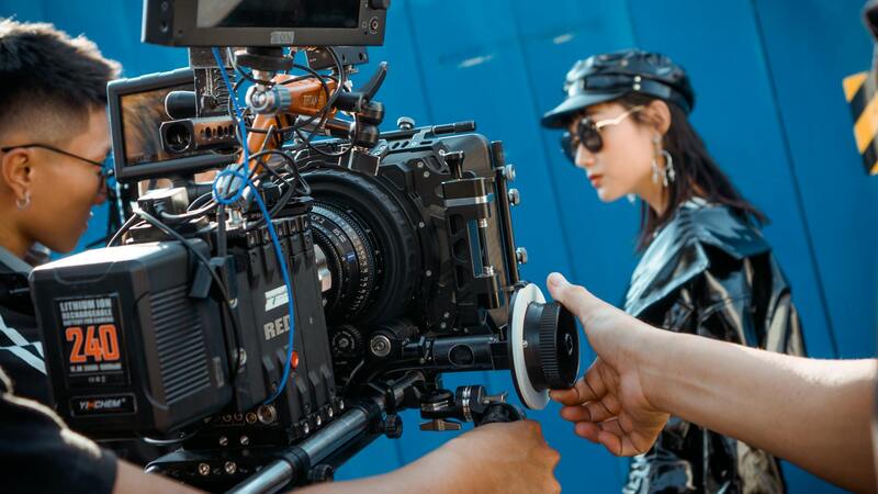
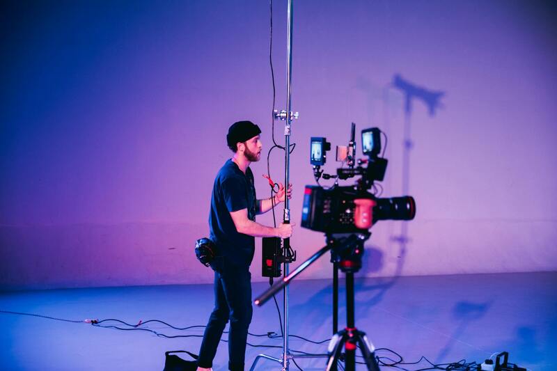
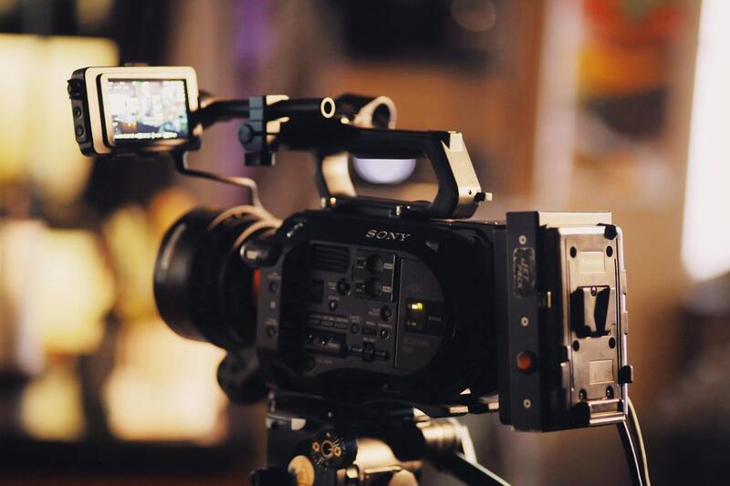
Firstly, the quality of the drone equipment plays a critical role. Utilizing drones equipped with high-resolution cameras capable of capturing 4K or higher video fidelity ensures crisp, detailed footage. Camera stabilization is essential to deliver smooth, cinematic movements that communicate professionalism and give viewers a seamless experience. Gimbals are integral components that maintain steady shots even in windy conditions, reducing jitters and blurriness.
Lighting conditions significantly influence the visual appeal of drone footage. Optimal filming occurs during golden hour—the periods shortly after sunrise or before sunset—when natural light is soft and warm, enhancing the property's features and landscape nuances. Additionally, meticulous planning of flight paths and shot sequences ensures comprehensive coverage without unnecessary overlaps or gaps.
Post-production editing is the final stage that elevates raw drone footage into a compelling marketing asset. Professional editing involves color grading to enhance visuals, stabilizing shaky shots, and adjusting exposure to achieve balanced, attractive imagery. Transitions, text overlays, and background music can be added to craft a narrative flow that captivates viewers and emphasizes the property's key features.
Sound design also plays a subtle yet impactful role. Incorporating ambient sounds or a tailored soundtrack can evoke emotional responses, making the video more memorable. It's vital that the editing process maintains a natural, authentic representation of the property, avoiding over-embellishment that could mislead prospective buyers.
Additionally, attention to scale and perspective enhances the storytelling. For example, starting with an aerial overview of the neighborhood before zooming into the property itself allows viewers to contextualize the property within its surroundings, creating a layered viewing experience.
Overall, a commitment to high-quality equipment, thoughtful shot composition, expert editing, and an understanding of visual storytelling principles ensures that real estate drone videos effectively capture the attention of potential buyers. They serve as a vital component for real estate professionals aiming to produce visually stunning and highly persuasive marketing content that accurately represents the property's value and lifestyle opportunities.
Legal and Safety Considerations for Drone Usage
Executing high-quality real estate drone videos within a structured and compliant framework is essential for maintaining professionalism and safeguarding the project. Professionals should adhere to established operational standards, focusing on responsible drone conduct that prioritizes safety and compliance with prevailing regulations. Prior to shooting, obtaining clearances from relevant authorities provides a foundation for smooth operations, ensuring that flights occur in authorized zones and within permissible altitudes.
Operational planning is crucial. This includes meticulous site assessments to identify potential obstacles and risky areas, as well as complying with wind and weather conditions that may impact drone stability. Implementing safety protocols, such as maintaining line-of-sight with the drone and setting up no-fly zones around sensitive areas, minimizes accident risks. Real estate videographers frequently utilize pre-flight checklists to verify all equipment functions correctly, including batteries, controls, and GPS systems, to prevent mid-flight failures that could compromise footage quality or safety.
Maintaining an understanding of airspace restrictions, coupled with the consistent use of updated mapping tools, ensures adherence to applicable guidelines. Operators should also be trained in emergency procedures, such as quickly retrieving the drone in case of signal loss or system malfunction. Incorporating these practices into a comprehensive operational plan guarantees not only the quality of the produced footage but also upholds a professional reputation and respect for safety standards.
By following these best practices, professionals can responsibly capture stunning visuals that effectively showcase properties while maintaining the highest standards of safety and compliance. Proper planning and adherence to structured procedures form the backbone of successful real estate drone videography, emphasizing the importance of methodical preparation and operational excellence.
Optimal Techniques for Capturing Stunning Real Estate Drone Footage
Achieving visually compelling and professionally polished real estate drone videos requires more than just owning a high-end drone. It involves applying specific techniques that elevate footage quality and enhance the property’s appeal. First, planning the shot sequence meticulously allows for a smooth narrative flow, guiding viewers through the property’s most attractive features. Identifying key angles and points of interest prior to flight ensures efficient footage collection, reducing the need for excessive retakes.
Using the right altitude is crucial; not too high to lose detail, nor too low to invade privacy or cause obstruction issues. Aerial shots taken at various heights can effectively showcase both the overall layout and specific architectural details. Incorporating smooth, gradual movements—achieved through controlled drone panning and tilting—adds a cinematic quality that grabs viewers’ attention.
Furthermore, executing dynamic flyover sequences with gentle ascents and descents creates a sense of immersion, helping potential buyers visualize the home within its environment. Consistent framing and stabilization, whether by gimbal or software stabilization tools, prevent shaky footage that can distract from the property’s features.
Lighting plays a pivotal role in drone videography; filming during the golden hour—shortly after sunrise or before sunset—produces warm, inviting visuals with soft shadows and balanced tones. It’s also important to account for weather conditions; clear and calm days provide the optimal environment for steady aerial shots.
Lastly, integrating various shot types—such as wide-angle landscape views, close-up architectural details, and internally focused shots—delivers a comprehensive visual story of the property. Employing these techniques ensures that each drone flight captures footage that not only showcases the property in the best light but also aligns with professional real estate marketing standards.
Legal and Safety Considerations for Drone Usage
Maintaining the highest standards of drone operation ensures smooth, impactful footage that elevates real estate marketing efforts. Proper pre-flight planning involves checking wind conditions, ensuring clear weather, and confirming that the chosen location is suitable for aerial filming. Drones should always be operated within visual line of sight and at designated altitudes to optimize footage quality and operational safety.
Using well-maintained equipment and calibration tools minimizes risks associated with interference or malfunction during flight. It’s essential to respect property boundaries and avoid flying over private areas or crowded spaces without appropriate permissions, preserving client privacy and preventing disruptions.
Operatives should complete comprehensive training on drone controls and emergency procedures to handle unforeseen circumstances, such as sudden weather changes or technical issues. Sound judgment during flight operations, including maintaining a safe distance from people, structures, and wildlife, supports responsible drone usage.
Additionally, staying informed about evolving regulations and best practices fosters a professional approach that benefits both clients and service providers. This includes employing flight planning software that maps out flight paths, assesses potential hazards, and maximizes cinematic quality while adhering to operational guidelines.
Ultimately, a combination of diligent planning, expert operation, and respect for legal and safety protocols ensures the production of compelling, high-quality drone videos that showcase real estate assets effectively while maintaining high standards of professionalism and safety.
Legal and Safety Considerations for Drone Usage
Operating drones for real estate photography necessitates adherence to established procedures that prioritize safety, security, and respect for privacy. Implementing a comprehensive pre-flight plan involves assessing the specific site conditions, identifying potential hazards, and planning flight paths meticulously to avoid obstacles such as power lines, trees, and other structures. Utilizing flight planning software enables operators to visualize the environment, set appropriate flight parameters, and evaluate risk factors proactively.
Ensuring that the drone is equipped with proper safety features, including obstacle detection sensors and accurate GPS stabilization, enhances operational safety during the shoot. Regular maintenance and calibration of the drone's hardware and software components help prevent malfunctions that could lead to accidents or compromised footage quality.
Operational guidelines recommend maintaining a safe altitude and distance from buildings, wildlife, and crowds. This not only reduces the likelihood of disturbances but also preserves the privacy of residents and neighboring properties. When capturing footage in densely populated areas, obtaining necessary permissions and informing local authorities can facilitate smooth operations and prevent disruptions.
In addition, drone operators should be trained in emergency procedures, including how to handle sudden weather changes, signal loss, or mechanical issues. Maintaining a line of sight with the drone at all times, especially during complex shots, enhances control and reduces the risk of accidents. Continuous education and staying updated on the latest operational best practices help ensure responsible drone usage and uphold the integrity of real estate video projects.
Depending on the operating environment, specific rules and protocols may be in place for drone flights near airports, heliports, or other sensitive areas. Complying with designated no-fly zones and adhering to altitude restrictions contribute to safe, efficient, and legal drone operations. Employing detailed flight logs and documentation further supports accountability and transparency during the production process.
Ultimately, systematic planning combined with professional pilot training fosters a safe environment for drone-based real estate marketing, enabling stunning visuals while honoring safety standards and property privacy.
Choosing the Right Equipment and Software
Selecting the appropriate drone equipment is fundamental to capturing the best real estate drone videos. High-resolution cameras capable of shooting in 4K or higher ensure sharp, detailed images that highlight property features and surrounding landscapes. Equipment with gimbal stabilization minimizes motion blur and ensures smooth footage, even during dynamic or windy conditions. Additionally, choosing drones with GPS capabilities allows for precise positioning and automated flight paths, reducing operator fatigue and increasing shot consistency.
When it comes to software, advanced editing tools are essential to elevate drone footage. Programs like Adobe Premiere Pro, Final Cut Pro, or DaVinci Resolve offer robust features for color correction, stabilization, and visual enhancements. Specialized drone footage software also enables seamless stitching of aerial shots, motion stabilization, and 3D mapping. Incorporating aerial mapping and modeling tools can generate detailed property layouts or topographical views, adding depth to marketing presentations.
Furthermore, investing in reliable batteries and maintaining the drone regularly ensures uninterrupted shoots. Extra batteries allow for extended flight times, covering larger properties without interruption. Equipment durability is also critical, especially when filming in diverse weather conditions. Proper calibration of sensors and cameras prior to each shoot guarantees consistent results, maintaining the high standards expected in top-tier real estate marketing.
Post-Production Techniques to Enhance Drone Footage
- Color Grading: Adjusts the color palette for a warm or cool tone that complements the property's aesthetic.
- Stabilization: Corrects any residual shakes or jitters, ensuring smooth transitions and professional quality.
- Sky Replacement: Replaces dull or overcast skies with vibrant, appealing backgrounds to make visuals more compelling.
- Motion Tracking: Adds dynamic text or graphic overlays that follow moving objects within the footage.
- Noise Reduction: Minimizes visual noise in low-light conditions, enhancing detail and clarity.
By combining the right equipment with sophisticated post-production techniques, videographers can create visually stunning drone videos that effectively showcase the property's best features while engaging prospective buyers more deeply.
Advanced Methods for Creating Legally Compliant and High-Impact Drone Content
Despite the importance of drone footage in the real estate market, it is crucial to employ official methods to ensure the videos adhere to established standards and guidelines. These techniques not only enhance the visual appeal of property listings but also build trust among viewers by demonstrating professionalism and adherence to industry best practices.
Utilizing Certified Pilots for Drone Operations
The involvement of certified drone operators ensures that flights are conducted with adherence to official procedures, maintaining the safety and integrity of the footage. Certified pilots possess comprehensive training in navigation, environmental awareness, and operational protocols, which translates into smoother, more precise shots of the property and surrounding areas.
Implementing Permitted Flight Zones
Choosing designated flight areas helps mitigate risks associated with drone operation. By planning flights within approved zones, operators can avoid interference with manned aircraft and other restricted airspace, ensuring a seamless shooting process. Prior assessment of local airspace regulations provides clarity on permissible altitude, proximity to structures, and times of operation.
Pre-Planning and Site Evaluation
Conducting detailed site evaluations before the shoot helps identify potential hazards, optimal flight paths, and the best angles for capturing the property’s features. Proper planning minimizes the need for multiple takes and ensures efficient use of time while respecting public and private property boundaries.
This process involves reviewing aerial maps and property layouts, and if necessary, coordinating with property owners or local authorities to secure any required permissions. The goal is to align the technical aspects of the shoot with the legal parameters governing drone flights, resulting in high-quality imagery without infringing on privacy or restricted zones.
Maintaining Data Security and Privacy
Handling footage responsibly is essential. Secure storage solutions and controlled access to the drone videos maintain confidentiality and prevent unauthorized distribution. When showcasing properties, especially in sensitive neighborhoods, it’s important to avoid capturing personal or private spaces unintentionally, respecting community standards and privacy expectations.
Documentation and Record-Keeping
Keeping detailed records of flight logs, pilot certifications, and permissions obtained can streamline the production process. Proper documentation demonstrates compliance and enhances credibility with clients and regulatory bodies, fostering trust and professionalism in every project.
By integrating these official practices into your drone video workflows, real estate professionals can produce compelling, compliant, and trustworthy visual content that resonates with potential buyers and stakeholders alike.