Factors Influencing Drone Photography Costs
When evaluating the cost for real estate drone photography, a variety of factors come into play that can significantly influence the overall price. Understanding these elements is essential for property owners and real estate professionals aiming to optimize their investment while ensuring high-quality results. These key factors include the property's size, its location, and the amount of flight time required to capture comprehensive visuals. Each element contributes distinctly to the pricing structure, shaping the final cost provided by service providers.
Property Size and Complexity
One of the primary determinants of drone photography pricing is the size and complexity of the property. Larger estates or commercial properties demand more extensive flight plans, longer shoot durations, and additional editing time. This factor directly correlates with increased labor and equipment usage, thereby elevating the overall cost. In contrast, smaller residential properties typically require less planning and fewer resources, often resulting in more affordable packages.
Location and Accessibility
The geographic location plays a vital role in pricing considerations. Properties situated in remote or hard-to-access areas may incur higher costs due to logistical challenges. Additionally, urban areas with dense environments may necessitate specialized flying techniques and compliance measures, impacting the price. In Miami, for instance, properties located near busy streets or waterfronts might demand additional planning and safety measures to ensure optimal capture without disruptions.
Required Flight Time and Resolution
The duration of drone flights directly influences cost, especially when high-resolution imagery or extensive coverage is desired. Longer flight sessions involve additional operator time, battery usage, and potential multiple takes to secure the perfect shots. Tailoring the number of flight paths and camera settings to meet specific marketing or documentation needs can lead to variable pricing, reflecting the scope of work involved.
Operational Factors and Equipment
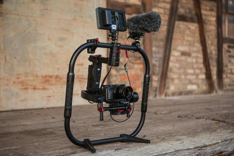
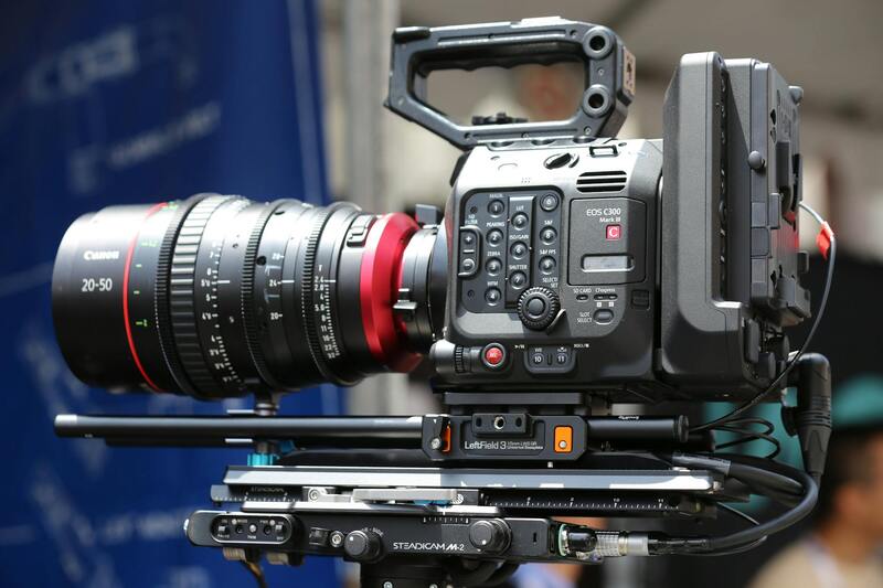
High-end drone models equipped with advanced cameras, stabilization systems, and flying capabilities often come with higher operational costs. Service providers with access to state-of-the-art technology might charge premium rates to reflect their expertise and equipment sophistication. Moreover, weather conditions, time of day, and additional safety measures required during certain flights also influence the final costs charged by professionals.
Summary
In essence, a combination of property-specific details, location characteristics, and technical requirements influence the cost for real estate drone photography. As each project varies in complexity, engaging with experienced providers who can tailor their services while understanding these factors is paramount for achieving quality imagery that aligns with budget expectations.
Average Pricing Range for Real Estate Drone Photography
In the landscape of Miami’s real estate marketing, drone photography costs typically vary based on several key factors, including property size, location, and the desired image resolution. For standard residential properties, clients can expect to pay in a moderate range, often between $200 and $500 per project. These packages generally include a set of aerial images capturing the property's main features and surrounding areas, with some providers offering optional add-ons such as video tours or twilight shots.
For larger estates, commercial properties, or multi-unit developments, prices tend to be higher due to the increased operational effort and coverage area. Costs may range from $500 to $1,500 or more, reflecting the need for extended flight time, multiple angles, and higher-resolution footage suitable for wide-angle marketing campaigns. At the high end, premium services that incorporate detailed cinematography, 4K or higher resolution, and custom editing can significantly increase overall expenses, often surpassing $2,000 per project.
It's important to recognize that these price ranges serve as general guidelines. A variety of factors, including the complexity of the shoot, weather conditions, and specific client requests, can influence final pricing. For instance, properties situated in areas with challenging access or requiring special safety measures might incur additional fees. Likewise, if a project involves multiple days of shooting or specialized equipment, the costs will reflect these complexities.
Pricing Models and Packages
Drone service providers typically offer a range of pricing models designed to accommodate different project needs. Common options include:
- Flat-Rate Packages: Fixed prices that cover a set number of flights, images, and edits, ideal for standard property listings.
- Hourly Rates: Billing based on actual time spent in the field; preferable for projects requiring flexible or extensive coverage.
- Customized Quotes: Tailored estimates considering all project specifics, such as property size, location, and desired deliverables.
Some providers bundle additional services, like video production or advanced editing, into premium packages. Clients should carefully review what each package includes to ensure it aligns with their marketing objectives and budget constraints.
Additional Costs and Services
Beyond the base fee, additional costs may arise depending on specific requirements:
- Permits and Access Fees: Some locations may require special permissions for drone flights, which can incur extra charges.
- Post-Production Editing: Complex editing, color correction, or animated graphics can add to the overall project cost.
- Expedited Delivery: Rushing the editing or delivery process often involves additional fees.
- Extended Flight Time: Projects requiring more comprehensive or longer-duration flights will raise costs accordingly.
Regulations and Permits in Miami
While specific legal terminology may be avoided, clients should be aware that drone operations in Miami often involve compliance measures to ensure safe and responsible flight. Service providers experienced in local workflows typically handle the necessary paperwork and permissions, which may influence overall scheduling and pricing. These procedures help facilitate smooth project execution while adhering to city-specific guidelines designed to foster responsible use of aerial equipment.
Factors to Consider When Choosing a Service Provider
Selection criteria should focus on the provider’s experience with similar projects, technological capabilities, and portfolio quality. Transparent pricing, clear service descriptions, and flexibility to customize packages are also key indicators of a professional provider capable of delivering high-quality results within budget.
Average Pricing Range for Real Estate Drone Photography
When planning a drone photography project for real estate purposes, understanding the typical price range can help set realistic expectations and budgets. Most service providers in Miami offer a variety of pricing options based on the scope of the project, complexity, and the level of additional services required.
Standard packages for basic real estate drone photography generally start from a minimum of $150 to $300 per property. These usually include a set number of aerial shots, a basic overview of the property, and limited post-processing. For properties of larger size or more comprehensive coverage, prices can increase to the $400-$800 range, where multiple angles, video footage, and detailed photo editing are included.
Higher-tier packages might involve advanced features such as 3D mapping, panoramic videos, or virtual tours, which can elevate costs to over $1,000 per project. These bespoke options are typically tailored to client needs and can be customized through additional services, ensuring the final presentation is optimized for marketing or listing platforms.
It’s essential to select a service provider who offers transparent pricing structures with clear differentiation between core services and add-ons. Budget considerations should account not only for the flight time and quality equipment but also for the editing process, which enhances visual appeal and helps showcase the property’s best features. As drone technology continues to evolve, some providers might include newer innovations at competitive rates, adding value to their offerings without significant cost hikes.
Ultimately, clients should prioritize experienced providers who understand local inspection and zoning requirements. Competitive pricing is advantageous, but the value derived from professional expertise and high-quality visuals directly impacts marketing effectiveness and property visibility. When selecting a service, reviewing previous work samples, understanding what is included in the quoted price, and discussing potential additional costs upfront can ensure the project remains within budget while delivering exceptional results.
Detailed Breakdown of Cost Components in Drone Photography for Real Estate
When evaluating the cost for real estate drone photography, it’s important to understand the specific components that contribute to the overall price. Each element plays a role in ensuring the final product meets professional standards and effectively showcases the property.
- Pre-Production Planning: This stage includes site assessment, planning flight paths, and establishing safety protocols. Proper planning minimizes on-site issues and ensures comprehensive coverage, which can slightly increase the initial consultation fee but saves time during shooting.
- Flight Time and Coverage: The duration of drone operation directly impacts costs. Larger properties or complex terrains require longer flight sessions. Some providers charge hourly rates or base their pricing on footage volume, which influences the final expenditure.
- Quality of Equipment and Technology: High-resolution cameras, stabilization gimbals, and advanced drone models with obstacle avoidance features ensure crisp visuals and safety during flight. Equipment upgrades or specialized drones such as 4K, 8K, or thermal imaging units, add to the service price.
- Post-Production and Editing: The editing process transforms raw footage into polished marketing materials. This involves color correction, image stabilization, and sometimes 3D modeling or panoramic stitching for virtual tours. The complexity of editing influences total cost, with premium edits commanding higher fees.
- Additional Content Creation: Besides aerial photos, clients often request video walkthroughs, twilight shots, or HDR images. These extras require extra filming hours and editing, thus increasing the overall cost.
Additional Factors That Affect Pricing
Additional charges can also stem from the need for special permits, specific insurance coverage, or filming during restricted hours. If a property is located within a densely populated area or close to sensitive infrastructure, extra precautions and permissions might be necessary, which could add to the cost. Moreover, seasonal demands or peak activity times might influence pricing, especially when service providers must allocate premium resources or schedule during off-peak hours to meet deadlines.
Complex projects that involve customized solutions, such as integrated virtual reality walkthroughs or 3D mapping, generally require more extensive planning and specialized expertise. These services are often billed separately from standard packages to account for their bespoke nature.
Understanding Pricing Transparency and Client Budgeting
To make informed decisions, clients should seek providers who offer detailed quotes that clearly delineate each component of the service. This transparency helps in comparing options and ensures there are no surprises during the billing process. When assessing costs, also consider the provider's portfolio and reviews to gauge the quality and consistency of their work, which can justify a higher investment due to better marketing outcomes.
Furthermore, understanding the scope of service and potential extra charges allows clients to plan their budgets more effectively, ensuring the project remains financially manageable while achieving premium visual results.
Pricing Models and Packages
Real estate drone photography providers often present their services through various pricing models designed to accommodate different project scopes and client requirements. Common approaches include flat-rate packages, hourly rates, and custom quotes based on specific needs.
Flat-rate packages typically encompass a predetermined set of services, such as a specific number of aerial photos, a brief video tour, and basic editing. These packages are ideal for property listings that require standard imagery delivered within a set timeframe, offering clients predictable expenses and straightforward billing.
Hourly rates are frequently employed for more complex or extensive projects, including lengthy shooting sessions, multiple property angles, or detailed post-production work. This model provides flexibility, enabling clients to scale their services according to their timeline and desired output.
Custom quotes are tailored for unique requirements, such as high-end luxury properties, development sites, or projects requiring specialized services like 3D mapping or VR integration. These quotes often consider the specific scope, location complexities, and additional services, ensuring clients pay only for the resources they utilize.
Additional Costs and Services
Beyond standard shooting fees, several supplemental costs may affect the total investment in drone photography for real estate. For instance, obtaining necessary permits or permissions to operate drones in certain areas can incur fees, especially in locations with strict regulations or busy urban environments.
Insurance coverage is another factor, with some providers requiring clients to acquire specific policy endorsements to cover potential liabilities related to drone operations. This adds an extra layer of protection but can also contribute to overall costs.
Additional services that enhance the visual presentation of a property often come at an extra charge. These include professional editing, color correction, aerial video production, or panoramic virtual tours. Advanced features like 3D modeling or interactive floor plans are typically billed separately due to their specialized nature and higher production value.
Operational considerations, such as the need for flights during restricted hours, handling complex terrains, or operating in congested areas, may also lead to supplemental fees. These factors demand meticulous planning and sometimes additional personnel or equipment to ensure safety and compliance.
Factors Influencing Drone Photography Costs
The cost for real estate drone photography in Miami varies significantly based on multiple key factors that influence the overall pricing structure. Understanding these elements enables clients to make informed decisions that align with their property marketing goals while managing their budgets efficiently.
Complexity of the Property and Location
The size and intricacy of the property directly impact the drone photography costs. Larger properties or those with complex layouts demand more extensive flight plans, additional takes, and longer editing processes. Urban environments or areas with high restrictions may also incur higher fees due to the need for precise planning or special permissions.
Type of Shots and Visual Content Needed
The specific visual elements desired by the client influence the overall price. Standard aerial shots are typically included in base packages, but specialized footage such as high-resolution panoramas, twilight shots, or 4K video require extra equipment, time, and editing. Creative content like virtual tours or 3D modeling, which provide a comprehensive view of the property, tend to come at a premium.
Operational Factors and Environmental Conditions
Weather conditions, such as wind or rain, can affect drone flights, potentially leading to delays or rescheduling, which may increase costs. Additionally, challenging terrains or densely populated areas require meticulous planning, specialized equipment, and sometimes additional personnel, all of which contribute to the overall expense.
Experience and Expertise of the Service Provider
Companies with extensive experience and a track record of high-quality work often command higher prices. Their ability to deliver visually compelling content efficiently, along with professional-grade editing and post-production, ensures a premium result that justifies the cost.
Additional Services Requested
Clients seeking supplementary services—such as professional editing, sunset or twilight shots, aerial videography, or interactive virtual tours—should anticipate additional fees. These add-ons enhance the property's presentation but require extra resources and time to fulfill.
Average Pricing Range for Real Estate Drone Photography
In Miami, the typical cost for drone photography associated with real estate varies depending on service scope, property size, and complexity. Basic packages generally start around $150 to $300 for small properties with standard aerial shots. Mid-tier options, which include a combination of photos and short videos, typically fall within $300 to $600. For high-end properties or those requiring specialized footage, prices can escalate from $600 to over $1,200.
It is worth noting that some providers may offer bundled services—combining drone photography with traditional photography or videography—which could provide cost savings. Additionally, region-specific factors such as Miami’s dense urban environment or high demand for premium visuals influence these average prices.
Cost Breakdown Based on Service Tiers
- Basic Package: $150 - $300; includes standard aerial photography of the property exterior, typically 10-15 images.
- Standard Package: $300 - $600; includes multiple angles, short aerial videos, and basic editing.
- Premium Package: $600 - $1,200+; features extensive aerial footage, twilight shots, virtual tours, and advanced editing.
Pricing Models and Packages
Most Miami drone photography providers operate on clear pricing packages designed to cater to varied client needs while maintaining transparency. Fixed-price packages traditionally cover a set number of images and videos, with additional costs for extra content or customized requests.
Flat-Rate Packages
Flat-rate models offer clients comprehensive services at a predetermined price, providing predictability for budgeting. These are ideal for clients who require a defined set of deliverables, ensuring that all key visual assets are included without unexpected expenses.
Hourly or Per-Flight Rates
Some providers utilize hourly billing, which can be beneficial for complex projects or properties requiring multiple flight plans. Hourly rates often range from $100 to $300 per hour, depending on the provider’s expertise and drone equipment used. This model offers flexibility but requires careful estimate management to avoid exceeding budgets.
Customizable Service Packages
Many companies now offer flexible, customizable packages, allowing clients to select specific services such as aerial photography, videography, editing, or virtual tours. This approach ensures clients only pay for what they need while accommodating unique property features and marketing strategies.
Additional Costs and Services
Beyond the core drone flying and image capture, several ancillary services can influence the total expense for real estate marketing in Miami. These additional costs are often essential for creating compelling, professional-quality visuals that stand out in a competitive market.
Permits and Location-Specific Fees
Operating drones in certain Miami neighborhoods or restricted zones might require permits, which can involve application fees. Locations with high pedestrian activity or commercial airspace also demand meticulous planning and possibly additional fees for operational clearance.
Insurance Requirements
Providers usually carry liability insurance to cover potential damages or accidents. Clients may need to reimburse for coverage extensions or special endorsements, adding to the overall expenses but ensuring smooth operation and risk management.
Post-Production Enhancements
Advanced editing, including color correction, aerial videography, virtual tours, and panoramic images, incur extra charges. These enhancements significantly boost the property's visual appeal and marketing potential, especially for luxury listings or high-end developments.
Specialized Equipment and Techniques
For properties with unique features or challenging terrain, additional equipment such as stabilized gimbals, infrared sensors, or 3D scanning technology might be necessary. The use of such specialized tools involves higher costs but produces immersive, high-quality visuals.
Factors Influencing Drone Photography Costs
Several key elements determine the overall expense of professional real estate drone photography in Miami. One of the primary factors is the complexity and size of the property. Larger estates, commercial developments, or properties with extensive acreage demand more drone flight time and specialized equipment, which can elevate costs. Additionally, the presence of architectural intricacies or landscape features requiring detailed capturing may necessitate investment in advanced camera stabilization tools or multiple flight passes to ensure comprehensive coverage.
Another critical element is the level of post-production editing required. High-quality images featuring color correction, HDR processing, virtual tours, or aerial videography will incur additional charges. These enhancements significantly enhance the visual appeal, especially for luxury listings and high-end developments, and require skilled editing personnel or advanced editing software. Equipment considerations also influence costs; using specialized drones equipped with infrared sensors, 3D mapping, or stabilized gimbals involves higher operational expenses but yields superior visual results.
Operational variables such as weather conditions, airspace restrictions, and the need for permits can further impact pricing. Scheduling flights during optimal weather reduces delays and enhances image quality but might increase costs due to time sensitivity. Securing necessary permissions, especially in sensitive or high-density areas of Miami, can involve application fees and extended planning, contributing to total project costs.
Average Pricing Range for Real Estate Drone Photography
In Miami, the typical cost for a standard drone photography session for real estate falls within a specific range, allowing clients to budget accordingly. Basic services, which often include a limited number of aerial images and a brief flight, generally start at around $200 to $300 per property. For more comprehensive packages, encompassing multiple angles, high-resolution imagery, and short video clips, prices can range from $400 to $800, reflecting the added value and detailed capture involved.
Luxury or large-scale properties with extensive footage, virtual tours, and custom editing tend to command higher rates, often exceeding $1,000 per project. Seasonal demand, the urgency of delivery, and specific client requests can also lead to fluctuations within these ranges. It’s essential for property owners and marketers to recognize these variations to select services aligned with their marketing goals and budget considerations.
Pricing Models and Packages
- Hourly Rate: Some providers charge by the hour, typically between $150 and $300, with the total cost dependent on flight duration and complexity.
- Flat-Rate Packages: Predefined packages often include a set number of images, edited videos, and post-processing services at a fixed price, ranging from $300 to $1,200.
- Customized Quoting: For specialized needs or large-scale projects, service providers may offer tailored quotes based on project scope, location, and service elements.
Additional Costs and Services
Beyond basic photography, several ancillary services can influence the overall cost. These include logistics such as obtaining flight permits in restricted or sensitive areas of Miami, which might involve application fees or compliance expenses. Insurance coverage, necessary to mitigate operational risks, sometimes requires additional premiums or endorsements, especially for complex or high-value properties.
Post-production work, such as advanced editing, virtual staging, 3D walkthroughs, and panoramic images, significantly enhances marketing appeal but adds to the total expenditure. For high-end properties, virtual tours or drone-based videography can elevate the listing's professionalism and attract serious buyers, though these services come with premium pricing.
Regulations and Permits in Miami
Conducting drone flights in Miami necessitates careful adherence to local airspace policies. In particular zones—such as near airports, airports, or certain urban areas—additional permits or operational clearances may be required. The process often involves submitting flight plans for approval and paying associated fees, which can vary based on location and scope of the project. Planning ahead ensures timely deployment and compliance, minimizing delays that could otherwise escalate expenses.
Factors Influencing Drone Photography Costs
When evaluating the cost for real estate drone photography, several key factors significantly impact the overall pricing structure. These include the complexity and scale of the property, the geographic location within Miami, the experience level of the drone operator, and the specific requirements of the project. Large, multi-acre properties or high-end luxury homes often require more extensive planning, specialized equipment, and additional footage, all of which contribute to higher costs.
Property accessibility also plays a critical role. Hard-to-reach locations or properties located near sensitive zones may necessitate additional logistical arrangements or operational planning, thereby increasing expenses. The desired deliverables—such as aerial videos, high-resolution still images, 3D mapping, or virtual tours—also influence the pricing, with comprehensive packages naturally demanding more time and resources.
Moreover, weather conditions and seasonal considerations can affect flight schedules and operational costs, especially in a climate like Miami’s where wind and humidity levels fluctuate. Drone operators often incorporate these variables into their pricing to ensure a contingency plan for weather-related delays or rescheduling.
Average Pricing Range for Real Estate Drone Photography
In Miami, the typical cost for basic drone photography packages ranges from approximately $200 to $500 per session. For properties requiring more extensive coverage or high-definition video tours, prices can escalate to between $500 and $1,000 or more per project. Luxury listings or commercial real estate developments tend to fall at the higher end of this spectrum, reflecting the additional complexity and quality standards demanded.
It’s important to recognize that these prices often include not just the flight and capture but also a certain level of post-production editing to ensure the visuals meet professional marketing standards. Some providers offer bundled packages that encompass multiple images, videos, and editing services, providing clients with a comprehensive visual marketing suite for a set fee.
Pricing Models and Packages
- Hourly Rates: Some service providers charge by the hour, typically ranging from $150 to $300 per hour depending on the drone's capabilities and operator expertise.
- Flat-Rate Packages: Standard packages are often fixed-price offerings that include a predetermined number of photos and videos, ideal for straightforward listings.
- Custom Quotes: For more complex or high-value properties, tailored estimates are common, reflecting the specific requirements and scope of the project.
Additional Costs and Services
Beyond the basic drone flights, a variety of supplementary services can influence the total cost. These include:
- Permitting and Licensing: Securing necessary flight permits in regulated zones in Miami may incur additional fees or administrative costs.
- Insurance: Ensuring coverage for drone operations, especially in urban or high-value areas, often adds to the expense.
- Advanced Editing and Virtual Tours: High-quality post-production work, such as virtual staging, panoramic images, and professional editing, can significantly enhance the visual appeal but increase costs.
- Specialized Equipment: Using higher-end drones with advanced stabilization, thermal imaging, or other capabilities can lead to premium pricing.
Understanding these potential additional costs helps clients budget effectively and choose services aligned with their marketing goals.
Regulations and Permits in Miami
Miami's airspace policies require drone operators to obtain clearances for specific flight zones, especially near airports, urban centers, or restricted areas. The application process involves submitting detailed flight plans and sometimes paying associated fees, which vary depending on the area and scope of work. Advanced planning is essential to secure all necessary approvals, avoid delays, and stay within operational parameters.
Proper adherence to local guidelines ensures smooth operations and minimizes the risk of project modifications or cancellations. Permission processes typically involve coordination with local authorities or airspace management agencies, which may take several days or weeks to process, thus impacting project timelines and budgets.
Factors to Consider When Choosing a Service Provider
Clients should prioritize experience and professional credentials, including proof of successful project completions in similar settings. Equipment quality is also vital—high-end drones with stabilized gimbals and 4K video capabilities ensure superior results. Communication and responsiveness are equally important, as clear understanding of project scope reduces surprises and additional costs.
Reviewing portfolios and requesting detailed quotes can help compare pricing and service levels. It’s also advisable to confirm what is included in the package—such as editing, turnaround times, and delivered formats—to ensure the offering aligns with specific marketing objectives.
Cost Savings Tips for Clients
- Combine Services: Bundling aerial photography with ground-level shots or videography can often lead to discounts.
- Plan During Optimal Weather Windows: Scheduling flights during stable weather conditions minimizes delays and associated costs.
- Leverage Off-Peak Periods: Booking services during less busy times can sometimes reduce rates due to lower demand.
- Clear Project Scope: Defining your needs upfront avoids scope creep and unexpected charges.
- Use Local Providers: Miami-based firms may offer more competitive pricing due to reduced logistical expenses.