Overview of Drone House Photography
Drone house photography has emerged as a revolutionary approach in real estate marketing, leveraging unmanned aerial vehicles (UAVs) to capture high-quality images and videos from distinctive aerial perspectives. This technique allows real estate professionals to showcase properties in a manner that highlights their spatial context, architectural details, and surrounding landscapes with striking clarity and depth. Unlike traditional ground-based photography, drone imagery provides a comprehensive view of the property, including yards, rooftops, nearby amenities, and the property's proximity to other features within the Miami area.
Property marketing significantly benefits from aerial visuals by offering potential buyers an immersive experience even before visiting the site. This method creates compelling visuals that can distinguish a listing in a competitive market. For homeowners and agents in Miami, drone house photography also captures the aesthetic appeal of waterfront views, landscaped gardens, and upscale community features that are often a decisive factor for prospective buyers.
Traditional photography methods, primarily static and ground-based, tend to limit the scope of property presentation to indoor shots or exterior images taken from the ground. In contrast, drone photography provides a dynamic, comprehensive perspective that includes panoramic vistas and detailed aerial shots, adding a modern and professional touch to property listings. This technique not only enhances visual storytelling but also conveys a sense of scale and property uniqueness, which are crucial elements in effective real estate marketing.
Moreover, drone house photography aligns with the digital trends of virtual tours and online listings, making property showcases more engaging and accessible from remote locations. As technology advances, the quality and versatility of aerial imagery continue to improve, providing real estate professionals with a powerful tool to attract and inform potential buyers better than ever before.
Legal and Safety Considerations in Miami
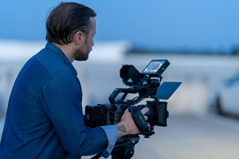
Operating a drone for house photography in Miami requires adherence to established standards to ensure safe and responsible use. Professionals in this field utilize specialized equipment that includes GPS stabilization, obstacle detection, and failsafe mechanisms, which are critical for maintaining safety during flight operations. Use of these technologies allows operators to navigate complex environments, such as residential neighborhoods with dense infrastructure, trees, and power lines, minimizing the risk of accidents or damage.
Qualified drone operators typically undergo comprehensive training to understand the nuances of airspace management, emergency procedures, and privacy considerations. They employ pre-flight assessments, including site surveys and risk analyses, to prepare for each shoot. This proactive approach helps prevent technical failures and ensures smooth execution of aerial photography sessions, maintaining the integrity of the property showcase and the safety of residents and bystanders.
In Miami, particular attention is given to respecting the privacy of property owners and neighbors during drone operations. Utilizing flight plans that exclude private spaces and adhering to local guidelines ensures that aerial image capture complies with community standards. Maintaining clear communication with property owners and coordinating flight times minimizes disruptions and fosters trust, which is essential in high-value markets like Miami residential real estate.
Types of Drone Equipment and Technology
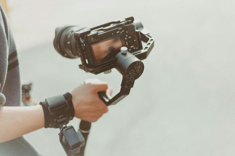
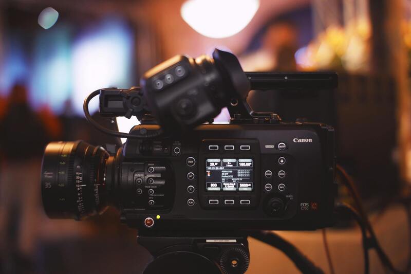
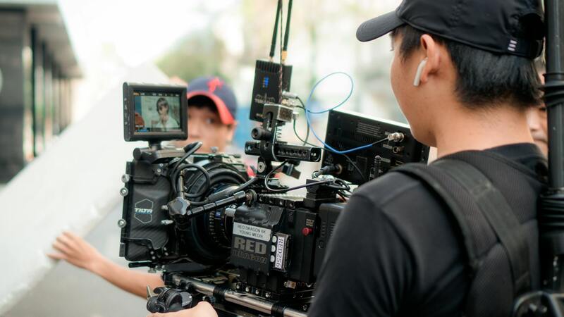
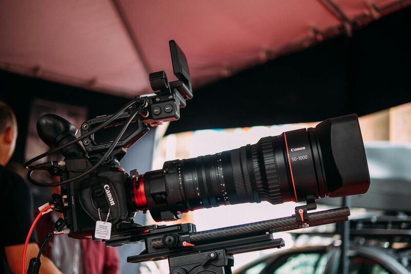
The backbone of effective drone house photography lies in sophisticated equipment that combines stability, image quality, and ease of use. Most professionals prefer multi-rotor drones equipped with high-resolution digital cameras capable of capturing 4K or higher resolution images and video. These advanced cameras often feature gimbal stabilization, which eliminates blur caused by drone movement, producing sharp, professional-grade visuals.
Recent advancements also include thermal imaging, lidar sensors, and multispectral cameras, which—while more common in specialized applications—are occasionally used in property inspections or landscape analysis. Drones equipped with obstacle avoidance sensors excel in complex residential environments, ensuring safe maneuvering around trees, power lines, and architectural features. Additionally, integrated GPS allows for precise positioning and automated flight paths, facilitating consistent and repeatable shoots for marketing campaigns.
Battery life and flight time are also key considerations, with most professional drones offering sufficient power to conduct comprehensive property scans without frequent recharging. The right combination of stability, camera capability, and flight management ensures the delivery of high-quality, visually appealing aerial imagery that elevates marketing efforts in Miami’s competitive real estate market.
Professional Techniques for Optimal Drone House Photography
Achieving stunning drone house images in Miami requires more than just deploying high-end equipment. It is essential to adopt specific techniques that maximize the potential of aerial photography and produce compelling visuals. Meticulous planning of flight paths ensures comprehensive coverage of the property, capturing all angles and architectural details with precision. Using automated flight modes, such as waypoint navigation, enables consistent shot repetition and enables multiple perspectives without manual piloting errors.
Proper altitude selection is crucial to balance context and detail. Flying too high might miss intricate house features, while flying too low could omit surrounding landscape elements that add value to the property’s visual presentation. Generally, maintaining an altitude that showcases the property’s scale while capturing surrounding amenities and neighborhood features provides a comprehensive view that appeals to prospective buyers or investors.
Lighting conditions significantly influence image quality. Scheduling shoots during the golden hour—shortly after sunrise or before sunset—provides soft, warm light that enhances the house's aesthetics and diminishes harsh shadows. Additionally, multiple exposure settings can be used to create high dynamic range (HDR) images, which accurately depict both shadowed and brightly lit areas within the same frame, ensuring the property's details are vividly captured.
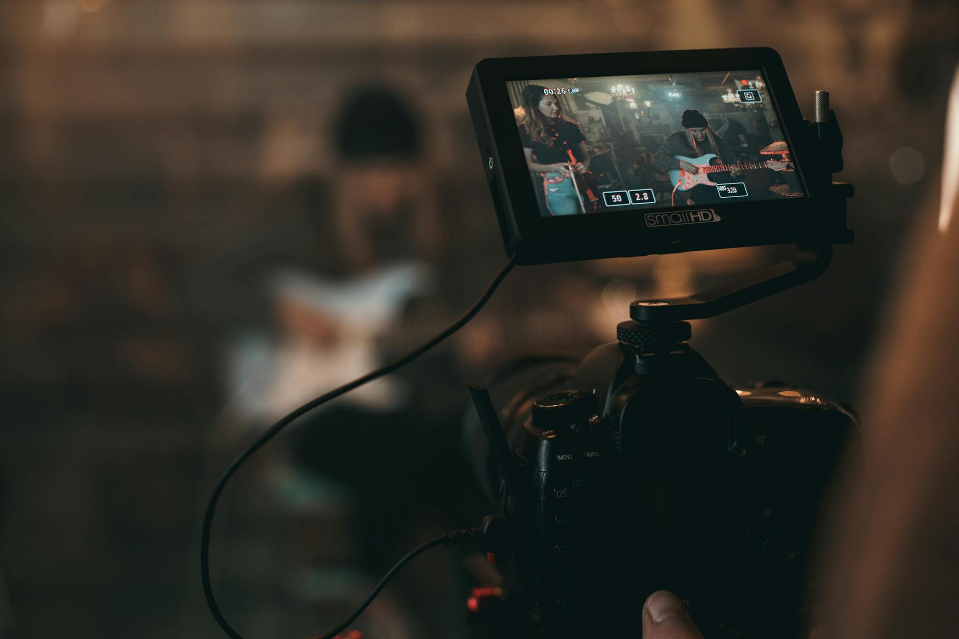
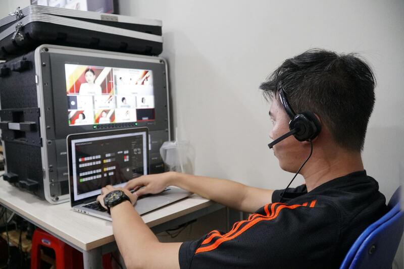
Post-flight, careful processing of the footage via professional editing software can significantly improve image clarity, color balance, and overall visual impact. Adjustments to contrast, sharpness, and color saturation help highlight the property's best features and create visually cohesive marketing assets. Advanced techniques such as panoramic stitching or 360-degree virtual tours can further enhance the property's presentation, offering potential buyers an immersive experience.
Additionally, integrating aerial images with ground-level photography results in a comprehensive visual narrative of the property. This holistic approach provides viewers with both detailed close-ups of architectural features and sweeping landscape views, establishing an emotional connection while emphasizing the property's unique selling points.
Types of Drone Equipment and Technology
Successful drone house photography in Miami relies heavily on selecting the appropriate equipment tailored to the specific needs of property imaging. Modern aerial drones feature a range of camera specifications, stabilization systems, and software capabilities that enhance image quality and operational efficiency.
High-resolution cameras are a staple, with many professional-grade drones equipped with sensors capable of capturing images at 20 megapixels or higher. This high level of detail allows for crisp, clear visuals that highlight architectural features and landscape elements, making the property stand out in marketing materials.
Gimbal stabilization systems play a critical role in ensuring footage remains steady during flight, especially in Miami's often breezy conditions. Three-axis gimbals counteract drone movements, resulting in smooth, professional-grade imagery that accurately represents the property.
Advanced flight control software enables precise navigation, automated flight paths, and intelligent positioning. Features such as obstacle avoidance and GPS-based waypoint planning increase safety and efficiency during shoots, minimizing the risk of accidents or missed shots.
Post-processing software, such as Adobe Lightroom and Photoshop, complements the hardware by allowing detailed editing and enhancement of images. These tools facilitate adjustments to exposure, contrast, and color grading, ensuring the final visuals accurately reflect the property's appeal and environment.
For immersive virtual presentations, specialized software like panorama stitching tools and 3D mapping applications generate panoramic views and virtual tours from drone footage. Such innovative approaches provide prospective buyers with dynamic, engaging experiences, offering a comprehensive perspective of the property and its surroundings.
Moreover, integration with geographic information systems (GIS) tools and altitude data improves the precision of aerial imaging, creating detailed maps that can be used for marketing and planning. As drone technology continues to evolve, the combination of high-quality hardware and sophisticated software remains essential for delivering compelling, professional-grade house images in Miami's competitive real estate market.
Types of Drone Equipment and Technology
Selecting the appropriate drone for house photography in Miami involves understanding the different types of equipment and technological features that can significantly impact image quality and efficiency. High-resolution cameras are fundamental, with many professional-grade drones equipped with 20-50 megapixel sensors capable of capturing sharp, detailed images that showcase a property's exterior and surrounding landscape. These cameras often feature adjustable lenses, enabling photographers to customize focus and framing, enhancing the overall visual narrative.
Gimbal stabilization systems are another critical component, providing smooth, steady footage even in windy conditions common in Miami's outdoor environments. This stabilization ensures that aerial shots remain clear and professional-looking, minimizing motion blur and jitter that can detract from the image's quality.
Advanced sensor technology, such as multispectral or infrared capabilities, allows for unique visual perspectives and detailed property analyses, especially useful for showcasing landscape features or assessing property conditions. The integration of GPS and GLONASS systems supports precise positioning and automated flight paths, facilitating complex shooting patterns without manual control, which is especially valuable for capturing comprehensive property views or creating virtual tours.
Moreover, intelligent flight modes, including obstacle avoidance sensors, enable safer operations around structures and variable terrain. These sensors detect power lines, trees, and other obstacles, allowing the drone to execute complex maneuvers without risk of collision. This technology not only enhances safety but also ensures comprehensive coverage of properties, especially those with intricate layouts or hard-to-reach areas.
For Miami real estate professionals seeking the best visual outcomes, deploying drones equipped with thermal imaging or panoramic stitching software can add value by presenting properties in a compelling, multifaceted manner. The synergy between sophisticated hardware and cutting-edge software solutions ultimately results in stunning, high-quality imagery that elevates property marketing efforts in a competitive landscape.
Overview of Drone House Photography
Drone house photography has transformed the way real estate professionals and property owners showcase their properties in Miami. Utilizing advanced unmanned aerial vehicles (UAVs), this technique captures breathtaking aerial perspectives that traditional ground-level photography simply cannot achieve. These high-altitude images provide a comprehensive view of property boundaries, landscaping, surrounding amenities, and neighborhood context, offering potential buyers an immersive visual experience. The strategic use of drone technology enables highlighting the unique aspects of each property, such as sprawling yards, waterfront access, or architectural details, with clarity and precision.
In addition to early-stage marketing, drone house photography is increasingly employed during property inspections, construction progress documentation, and remote assessments. This multidimensional approach facilitates detailed analysis and sharing of property features with stakeholders, brokers, and clients remotely. The combination of high-resolution imaging and innovative flight capabilities ensures that every angle of the property is captured with accuracy, making it an indispensable tool for modern real estate marketing in Miami.
Advantages of Using Drones for House Photography
- Extended vantage points: Drones can access hard-to-reach areas, providing unique angles that elevate the property's visual appeal.
- Cost-efficiency: Compared to traditional helicopter or crane-based aerial photography, drone services often reduce costs and streamline the capturing process.
- Fast deployment: Quick setup and autonomous flight capabilities allow for efficient shoot schedules, especially for multiple properties.
- Enhanced marketing impact: Visually compelling images and videos boost online listings, social media engagement, and client interest.
- Improved spatial understanding: Aerial shots help clients better understand property layouts, lot sizes, and neighborhood proximity.
Technical Considerations to Ensure Optimal Results
Employing the right drone models equipped with high-resolution cameras, stabilization, and intelligent flight modes is crucial. The latest camera systems offer exquisite detail, sharpness, and color accuracy, capturing footage suitable for high-quality marketing materials. Incorporating advanced flight controllers and obstacle detection technology minimizes risks during operation, especially in dense urban or landscaped environments. This ensures safety, compliance, and consistent image quality throughout each project.
Furthermore, software solutions for image stitching, panoramic views, and virtual tour creation enhance the value of drone footage. These tools convert raw images into immersive digital experiences that attract potential buyers and provide virtual walkthroughs, reducing the need for physical site visits and expediting decision-making processes.
Types of Drone Equipment and Technology
For drone house photography, selecting the appropriate equipment is essential to achieve high-quality results that truly showcase a property's unique features. Modern drones used in real estate photography are equipped with advanced features such as high-resolution cameras, stability systems, and intelligent flight modes designed specifically for capturing detailed aerial images. Cameras with 20-megapixel sensors and 4K video capabilities are common, providing crisp, vibrant visuals that appeal to prospective buyers and marketing campaigns alike. These cameras often include gimbal stabilization, which ensures smooth footage even in windy conditions or uneven terrains, minimizing motion blur and maintaining image clarity.
Additionally, drones equipped with obstacle detection and avoidance technology enhance operational safety, allowing pilots to focus on composition without undue concern about surrounding objects. These intelligent flight modes facilitate automated routes and high-precision positioning, essential for efficient coverage of complex property layouts. The integration of GPS and GLONASS systems further improves navigation accuracy, enabling consistent shot framing across different property types.
Moreover, software solutions like photogrammetry and panoramic stitching tools are increasingly integrated with drone technology. They allow for creating highly detailed orthomosaics, 3D models, and virtual walkthroughs from captured imagery. This combination of hardware and software enables real estate professionals to deliver engaging and interactive visual content that accelerates property marketing efforts.
Employers should ensure their chosen drone systems are compatible with the latest image processing applications, providing versatility and scalability for various project requirements. This enables the generation of immersive virtual tours, detailed floor plan overlays, and dynamic promotional videos that resonate with today's digital-savvy homebuyers.
Effective Use of Drone House Photography for Property Marketing
Harnessing drone technology for house photography offers a transformative approach to real estate marketing, especially within vibrant markets like Miami. The strategic deployment of high-end drone equipment allows for the capture of compelling aerial visuals that highlight a property's best features, from expansive rooftop decks to picturesque backyard landscapes. When executed properly, these images not only enhance online listings but also attract a broader audience by providing a comprehensive perspective that ground-based photography can seldom achieve.
To maximize the impact, real estate professionals often integrate drone imagery into their marketing strategies early in the listing process. This involves showcasing unique architectural details, landscaping layouts, proximity to local amenities, and the surrounding environment—all critical factors influencing buyer interest. The ability to present such comprehensive views efficiently engages potential buyers and facilitates quicker sales cycles.
Optimizing Drone Imagery for Real Estate Listings
- Consistent Lighting Conditions: Schedule drone shoots during optimal lighting hours, typically early morning or late afternoon, to ensure soft, natural lighting that minimizes shadows and highlights property features.
- Strategic Framing: Incorporate wide-angle shots to capture entire property limits and zoom in on distinctive elements like custom roofing features or landscaped gardens. li> Date and Time Considerations: Align flights with weather conditions that favor clear skies and minimal wind, ensuring stable camera operation and high-quality imagery.
- Complementary Ground Shots: Combine aerial drone shots with ground-based imagery to present a complete visual narrative of the property.
Best Practices for Drone Operation and Image Capture
Professional drone operation involves meticulous planning around flight paths, altitudes, and camera settings. Using automated flight plans helps ensure comprehensive property coverage while maintaining consistency in shot framing. High-definition drone cameras with stabilized gimbals are essential for sharp, distortion-free images, even in windy conditions. Pilots should also prepare pre-flight checks focusing on battery life, GPS signal integrity, and obstacle avoidance systems to reduce operational risks and preserve image quality.
Post-Processing for Enhanced Visual Appeal
Post-capture editing plays a crucial role in elevating drone house photography. Adjustments in color grading, brightness, contrast, and sharpness help bring out the textures and details that make the property stand out. Software tools for panoramic stitching can create expansive views that encapsulate entire neighborhoods or property complexes. Furthermore, advanced editing techniques can refine the visual storytelling by adding labels, maps, or virtual tour elements, making the property more attractive to online viewers.
Applications Beyond Marketing
Drone photographs are invaluable for developing detailed property documentation, including topographical surveys, construction progress tracking, and environmental assessments. These images can be used to support detailed floor plans, 3D walkthroughs, or virtual reality experiences that immerse potential buyers in the property. Additionally, aerial imagery contributes to neighborhood analysis, providing buyers with contextual insights into the community's layout, green spaces, and accessibility features.