Overview of Drone Photography for Residential Properties
Drone photography has revolutionized the way real estate professionals and homeowners showcase properties. Utilizing unmanned aerial vehicles equipped with high-resolution cameras, drone images provide a unique perspective that traditional ground-level photography cannot achieve. This technology enables the capture of expansive views of property layouts, landscaping, and surrounding neighborhoods, offering potential buyers a comprehensive visual understanding of the property's context and appeal.
In the residential real estate market, drone pictures of houses have become a vital component of marketing strategies. They allow real estate agents and homeowners to highlight the property's features from above, emphasizing the property's size, architectural details, outdoor amenities, and proximity to local attractions. As the demand for visually compelling content increases, professional drone photography has become a standard in high-end property marketing campaigns, contributing significantly to faster sales and higher listing visibility.
In Miami, a city renowned for its luxurious residences and vibrant neighborhoods, drone images serve as a strategic tool for maximizing property exposure. With its diverse architecture and scenic landscapes, Miami's real estate market benefits immensely from the professional use of drone technology. Properly captured drone footage not only showcases individual homes but also highlights neighborhood features, nearby waterfronts, parks, and commercial areas, making property listings more attractive and engaging for prospective buyers.
As this technology continues to advance, its application extends beyond simple aerial shots to dynamic videos and 3D mapping, further enriching the marketing landscape. For homeowners and real estate companies alike, integrating drone imagery into marketing efforts underscores a commitment to high-quality presentation and multimedia storytelling that resonates with today’s visually-driven consumers.
Key Equipment and Techniques for Shooting House Photos from Drones
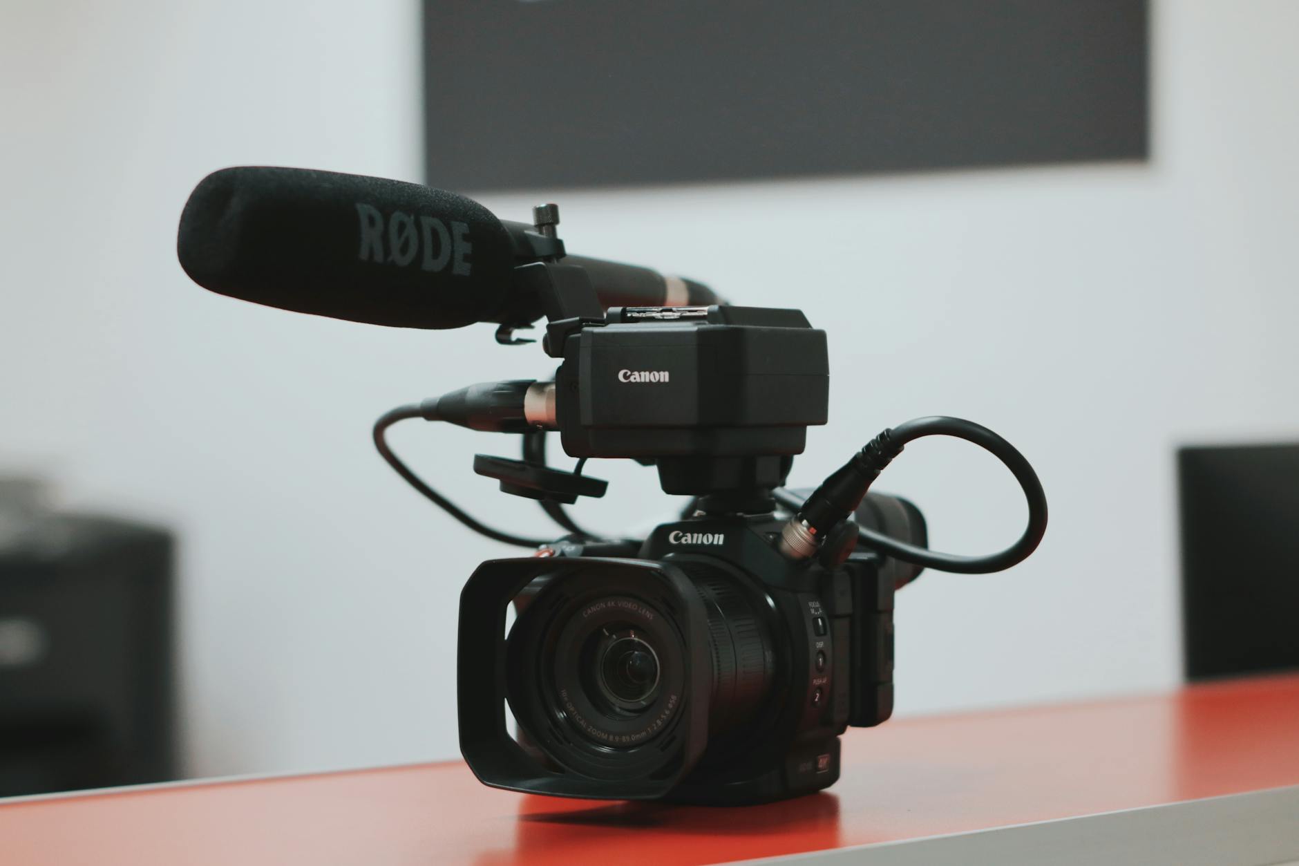
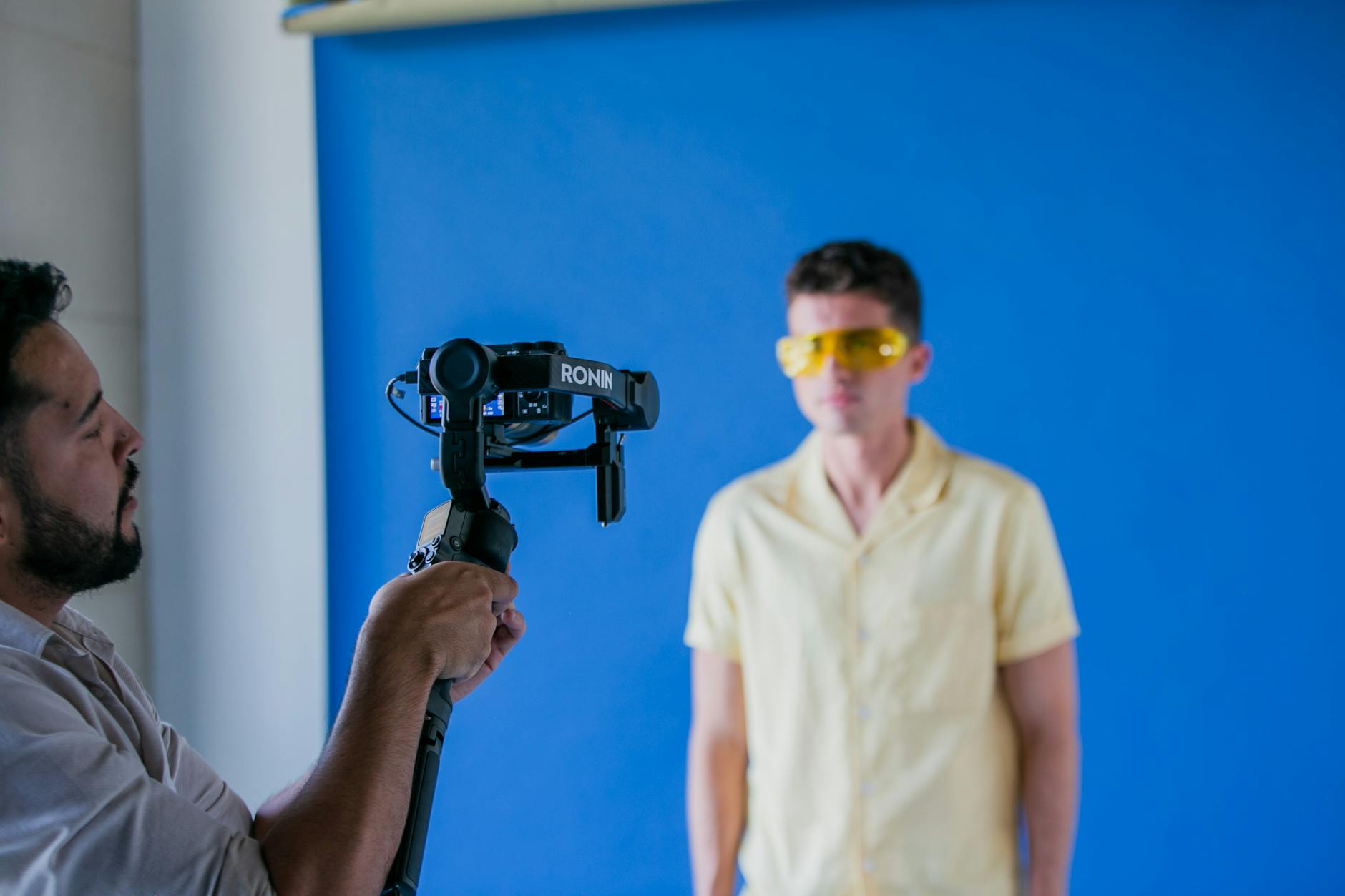
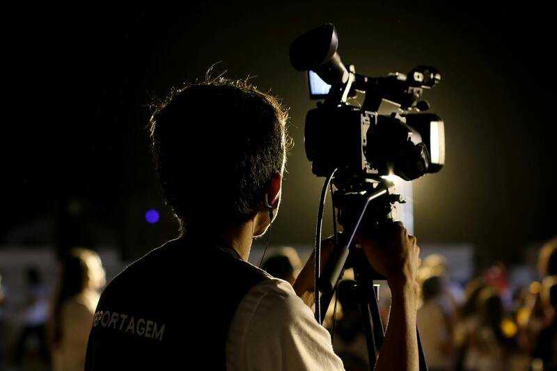
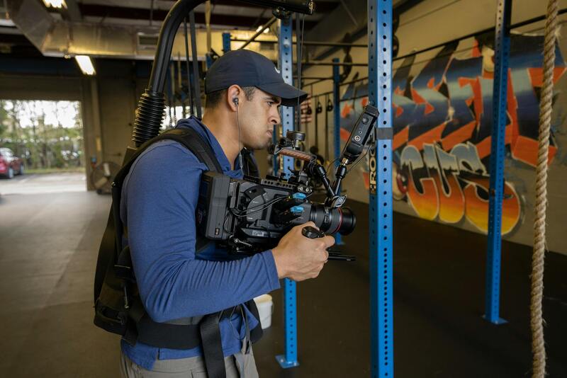
To achieve high-quality drone pictures of houses, professionals rely on an array of advanced equipment and proven techniques that ensure clarity, stability, and compelling composition. Essential hardware includes multi-rotor drones equipped with high-resolution cameras capable of capturing detailed images from various angles and altitudes. Modern drone camera systems often feature 4K or higher resolution sensors, offering crisp visuals that showcase intricate architectural features and outdoor landscapes.
Gimbal stabilization is a critical component for producing steady, blur-free images, particularly when capturing shots from challenging angles or during windy conditions. A reliable gimbal system aligns the camera's movement with the drone’s flight, resulting in smooth, professional-grade imagery.
In addition to hardware, effective shooting techniques involve strategic planning of flight paths, optimal altitude selection, and careful framing to highlight a property's best features. Piloting a drone with precision allows capturing a variety of perspectives — from expansive aerial shots of the entire property to close-ups of specific architectural details or outdoor amenities. Utilizing waypoints and automated flight modes ensures consistent image capture across different lighting conditions and times of day.
Lighting is a vital factor when shooting drone images. Shooting during the golden hour — shortly after sunrise or just before sunset — enhances the natural colors and reduces harsh shadows, resulting in warm, inviting visuals. Posture and angle selection should aim to emphasize the property’s size, layout, and surrounding environment, making the property stand out in a competitive real estate market.
Advanced techniques involve HDR (High Dynamic Range) photography, which merges multiple exposures to balance bright and dark areas, creating vibrant and well-exposed images. Additionally, panoramic shots or aerial videos can be captured to provide comprehensive views for marketing collateral. Drones equipped with LIDAR (Light Detection and Ranging) sensors enable the creation of detailed 3D models of properties and landscapes, adding a new dimension to real estate presentations.
Regular maintenance and calibration of drone equipment are crucial for consistent performance. Ensuring batteries are fully charged, propellers are clean, and sensors are calibrated minimizes technical hiccups during shoots. Skilled operators also prioritize scene exploration and shot planning, often scouting the property beforehand to determine the most effective angles and flight paths.
In sum, creating stunning and effective drone images of houses hinges on combining sophisticated hardware with strategic operational practices. This approach guarantees that real estate professionals and homeowners can leverage visually compelling content that elevates property listings in Miami’s vibrant real estate scene.
Overview of Drone Photography for Residential Properties
Drone photography has transformed the way real estate professionals showcase residential properties. By leveraging aerial perspectives, drone images provide a unique vantage point that ground-level photographs cannot match. This approach enables a comprehensive visual exploration of a property’s exterior and surrounding landscape, capturing the full scope of its aesthetic appeal and contextual placement within the neighborhood. High-quality drone images can highlight key features such as lush gardens, swimming pools, multi-level roofs, and expansive driveways, all from angles that enhance the property’s allure.
Using sophisticated flight technology, drones can capture images from multiple altitudes and angles, allowing for a dynamic presentation that includes wide-angle shots and detailed close-ups. The ability to generate bird’s-eye views yields marketing content that is not only visually impressive but also informative for prospective buyers. When integrated into online property listings, these images serve to draw initial interest and increase viewer engagement, making them essential tools in a competitive real estate landscape.
Drone photography also supports detailed property assessments without the need for physical inspections of every aspect. This means real estate agents can efficiently identify features worth emphasizing and potential issues requiring attention. Advances in drone-based imaging technologies, such as HDR and 3D mapping, further extend the capabilities of aerial photography by offering crisp, vibrant images and comprehensive digital models of properties, aiding both marketing and planning processes.
Optimally planned drone shoots entail meticulous pre-flight preparation, including site reconnaissance and weather assessment, ensuring safety and image quality. Skilled operators employ precise flight paths to capture consistent, well-composed shots that align with the overall marketing strategy. These practices enable real estate professionals to present properties in their best light, appealing to a broader audience and facilitating quicker sales.
Key Equipment and Techniques for Shooting House Photos from Drones
Capturing high-quality drone pictures of houses requires specialized equipment and refined techniques that maximize visual appeal and informational value. The foundation begins with selecting the right drone platform, which must be equipped with high-resolution cameras capable of capturing sharp, detailed images in a variety of lighting conditions. Components such as gimbal stabilizers are essential to ensure smooth and steady footage, reducing shake and blurring in aerial shots, especially when operating at lower altitudes or during windy conditions.
Lens selection also plays a critical role in drone photography for residential properties. Wide-angle lenses are preferred for capturing expansive views of property exteriors, landscapes, and surrounding features, providing potential buyers and viewers with a comprehensive perspective. For close-up or detailed shots of architectural elements, macro or standard lenses can be used to accentuate specific features without distortion.
Beyond equipment, operational techniques significantly influence the quality and effectiveness of drone imagery. Skilled operators plan flight paths meticulously, choosing optimal angles and altitudes to highlight the property's best features. Techniques such as nadir shots (directly downward views), oblique angles for dramatic perspectives, and panoramic sweeps contribute to a compelling visual narrative of the property.
Managing lighting conditions is also crucial; photography during the golden hour—shortly after sunrise or before sunset—provides soft, warm light that enhances the property's features and reduces harsh shadows. Additionally, using HDR (High Dynamic Range) imaging allows capturing details in both bright and shadowed areas, ensuring that all facets of the property are vividly represented regardless of lighting challenges.
Pre-flight site reconnaissance is vital for identifying potential obstacles and planning safe flight routes, while weather assessments help avoid conditions that could compromise image quality or drone safety. Post-flight, images often undergo editing to correct color balance, contrast, and sharpness, and to remove any undesirable elements such as obstructions or shadows that distract from the property's appeal.
Ultimately, mastering both the right equipment and shooting techniques ensures that drone pictures of houses serve their purpose effectively—captivating audiences, providing comprehensive views, and supporting detailed inspections—all of which contribute to successful real estate marketing initiatives.
Optimal Approaches for Capturing Drone Images of Houses in Miami
Securing high-quality drone pictures of houses requires a combination of precise methods and dedicated equipment. Professionals utilize advanced drones equipped with high-resolution cameras capable of capturing detailed images from multiple angles and altitudes. Achieving the desired visual impact involves selecting the right flight paths and camera settings tailored to each property’s unique features.
Pre-flight planning is essential. This process includes a thorough reconnaissance of the site to identify obstacles such as trees, power lines, or other structures that could interfere with the drone’s path. Detailed site analysis helps determine the safest and most effective flight routes to capture comprehensive views of the property while ensuring safety standards are maintained. Weather conditions are continually monitored; clear, windless days typically yield the best results, minimizing motion blur and ensuring stability.
Utilizing the right angles is key to emphasizing a property’s strengths. Overhead shots from directly above give a sense of the overall layout, while oblique angles introduce depth and dimension, showcasing exterior design elements and landscaping. Panoramic sweeps can effectively illustrate the property's surroundings, including nearby amenities, water features, or scenic views that make the property attractive to prospective buyers.
Camera settings should be adjusted for optimal exposure, with attention to shutter speed, aperture, and ISO values. These adjustments help in capturing sharp images in varying lighting conditions, such as during the golden hour or under overcast skies. Techniques such as HDR imaging are frequently employed to balance exposure levels, ensuring that both the shadows and highlights retain detail. This comprehensive approach enhances the visual clarity and vibrancy of the drone shots.
The use of gimbals and stabilizers is crucial during flight to avoid motion blur and shake, especially when capturing high-resolution imagery from considerable altitudes. Post-flight, images often undergo meticulous editing to correct color imbalances, enhance contrast, and remove artifacts or unwanted shadows. This process ensures that the final visuals accurately reflect the property's aesthetic appeal, making them suitable for sophisticated marketing channels.
In essence, combining strategic flight planning, precise equipment, and expert shooting techniques results in compelling drone pictures of houses that effectively showcase property features and surroundings. These images play a pivotal role in attracting buyers, supporting marketing campaigns, and providing comprehensive visual documentation for real estate professionals operating in Miami’s competitive housing market.
Editing and Enhancing Drone Images for Real Estate Marketing
After capturing high-quality drone footage of residential properties, the post-production process transforms raw images into visually compelling marketing material. Professional editing ensures that each photograph accurately highlights the property's best features while maintaining a natural appearance. Techniques such as color correction are employed to enhance vibrancy and ensure consistent tonal balance across image sets. Adjusting contrast and clarity provides depth, making architectural details and landscaping stand out more vividly.
In addition to basic corrections, advanced editing may involve aerial image stitching, where multiple shots are combined to produce wide-angle or panoramic views that effectively showcase expansive properties and their surroundings. This approach offers prospective buyers a comprehensive visual experience that emphasizes the property's scope and environment. Further, skilled retouching can remove distractions such as power lines, clutter, or shadows that obscure important features.
Specialized software also allows for subtle enhancements like sharpening details, reducing noise, and balancing exposures across different sections of an image, especially when HDR techniques are employed during the shooting phase. These refinements contribute to a polished final product suitable for high-end marketing formats, including online galleries, virtual staging, and print advertisements.
Incorporating well-edited drone visuals into property listings enhances viewer engagement and facilitates a better understanding of the property’s layout and landscape. When used strategically across various platforms, these images can significantly influence buyer perception, showcase the property’s unique aspects, and accelerate the marketing timeline. Whether for digital brochures, virtual walkthroughs, or social media promotions, professionally enhanced drone images serve as a powerful tool in the competitive Miami real estate market.
Future Trends in Drone Photography for Houses in Miami
As technology continues to evolve, drone photography for residential properties in Miami is set to experience significant advancements that will enhance the marketing and visualization of real estate assets. One notable trend is the integration of AI-powered imaging tools which will enable real estate professionals to automatically analyze drone footage, identify key property features, and generate detailed virtual tours with minimal manual input. These intelligent systems can also optimize image quality dynamically during or after flight, adjusting for lighting conditions, shadows, and other environmental factors to produce stunning visuals with minimal post-processing.
Moreover, the adoption of multispectral and thermal imaging technologies is likely to become more prevalent. These tools allow for comprehensive analysis of property health, including assessing roof conditions, detecting moisture intrusion, or identifying heat leaks — information valuable for buyers and sellers alike. Such high-tech imaging contributes to a more transparent view of property conditions, supporting informed decision-making and enhancing marketing narratives.
Another emerging trend involves the use of 3D mapping and photogrammetry, which are transforming drone photography into detailed, interactive 3D models of properties. These models allow potential buyers to virtually navigate around the property as if they were physically present, providing a highly immersive experience. For Miami’s competitive real estate market, such sophisticated visual content can significantly increase listings’ visibility and appeal.
The development of autonomous drone flight systems equipped with obstacle avoidance and automated flight planning algorithms is also poised to revolutionize property photography. These systems enable consistent, comprehensive coverage of large properties, even in complex environments, reducing the need for manual piloting while ensuring safety and precision. As a result, real estate agents and marketing agencies can reliably produce high-quality images and videos at a faster turnaround, enabling quicker sales cycles.
Finally, live-streaming capabilities are expected to become more integrated into drone operations. This feature allows real-time video feeds from drone flights, giving prospective buyers and investors instant access to property views during virtual showings. This immediacy fosters deeper engagement and helps to address specific client inquiries on the spot, making remote property evaluation more practical and effective.
Investing in future-ready drone technology and keeping abreast of these developments will position Miami real estate professionals at the forefront of innovative property marketing, delivering superior visual content that captivates and informs prospective buyers. As these technologies mature, they will not only streamline workflows but also unlock new possibilities for showcasing residential properties in compelling and dynamic ways.
Enhancing Visual Content Through Advanced Image Editing and Post-Processing
Refining drone images post-flight is crucial for highlighting the architectural features and aesthetic appeal of residential properties. High-resolution drone photos serve as the foundation for effective real estate marketing; however, applying targeted editing techniques can significantly elevate the visual quality, ensuring the images resonate with prospective buyers.
One of the primary objectives during post-processing is optimizing lighting and color balance. Adjustments to brightness, contrast, and saturation help in accentuating the property's details, whether it’s a modern facade, a landscaped garden, or a pool area. Proper color correction ensures the images remain true to the actual environment, promoting transparency and trustworthiness in listings.
Further enhancements involve correcting perspective distortions that occasionally occur during drone flights, especially when capturing wide-angle shots. Utilizing lens correction tools and perspective adjustments results in images that maintain proportional accuracy, which is essential in architectural photography. Cropping and framing should be strategically used to draw attention toward key features, such as breathtaking rooftops or expansive backyard spaces.
Advanced editing techniques also include removing visual distractions, such as power lines or construction debris, which can detract from the asset’s appeal. Sky replacements or enhancements can be employed to add a vibrant or twilight ambiance, making the property stand out in competitive listings. For video content, stabilization and color grading contribute to a polished presentation that aligns with the property’s branding and marketing strategy.
Incorporating consistent branding elements, such as overlays with the real estate company's logo or contact information, can also improve brand recognition and viewer engagement. Utilizing software with AI-driven optimization tools allows for batch editing, maintaining visual consistency across multiple images and saving valuable time in the post-production process.
Ultimately, the goal is to produce visually compelling images that not only showcase a property’s main features but also invoke an emotional response from potential buyers. Detailed and professionally edited drone photos help build a trustworthy image, foster interest, and accelerate the decision-making process, making them an indispensable asset in modern residential property marketing.