Role of Drone Photography in Real Estate Marketing
In the highly competitive real estate market, visual content plays a critical role in capturing the attention of prospective buyers. Drone real estate photographers leverage advanced aerial imaging technology to deliver stunning visuals that set property listings apart. Utilizing drones equipped with high-resolution cameras, agents and property owners gain the ability to showcase properties from perspectives previously unattainable with traditional photography methods.
Drone imaging provides comprehensive aerial views, including the full scope of a property's exterior, landscaping, and surrounding neighborhood. These perspectives give potential buyers an immersive experience, helping them gauge the property's size, layout, and environment with increased clarity. As buyers increasingly rely on digital platforms for property searches, the inclusion of aerial photos and videos can significantly boost engagement and interest.
Moreover, drone photography can highlight features such as waterfront access, sprawling gardens, or proximity to amenities, which might otherwise be difficult to convey through ground-level images. This innovative approach not only enhances the visual appeal of listings but also offers a competitive edge in today's real estate industry, making properties more memorable and appealing.
Investing in professional drone real estate photography is increasingly becoming an essential element of comprehensive marketing strategies. The ability to deliver high-impact, eye-catching visuals reduces time on the market by attracting qualified buyers early in the search process and encouraging faster decision-making. The dynamic nature of drone footage, including sweeping panoramas and smooth cinematic shots, adds an extra layer of sophistication and professionalism to property listings, elevating the perceived value and desirability of the property.
Overall, drone technology not only revolutionizes property marketing by providing exclusive perspectives but also plays a strategic role in enhancing buyer engagement, accelerating sales, and showcasing properties in their best light.
Legal and Permitting Requirements in Miami
For real estate professionals seeking to utilize drone technology, compliance with local regulations in Miami is essential. This includes understanding the procedures for obtaining necessary permits and licenses to operate drones legally within the city. Typically, drone operators must register their aircraft with relevant authorities and adhere to specific operational guidelines to ensure safe and responsible use.
In Miami, it is recommended that drone operators conduct thorough research on the current regulations established by the Federal Aviation Administration (FAA), which oversee commercial drone use across the United States. Compliance involves adhering to altitude restrictions, maintaining visual line-of-sight, and avoiding flight over private property without consent. Additionally, special permits may be required for flights in restricted or controlled airspace, especially in proximity to airports or sensitive city zones.
Part of the permitting process also involves securing permissions from property owners when capturing aerial footage over private land. This proactive approach not only helps in avoiding potential legal issues but also strengthens professional credibility. It is advisable to work with licensed drone pilots who are familiar with Miami's specific regulations and have a track record of responsible operation within the region.
Staying informed about regional policies also involves regularly checking updates from city authorities or relevant agencies that oversee aerial vehicle operation. By doing so, real estate professionals can avoid inadvertent violations that could delay marketing efforts or result in penalties. Engaging with local drone associations or professional networks can provide additional insights into best practices for legal compliance and safe flying procedures in Miami.
This diligent approach ensures that drone real estate photography not only produces stunning visuals but does so within a framework that respects legal standards and promotes responsible usage. Such professionalism underscores a commitment to regulatory adherence, ultimately benefiting all parties involved in the property marketing process.
Types of Drone Equipment and Shooting Techniques
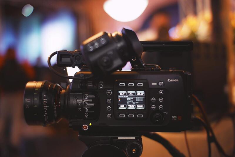
Choosing the appropriate drone equipment is essential for capturing high-quality real estate images and videos. Professional-grade drones equipped with high-resolution cameras and stabilized gimbals are preferred to ensure sharp visuals and smooth footage. Multi-rotor drones are commonly used due to their maneuverability and ability to hover precisely, which is critical for framing detailed shots of property exteriors and surrounding landscapes.
Sensor quality and camera capabilities significantly influence the clarity and detail of aerial imagery. Drones featuring 4K or higher resolution cameras allow for vibrant, crisp visuals that showcase the property's best features. Some advanced models include adjustable camera angles, zoom functionalities, and thermal imaging, expanding creative possibilities for real estate marketing.
Shooting techniques involve strategic planning of flight paths and angles to highlight key property features. Techniques such as panoramic shots, vertical flyovers, and orbiting can provide comprehensive views from different perspectives. Proper planning ensures that lighting conditions, often during the golden hour, are optimized to enhance visual appeal. Additionally, maintaining consistent altitude and speed during the shoot helps produce uniform imagery that aligns with high professional standards.
To achieve stunning results, operational practices like pre-flight checklists, battery management, and obstacle avoidance system utilization are integral. Employing advanced navigation systems assists in executing complex shot sequences safely and efficiently, ultimately delivering polished visual content tailored to the needs of real estate listings.
Legal and Permitting Requirements in Miami
When engaging in drone real estate photography in Miami, adhering to official standards and procedures is paramount to ensure smooth operations and high-quality results. The city’s regulations stipulate specific guidelines for drone flights, including restrictions on altitude, flight zones, and operational hours. Photographers must verify designated no-fly zones, particularly around sensitive areas such as airports, government facilities, and private properties, to avoid unauthorized flights and potential disruptions.
To initiate drone captures, operators should obtain necessary clearances and authorizations from relevant authorities. This process typically involves submitting detailed flight plans, outlining the purpose of the shoot, designated areas, proposed flight paths, and safety measures. Using official platforms or contacting local aviation authorities helps streamline approvals and align with established protocols.
Miami’s remote pilot certification system provides a structured pathway for drone operators, which includes proof of training and competency. Maintaining current certification ensures that flyers stay compliant with ongoing updates to regulations and best practices, thereby minimizing operational risks. Additionally, operators are encouraged to review the city’s specific no-fly zones and temporary flight restrictions, particularly during major events or emergencies, to avoid inadvertent violations.
Employing official guides and resources ensures that drone photography activities are carried out responsibly and legally. These resources also provide detailed information on operational restrictions, safety zones, and procedures for requesting special permissions if standard clearances do not cover specific shot requirements. Adhering to these standards not only preserves the integrity of the operation but also safeguards the reputation of the service provider.
In addition, organizations providing drone services often have access to interfaces for permit applications or have established relationships with regulatory bodies, simplifying the process for clients. This professionalism guarantees that every aerial project for real estate listings complies with Miami’s official protocols, enabling seamless integration into marketing efforts while maintaining adherence to legal standards.
Ultimately, collaborating with a drone real estate photographer who understands and navigates the local permitting landscape is vital for successful marketing campaigns. This approach not only guarantees legal operations but also provides peace of mind, allowing focus on capturing compelling visuals that elevate property listings and attract potential buyers. Proper licensing and adherence to city regulations are foundational elements of professional drone real estate photography in Miami, reflecting a commitment to safety, quality, and regulatory compliance.
Types of Drone Equipment and Shooting Techniques
To achieve optimal results in real estate marketing, selecting the appropriate drone equipment and employing advanced shooting techniques are essential. Understanding the diversity of available drone hardware allows photographers to tailor their approach based on specific property types, location constraints, and desired visual effects.
Drone Equipment for Real Estate Photography
High-quality drones equipped with stabilized gimbals and high-resolution sensors are paramount. These features ensure smooth, crisp footage that highlights the property's best angles and features. Cameras with 4K or higher resolution capabilities enable detailed and vibrant images, which are crucial when showcasing interior and exterior spaces.
- Multirotor Drones: Ideal for maneuverability and precise control in tighter spaces or complex architectures.
- Fixed-Wing Drones: Suitable for capturing expansive areas, such as large estates or properties with extensive land.
- Hybrid Drones: Combine features of multirotor and fixed-wing platforms, offering versatility for various shooting requirements.
- Camera Payloads: Drones equipped with lens options like wide-angle, fisheye, or zoom lenses expand creative possibilities and allow for varied perspectives.
Shooting Techniques for Effective Property Showcases
Mastering drone photography involves more than just equipment—it requires strategic techniques that maximize visual appeal and provide prospective buyers with compelling views of the property. These techniques include:
- Optimal Framing and Composition: Utilizing the rule of thirds and leading lines helps create balanced shots that direct viewers' attention to key features of the property.
- Lighting Considerations: Shooting during the golden hour—shortly after sunrise or before sunset—provides warm, soft lighting that enhances textures and colors, making properties more inviting.
- Elevation and Angles: Varying altitudes and camera angles reveal different aspects of the property, including landscape features, surrounding amenities, and architectural details.
- Motion Shots and Panoramas: Incorporating smooth flight paths and panoramic shots adds dynamic elements to marketing materials, offering comprehensive views that static images cannot achieve.
- Editing and Post-Processing: Color correction, horizon leveling, and HDR techniques help produce polished visuals that captivate potential buyers and elevate listing quality.

Types of Drone Equipment and Shooting Techniques
Utilizing the appropriate drone equipment and mastering specific shooting techniques are fundamental to achieving high-quality real estate imagery. The selection of drone models should be based on the scope of property size, desired image quality, and specific marketing needs. For instance, professional-grade drones equipped with high-resolution cameras and stabilized gimbals enable crisp, clear visuals even in challenging conditions.
In terms of shooting techniques, strategic planning before flights plays a pivotal role. Conducting site reconnaissance to identify the best angles, lighting conditions, and times of day ensures the visuals captured are impactful. Properly planning flight paths minimizes unnecessary movements, reduces flight time, and ensures comprehensive coverage of the property and its surroundings.
Optimal Flight Planning and Camera Settings
- Pre-Flight Checks: Verify battery levels, GPS signal, and weather conditions to prevent interruptions and safety hazards.
- Desired Perspectives: Set specific goals for each shot, such as capturing aerial views of the entire property or highlighting architectural details from interesting angles.
- Camera Configurations: Adjust resolution settings (e.g., 4K or higher), ISO, shutter speed, and aperture to suit lighting conditions and desired visual effects.
Advanced Shooting Techniques
- Dynamic Elevation Changes: Varying altitude during the flight to showcase different perspectives—zoomed-in shots of architectural features or sweeping overhead views.
- Smooth Camera Movements: Incorporate controlled pans, tilts, and slow, steady flight paths to produce cinematic visuals that highlight property features seamlessly.
- Time-Lapse and Panoramic Shots: Utilize automated modes to capture dynamic scenes such as sunset over the property or expansive vistas that provide a sense of scale.
Post-Processing and Image Enhancement
Post-flight editing enhances the quality of raw footage, ensuring the final visuals are compelling. Techniques include color correction to accurately represent property tones, HDR processing to balance in-shadow and in-highlight details, and horizon leveling to maintain straight perspectives. Combining these adjustments sustains a professional appearance that appeals to prospective buyers and strengthens marketing efforts.
Role of Drone Photography in Real Estate Marketing
Drone photography has revolutionized the way properties are showcased in the real estate sector, offering detailed and dynamic aerial views that traditional photographs cannot match. By capturing expansive shots of a property's exterior, surrounding neighborhood, and unique landscape features, drone images provide prospective buyers with comprehensive insights, fostering greater engagement and interest. The ability to illustrate property size, layout, and proximity to amenities from a bird’s-eye perspective allows real estate professionals to communicate value more effectively. Additionally, aerial footage can highlight aspects such as outdoor living spaces, landscaping, swimming pools, and nearby natural or urban features, adding depth to property listings that resonates with buyers seeking a complete visual understanding of the property.
Integrating drone visuals into marketing campaigns enhances digital listings, social media promotions, and virtual tours, making properties stand out in competitive markets. This not only accelerates the sales process but also increases the likelihood of attracting serious inquiries from qualified buyers. The strategic use of drone photography as part of a comprehensive marketing approach highlights the property's best features, while also conveying professionalism and modernity that attract a tech-savvy audience.
Benefits of Using a Drone Real Estate Photographer
- Enhanced Visual Appeal: Drone captures stunning visuals that showcase properties from unique angles, creating compelling listings.
- Better Property Context: Shows the property's relationship with its neighborhood, nearby parks, schools, and amenities, providing prospects with spatial awareness.
- Time Efficiency: Provides quick, comprehensive shots that replace multiple traditional photographs, saving time during the marketing process.
- Increased Buyer Engagement: Aerial imagery stimulates interest and emotional connection, resulting in more inquiries and faster sales.
- Professionalism and Credibility: High-quality images indicate a serious approach, enhancing brand image and trustworthiness in the real estate market.

Furthermore, professionally captured drone footage reduces ambiguities about property size and scope, providing clarity that can prevent potential misunderstandings. This transparency encourages more confident decision-making among prospective buyers and investors. When used responsibly, drone imagery becomes a powerful asset in real estate marketing, elevating the presentation and competitive edge of property listings in Miami’s vibrant market.
Legal and Permitting Requirements in Miami
Operating drones for real estate purposes in Miami involves adherence to specific operational standards. Permissions must often be secured in advance, especially for flights over populated or restricted zones. Drone operators should ensure their equipment is registered with the appropriate authorities, and flight plans are coordinated with local agencies to avoid violations of airspace regulations. It is essential to conduct thorough pre-flight assessments, including reviewing local restrictions and obtaining any necessary clearances, to maintain a seamless and compliant shooting schedule. An experienced drone photographer understands these procedures and ensures all necessary documentation and permits are in place, minimizing disruptions and ensuring safety during the shoot.
Types of Drone Equipment and Shooting Techniques
A variety of drone models equipped with high-resolution cameras are available for real estate projects. Hybrid drones with stabilized gimbals facilitate smooth footage and enable precise adjustments in camera angles during flight. For detailed shots, drones with longer-lasting batteries and obstacle detection systems are preferred to achieve extended flight times and safe navigation around complex property landscapes. Advanced shooting techniques include dynamic elevation adjustments, controlled camera movements, and automated modes such as time-lapse or panoramic captures. These methods allow for versatile visual storytelling, showcasing the property from multiple perspectives and under varying lighting conditions.
Best Practices for Real Estate Drone Photography
- Pre-Flight Planning: Establish a clear shot list, evaluate weather conditions, and set the desired perspectives to optimize the shoot.
- Optimal Camera Settings: Use high-resolution configurations, correct ISO, shutter speed, and aperture suitable for lighting and scene composition.
- Consistent Shooting Angles: Maintain uniformity in shot angles to ensure a cohesive visual presentation across the listing.
- Safety Precautions: Prioritize safety by maintaining clear communication, avoiding flying over people, and adhering to airspace regulations.
- Post-Processing: Enhance footage with color correction, HDR balancing, and horizon leveling to produce visually appealing images that accurately represent the property.
Choosing a Drone Photography Service in Miami
Selecting a reputable drone photography service involves evaluating their experience, equipment quality, and understanding of local regulations. Look for providers with a history of successful real estate projects, who utilize the latest drone technology to capture diverse perspectives efficiently. Their proficiency in post-production editing ensures the final visuals meet professional standards, while transparent pricing and clear project timelines demonstrate reliability. An experienced Miami-based drone photographer also possesses comprehensive knowledge of local airspace and permits, which is crucial for smooth operations. Engaging a specialized service, such as those available through miamivideocompany.us, guarantees high-quality results that effectively elevate property marketing efforts in Miami's competitive landscape.
Advanced Techniques and Future Perspectives in Drone Real Estate Photography
As the industry continues to evolve, adopting cutting-edge drone technology and innovative shooting methods becomes essential for staying competitive. The integration of advanced stabilization systems, high-dynamic-range (HDR) imaging, and multi-spectral sensors allows real estate photographers to produce visuals that are not only striking but also rich in detail. For instance, multi-spectral sensors can capture data beyond visible light, enabling insights into property conditions, landscaping health, and environmental factors that might influence buyer interest.
Furthermore, automated flight planning and autonomous drone operations are transforming the efficiency of real estate shoots. Pre-programmed flight paths and GPS-guided navigation ensure comprehensive coverage of large properties while minimizing human error. These technological advancements allow for consistent, repeatable shots that enhance the overall quality and reliability of property marketing materials.
Artificial intelligence (AI) and machine learning are increasingly incorporated into post-processing workflows. AI-driven editing tools can automatically enhance images and videos, correct distortions, and even suggest optimal framing, reducing editing time and increasing accuracy. Such capabilities allow real estate professionals to quickly generate captivating visual content that highlights a property's best features.
Emerging Trends Shaping the Industry
- 360-Degree Virtual Tours: Using drone-mounted panoramic cameras, agents can provide immersive virtual experiences that allow prospective buyers to explore properties remotely, making listings more engaging and accessible.
- Live Streaming and Real-Time Visualization: Drones equipped with live video feeds enable real-time virtual viewings, facilitating instant client engagement and feedback, which is especially useful for remote or international buyers.
- Integration of Augmented Reality (AR): Combining drone footage with AR applications offers dynamic visualizations, allowing potential buyers to envision future modifications or landscaping enhancements directly within the interactive environment.
- Environmental and Sustainability Insights: Advanced sensors can gather data related to energy efficiency, insulation, and environmental conditions, offering a comprehensive overview of property features beyond just visual appeal.
Preparing for the Future
For real estate professionals and photographers aiming to capitalize on these innovations, establishing partnerships with seasoned drone service providers is crucial. Ensure that providers are familiar with the latest technology and possess the skills to implement these tools effectively. Continuous education and staying updated with industry advancements will enable you to offer clients compelling, modern visual content that elevates property marketing strategies.
In an increasingly digital world, embracing these technological trends will define the success of real estate marketing campaigns. The ability to produce innovative, high-quality drone visuals—whether through enhanced imagery, immersive virtual tours, or interactive experiences—will not only attract more prospective buyers but also set properties apart in competitive markets like Miami.