Benefits of Drone Photography in Real Estate Marketing
In the highly competitive real estate market of Miami, capturing the attention of potential buyers requires innovative and visually compelling marketing strategies. Drone photography has emerged as a powerful tool that significantly elevates property listings by offering striking, high-resolution aerial visuals. These images and videos present a comprehensive perspective of a property’s layout, surroundings, and unique architectural features, which traditional ground photography cannot easily capture.
Utilizing professional drone photography allows real estate agents and property owners to showcase properties from multiple angles, emphasizing accessibility, neighborhood context, and environmental conditions. This broad view can highlight desirable amenities such as spacious yards, waterfront access, or scenic vistas, making properties more attractive to prospective buyers.
The impact of stunning aerial imagery extends beyond just visual appeal. High-quality drone photos can lead to increased online engagement, with listings receiving more views, shares, and inquiries. This heightened exposure often results in quicker sales and higher market values, especially in a vibrant market like Miami where waterfront and luxury properties dominate. Furthermore, professionally captured drone visuals convey a sense of sophistication and professionalism, reinforcing the credibility of the real estate firm or agent involved.
Enhanced visual storytelling provided by drone photography engages viewers emotionally, offering a sense of presence that traditional photography often cannot provide. This immersive experience can be crucial in shortlisting properties for visits, ultimately accelerating the decision-making process. As real estate markets evolve, integrating professional drone photography into marketing strategies becomes an essential component for property success, adding a competitive edge that appeals to modern buyers seeking transparency and detailed visuals.
Key Features of Professional Drone Equipment for Real Estate
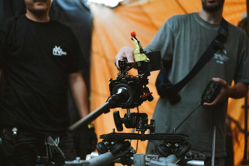
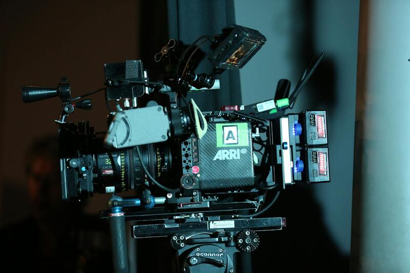
Utilizing advanced drone technology is fundamental to capturing high-quality real estate images that stand out in a competitive market. Professional-grade drones are equipped with high-resolution cameras capable of capturing detailed, sharp images and videos from various altitudes. These devices feature stabilized gimbal systems that ensure smooth footage, even in gusty conditions, providing crystal-clear visuals that emphasize the property's best features.
Understanding the specifications of drone equipment used in real estate is crucial for achieving consistent results. Modern models often incorporate wide-angle lenses that maximize field of view, allowing for expansive shots that showcase both the property and its surrounding environment. In addition, multispectral sensors and infrared cameras can be utilized for specialized imaging, highlighting landscape features or assessing environmental conditions around a property.
Flight endurance is another critical aspect of professional drone equipment. High-capacity batteries enable longer flight times, minimizing the need for multiple takes and ensuring a comprehensive coverage of large properties. Furthermore, drones with advanced obstacle avoidance sensors enhance safety during operation, reducing risks for both equipment and operators and guaranteeing smooth execution of aerial shoots.
In terms of versatility, multi-rotor drones are preferred because of their agility and ability to perform complex maneuvers. Fixed-wing drones, on the other hand, are advantageous for covering extensive areas efficiently, though they are less maneuverable in confined spaces. Combining these capabilities allows for customized solutions that meet specific project goals, whether capturing detailed shots of luxury estates or broad panoramas of waterfront communities.
Additionally, professional drone operations often employ state-of-the-art remote controllers with integrated monitoring systems. These allow pilots to manage camera settings such as shutter speed, ISO, and aperture in real-time, optimizing image quality based on lighting conditions. Such precision ensures the deliverables meet the high standards expected by real estate professionals, ultimately translating to more compelling visual content that enhances property listings.
Best Practices for Capturing Effective Drone Real Estate Photos
Achieving outstanding aerial imagery involves adhering to specific operational principles that maximize visual impact. First, planning flight paths based on the property layout and environmental conditions ensures comprehensive coverage and avoids missed angles. Conducting pre-flight inspections of the drone and equipment helps identify potential issues, reducing the risk of technical failures mid-shoot.
Lighting plays a pivotal role in drone photography. Shooting during the golden hours—early morning or late afternoon—provides softer light and warm tones that enhance property features and landscape textures. Maintaining proper exposure settings and adjusting camera angles to minimize shadows enhances image clarity and detail.
Stability is paramount for sharp images. Using flight modes that incorporate GPS stabilization and obstacle sensors helps maintain steady flight paths, especially in windy conditions. When capturing videos, smooth, deliberate movements and consistent altitude help produce professional-grade footage that resonates with prospective buyers.
Post-flight procedures, such as data transfer, calibration, and battery management, are essential to maintain equipment longevity and prepare for subsequent shoots. Developers of drone technology often recommend creating a shot list to guide the pilot, ensuring all essential property features and perspectives are covered efficiently.
Strategies for Optimizing Drone Footage in Real Estate Listings
Achieving maximum impact with drone visuals requires meticulous planning and execution. Starting with comprehensive shot planning allows photographers to establish a sequence that highlights the property’s best features while maintaining a cohesive narrative throughout the imagery. This involves identifying key angles, aerial perspectives, and proximity shots that showcase both the property and its surrounding environment.
During the shoot, maintaining consistent camera settings is crucial for uniformity across images and videos. Adjusting ISO, aperture, and shutter speed appropriately under the chosen lighting conditions ensures high-quality results, and careful framing enhances the visual storytelling. For instance, capturing wide-angle shots from elevated positions provides context and scale, while closer, detailed images of architectural features lend depth and interest.
Considerations such as time of day are integral to producing compelling visuals. Shooting during the golden hour yields softer shadows and warmer light, revealing details that may be lost in harsh midday sun. Conversely, shooting under clear midday light can emphasize sharpness and contrast for certain angles, especially when contrasting textures are desired.
Post-processing plays a pivotal role in refining drone imagery. Enhancing color balance, contrast, and sharpness can elevate visuals to a professional standard, ensuring the images stand out in listings and marketing materials. Proper editing also involves correcting distortions, removing unwanted elements, and ensuring consistent exposure across images for a polished appearance.
Integration of Drone Images into Overall Marketing Strategies
Embedding drone shots into broader marketing campaigns helps to boost property visibility and attract potential buyers. High-quality aerial imagery can be incorporated into virtual tours, social media promotions, and print advertisements, providing a comprehensive view that appeals to modern homebuyers. Additionally, drone videos that feature smooth transitions and engaging narratives can further enhance online listings, increasing engagement and inquiries.
By strategically deploying this visual content, real estate professionals can differentiate their properties in a competitive market, leverage the unique perspective offered by drones, and communicate the true potential of each property more effectively.
Legal and Safety Considerations for Drone Use in Miami
Successfully incorporating drone photography into real estate marketing requires adherence to specific procedural standards designed to ensure safe operation and compliance with local practices. Before flying a drone for property photography, operators should familiarize themselves with Miami’s guidelines that govern airspace use, safety distances, and flight restrictions. These protocols are established to protect both the operator and the surrounding community while facilitating effective image capture.
One of the primary steps involves obtaining necessary permits or authorizations when operating a drone in certain areas, especially in proximity to airports, government buildings, or densely populated zones. While some areas permit routine drone flights without extensive paperwork, photographing landmarks or private properties may necessitate formal approval. Proper planning and coordination are crucial to prevent disruptions and ensure smooth operation.
Implementing safety protocols extends beyond obtaining permissions. Drone operators must conduct pre-flight inspections to confirm equipment functionality and serviceability, ensuring batteries are fully charged, sensors are clean, and control systems respond correctly. During flights, maintaining visual line-of-sight with the drone is essential for precise maneuvering and obstacle avoidance. Weather conditions must be monitored diligently; high winds, fog, or rain can impair operational safety and image quality.
In addition, operators are encouraged to establish clear communication channels with property owners and other stakeholders involved in the project. This helps coordinate timing, set expectations, and address any potential hazards promptly. Following these established procedures fosters a professional environment that enables high-quality aerial images while prioritizing safety and operational integrity.
Best Practices for Capturing Effective Drone Real Estate Photos
Achieving impactful drone imagery in real estate requires adherence to specific techniques that enhance visual appeal and convey property features comprehensively. Effective drone photography begins with meticulous planning; understanding the property's layout, lighting conditions, and focal points ensures the right angles and perspectives are targeted. Strategic flight paths enable the capture of both exterior surroundings and unique architectural details, creating a compelling visual narrative for prospective buyers.
Optimal timing during the day contributes significantly to image quality. Shooting during the golden hour—shortly after sunrise or before sunset—provides natural, warm lighting that adds depth and allure to real estate photos. Overcast days are also suitable, as diffuse light minimizes shadows and reduces glare, resulting in clear, evenly lit images.
Proper camera settings, including appropriate ISO, shutter speed, and aperture, are vital for capturing sharp and vibrant images. Using higher shutter speeds helps counteract drone vibrations or slight movement, maintaining clarity. Additionally, choosing a high-resolution camera ensures detailed images that can be enlarged for marketing material without loss of quality.
Keep in mind that composition principles such as the rule of thirds, leading lines, and framing play a crucial role in aesthetically pleasing photos. Elevated vantage points provide sweeping views of the property and surroundings, emphasizing its scale and context within the neighborhood. Aerial shots that showcase landscape features, proximity to amenities, and overall neighborhood character make listings stand out.
Regular calibration and maintenance of drone equipment prevent technical issues that could compromise image quality. Operators should perform pre-flight checks, verify camera registration, and ensure GPS signals are strong, especially when shooting in complex environments. Post-flight review of images allows for immediate assessment of shot quality, enabling re-takes if necessary to meet marketing standards.
Additionally, maintaining smooth, stable flight paths minimizes motion blur and distortion, resulting in professional-looking photographs. Stabilization systems, whether built-in or external, contribute to a polished finish. When integrated with planning and technical proficiency, these best practices ensure that drone real estate photos effectively highlight the property’s value and appeal.
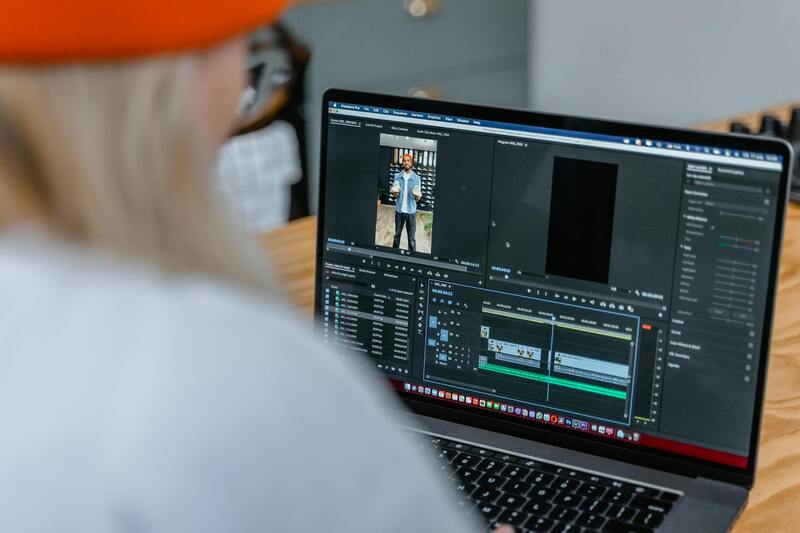
Post-Processing and Editing of Drone Real Estate Images
Following the capture of high-quality aerial images, the next critical phase involves detailed post-processing to ensure each photograph effectively showcases the property's best features. This stage not only enhances visual appeal but also aligns images with marketing objectives, creating a compelling narrative for potential buyers and investors.
One of the fundamental steps in post-processing is adjusting exposure, contrast, and color balance to produce vibrant, true-to-life images. Properly balanced lighting helps highlight architectural details and landscape features, accurately representing the property's appearance across various lighting conditions. Correction of lens distortion, especially in wide-angle shots, ensures straight lines and proportional perspectives, maintaining architectural integrity.
Advanced editing techniques may include sky replacement, to create more striking visual backgrounds, and selective sharpening to emphasize specific features such as swimming pools, gardens, or unique architectural elements. Ensuring that images are free from noise and motion artifacts contributes to a polished look that builds trust with viewers.
Efficient workflow management involves organizing raw files, applying batch adjustments to maintain consistency across a series of images, and exporting in suitable formats for various marketing platforms. Optimized images load quickly on websites and are compatible with print materials, increasing their versatility in promotional campaigns.
Utilizing Visual Storytelling through Edited Drone Shots
Careful editing can also facilitate storytelling by highlighting the property's surroundings and contextual features. For example, compositional overlays such as labelings of nearby amenities, parks, or transportation hubs can provide additional value. Furthermore, panoramic stitching or high dynamic range (HDR) techniques can be employed to create seamless, expansive views, offering prospective buyers an immersive experience of the property and its environment.
Employing professional-grade editing tools and adhering to best practices in color grading, perspective correction, and image stabilization ensures that the final visuals meet high standards of quality and accuracy. This meticulous approach significantly increases the property's appeal and sets listings apart in competitive Miami real estate markets. When images are consistently polished and professionally prepared, they serve as a powerful asset in attracting serious buyers, ultimately contributing to quicker sales cycles and higher property valuations.
Advanced Techniques for Drone Real Estate Photography in Miami
To maximize the visual impact of drone images, professionals employ a variety of advanced techniques that enhance the storytelling and appeal of property listings. Utilizing high dynamic range (HDR) imaging allows capturing a broader spectrum of light, rendering both shadowed and brightly lit areas with exceptional clarity. This approach ensures that images accurately represent the property’s features under varying lighting conditions, creating a balanced and vibrant visual presentation.
Panoramic stitching is another technique that plays a key role in showcasing expansive properties or picturesque surroundings. By seamlessly combining multiple overlapping shots, a panoramic image provides viewers with a wide-angle view that immerses them in the property's environment, offering a virtual tour experience from afar. This method is particularly effective in highlighting sprawling estates, waterfront views, or lush landscapes common in Miami's diverse real estate landscape.
Perspective correction is essential to maintain the integrity of architectural lines and avoid distortions that can occur due to drone camera angles. Using sophisticated editing software, photographers can straighten skewed lines and ensure proportions are true to life, which is crucial when depicting property exteriors and structures. Proper perspective correction maintains professional standards and supports accurate marketing materials.
Color grading and contrast adjustments further refine drone images, emphasizing natural tones and enhancing visual appeal without compromising realism. Balanced color enhances the property’s aesthetic features, making landscaping, building materials, and surrounding amenities more enticing. These enhancements help attract potential buyers by creating striking visuals that stand out in online listings and printed brochures.

Stabilization tools are vital in producing smooth, shake-free aerial footage and photographs. Using gimbals, professionals can maintain camera stability during flight, capturing crisp, professional visuals that reflect attention to detail. This smoothness is especially important for video tours or interactive virtual walkthroughs, which have become powerful tools in contemporary real estate marketing.
In deploying these advanced techniques, real estate professionals can significantly elevate their listing presentations. Sophisticated imagery not only draws attention but also builds a perception of quality and trust, reinforcing their brand reputation within Miami's competitive real estate market. Incorporating these methods requires expertise and specialist equipment, underscoring the value of engaging seasoned drone photography providers who prioritize precision and professionalism in their craft.
Advanced Techniques for Maximizing the Impact of Drone Real Estate Photography
Utilizing High Dynamic Range (HDR) Imaging
One of the most effective methods to enhance drone images for real estate is the application of High Dynamic Range (HDR) imaging. HDR combines multiple photographs taken at different exposures into a single image, balancing shadows and highlights to produce a more comprehensive visual representation of the property. This technique is especially beneficial when capturing properties with challenging lighting conditions, such as bright sunlight reflecting off windows or deep shadows cast by architectural features. By implementing HDR, real estate professionals can present properties with vivid detail and true-to-life tones, providing prospective buyers with an accurate depiction of the space's ambiance and features.
Proper Altitude and Angles for Strategic Shots
The selection of flight altitude and camera angle plays a critical role in showcasing a property's best features. Higher vantage points are ideal for capturing expansive views of the property and surrounding areas, which can be crucial in Miami's scenic neighborhoods. Similarly, varying the camera tilt allows for highlighting specific architectural elements, landscaping, or outdoor amenities such as pools or patios. Skilled drone operators analyze each property to determine optimal flight paths that maximize visual impact while maintaining safety standards. This strategic approach ensures that images reveal the property's full potential, creating compelling visual narratives that resonate with prospective buyers.
Sunlight Timing and Weather Conditions
Capturing drone images during optimal lighting conditions significantly affects the overall quality and appeal of the visuals. Early morning and late afternoon, when the sun is low, often provide softer, more flattering light that accentuates textures and reduces harsh shadows. Additionally, clear days with minimal wind enhance drone stability, resulting in sharper images. Seasonality may also influence shot selection; for instance, showcasing lush landscaping during peak growth seasons or highlighting coastal views under clear skies can make properties more attractive. Drone operators frequently monitor weather forecasts to identify ideal times for shooting, ensuring the final images are consistent with the property's highest visual standards.
Employing Advanced Flight Planning and Automated Missions
Pre-programmed flight paths and automation tools enable precise and efficient captures, especially when photographing multiple angles and verticals of a property. By defining specific waypoints and camera settings beforehand, operators can achieve consistent shot quality across different sessions. Automated missions also reduce human error and allow for repeatability, which is advantageous when creating virtual tours or comparative property analyses. Integrating geographic information systems (GIS) data further refines flight plans, ensuring comprehensive coverage of complex property layouts. This level of planning guarantees that every shot aligns with marketing goals, producing a cohesive and professional visual presentation.
Leveraging Real-Time Data and Live Video Feeds
Real-time data collection offers opportunities for immediate assessment of shooting conditions and instant adjustments. Live video feeds enable clients and real estate agents to direct drone pilots during specific shots, ensuring critical features are captured effectively. This collaborative approach allows for dynamic shot framing and immediate troubleshooting of issues such as glare or obstructions. Furthermore, incorporating live aerial footage into virtual listing tours offers potential buyers an interactive experience, increasing engagement and emotional connection to the property. The ability to adapt swiftly during shoots results in higher-quality visuals that better serve the marketing strategy.