Overview of Real Estate Aerial Videography
Real estate aerial videography has transformed the way property listings are presented to potential buyers and investors. By utilizing high-quality drone technology, videographers can capture expansive, dynamic views of properties and their surrounding neighborhoods from multiple angles, providing a comprehensive visual context that traditional photography often cannot achieve. This method offers a compelling, immersive experience that highlights a property's best features, its scale, and its integration within the local environment.
In the vibrant Miami real estate market, where waterfront homes, luxury condominiums, and sprawling estates are prevalent, aerial videography has become an indispensable marketing tool. Its ability to showcase properties from a bird's-eye view not only enhances visual appeal but also helps to communicate the unique qualities of each listing, such as proximity to beaches, parks, or city skylines. As buyers increasingly rely on online platforms for property searches, the need for engaging, high-quality visual content continues to grow, making real estate aerial videography an essential component of modern property marketing strategies.
Legal Regulations and Permits in Miami
When executing real estate aerial videography in Miami, adhering to established operational standards is paramount to ensure safety, efficiency, and compliance with local requirements. Miami's municipal authorities, in collaboration with state agencies, outline specific procedures and documentation necessary for aerial filming, particularly when operating drones or unmanned aircraft systems (UAS). Securing the appropriate permits involves submitting detailed flight plans that specify flight altitude, duration, and purpose, along with proof of operator certification.
Operators are typically required to hold valid remote pilot certificates issued by relevant aviation authorities, reflecting proficiency in drone handling and safety protocols. Maintaining current insurance coverage for drone operations is also a standard expectation, providing liability protection and demonstrating responsibility. Prior to any shoot, comprehensive site surveys are conducted to identify potential obstacles, restricted zones, and environmental sensitivities that might impact flight safety.
Miami's geographic and infrastructural context necessitates a careful approach to airspace management. In particular, flights near airports, helipads, or crowded urban areas require coordination with the Federal Aviation Administration (FAA) and local air traffic control. These entities regulate temporary flight restrictions (TFRs) to prevent interference with manned aircraft operations, especially during special events or high-traffic periods.
For property owners and real estate professionals, obtaining relevant permissions from property management or private landowners ensures unobstructed access for aerial shoots. These permissions often involve detailed agreements that specify the scope, duration, and safety measures for drone activities. Observing these official channels fosters a smooth filming process while mitigating any potential disputes or operational interruptions.
Understanding and navigating Miami’s specific airspace regulations not only facilitates successful project execution but also enhances the credibility of the professional overseeing the shoot. By following official procedures, aerial videographers contribute to a culture of safety and responsibility that benefits the broader real estate community and supports the continued growth of this innovative marketing approach.
Legal Regulations and Permits in Miami
Executing real estate aerial videography in Miami requires adherence to a set of established guidelines and procedures that govern drone operations within the city’s airspace. Authorized drone flights are subject to specific protocols designed to maintain safety, preserve privacy, and ensure the smooth integration of unmanned aircraft systems (UAS) into Miami’s busy environment.
Operators must familiarize themselves with Miami-Dade County's regulations, which often align with broader federal standards set forth by the Federal Aviation Administration (FAA). These standards mandate that drone pilots obtain certifications such as the FAA Remote Pilot Certificate, which verifies their proficiency in operating UAS responsibly and in compliance with national airspace rules.
Permits are integral to lawful aerial videography. For instance, if a shoot involves capturing footage over public roads, parks, or private properties, proper authorization must be secured from relevant authorities or property owners. These permits often cover specific flight times, altitude restrictions, and designated flight zones, informing operators of areas where drone activity is permissible and areas that require additional authorization.
In Miami, particular attention is given to privacy considerations. Drone operators should avoid capturing personal activities or private spaces without consent. Respecting privacy not only complies with local norms but fosters trust within the community and maintains professional integrity.
Because Miami’s urban landscape is dense and dynamic, the issuance and management of permits often involve coordination with multiple agencies including the FAA, the Miami-Dade Department of Aviation, and city-specific offices. Each agency provides guidelines that help drone operators plan their flights, ensuring compliance with air traffic management, safety protocols, and environmental considerations.
Proactively engaging with the proper authorities before scheduling an aerial shoot streamlines the process and minimizes disruptions. This approach ensures that filming occurs within the parameters established by local and federal regulations, thereby securing a smooth production process and high-quality footage that showcases property features effectively.
Ultimately, thorough preparation—grounded in official regulations and sustained by transparent communication with permitted agencies—helps real estate professionals and videographers capitalize on Miami's beautiful vistas while ensuring their projects meet all legal and operational standards. This careful planning reinforces the authenticity and reliability of the final visual product, demonstrating a commitment to quality and integrity in every aerial shot.
Equipment and Technology Used in Aerial Videography
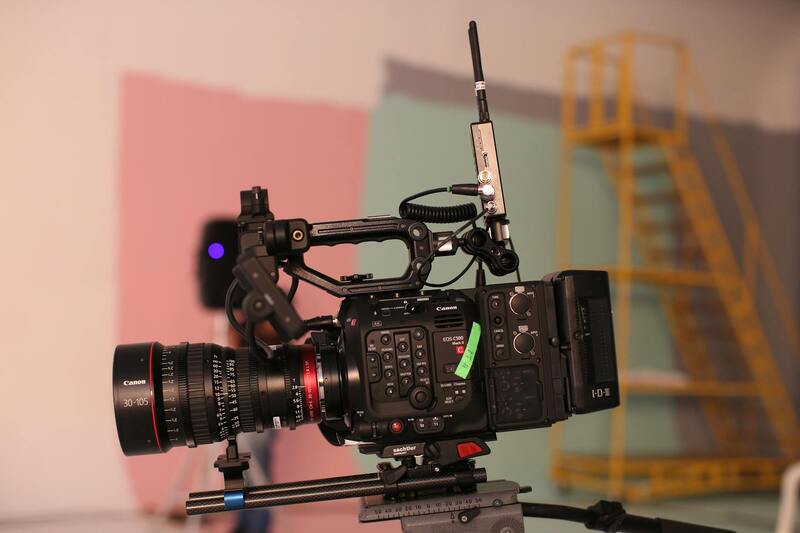
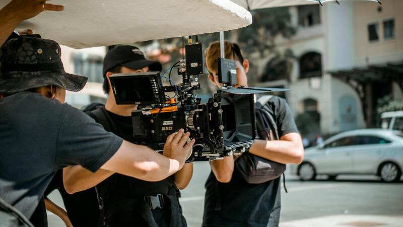
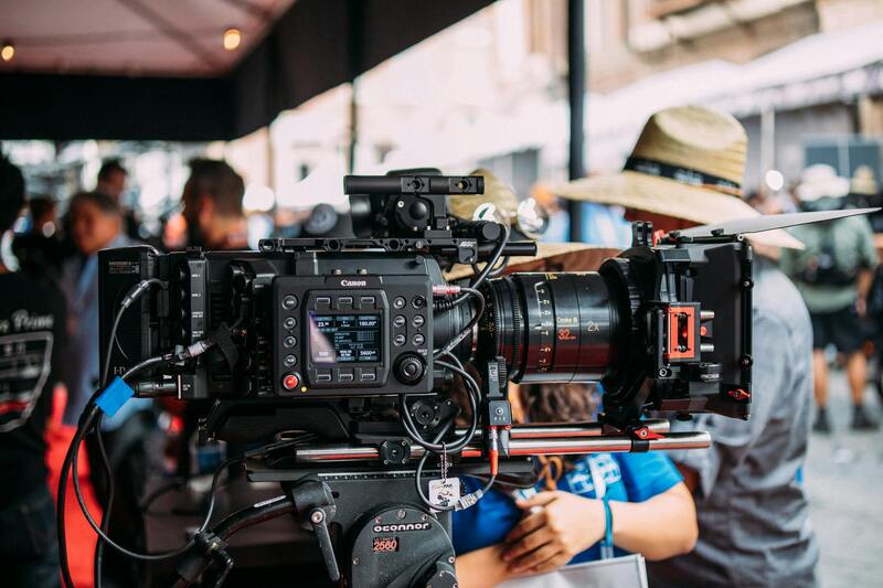
The foundation of compelling real estate aerial videography lies in the selection of advanced equipment capable of delivering high-definition visuals with stability and precision. High-quality drones equipped with 4K or higher resolution cameras are essential for capturing clear, detailed imagery that allows potential buyers to appreciate both the property and its surrounding environment in vivid detail.
Professional-grade stabilization systems such as gimbals are integrated with drone cameras to eliminate motion blur and shakiness caused by wind or rapid movements. These stabilization tools ensure smooth, cinematic footage that enhances visual appeal and effectively highlights the property's key features, such as architectural details, landscaping, and proximity to local amenities.
Lightweight, durable materials and efficient propulsion systems allow drones to operate safely within various flight conditions, providing flexibility in shot composition and angles. Additionally, multi-directional sensors and obstacle avoidance technologies enable safe navigation around complex structures and in confined spaces, making flight planning more reliable and reducing the risk of accidents that could compromise footage quality.
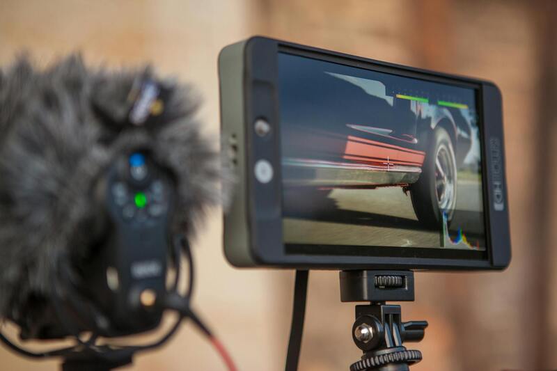
Camera settings such as aperture, shutter speed, and ISO are meticulously managed by operators to optimize image quality, particularly in variable lighting conditions characteristic of outdoor environments. Software tools for flight planning and live monitoring provide real-time control over camera angles and movement, allowing for dynamic shots that add visual interest and professionalism to property listings.
Investing in the right mix of drone hardware and support equipment not only elevates the quality of visual content but also ensures the safety and efficiency of each shoot. Proper maintenance, calibration, and adherence to manufacturer specifications further sustain the performance and longevity of equipment used in high-stakes filming scenarios like real estate marketing.
Legal Regulations and Permits in Miami
Executing aerial videography for real estate within Miami requires adherence to specific procedures that ensure safe and authorized drone operations. While the regulations are designed to promote responsible drone use, they also establish a clear framework for obtaining necessary permissions, which helps maintain a high standard of safety and professionalism in the industry.
Before initiating any filming activities, it is essential to identify the relevant governing bodies overseeing drone flights in Miami. These authorities typically include the Federal Aviation Administration (FAA) and local municipal agencies. Compliance with FAA guidelines involves registering your drone if it surpasses a certain weight threshold and ensuring that operators have the requisite certifications. These certifications prove knowledge of airspace rules, safety procedures, and operational limitations, ensuring pilots are qualified to handle complex aerial tasks.
Obtaining specific permits from local authorities is a crucial step in the planning process. Miami may require a Special Flight Authorization or a Notice of Proposed Operation, especially when flying in populated or restricted areas. These permits facilitate the coordination between drone operators and city officials, minimizing potential conflicts while promoting responsible practices.
Operational safety is prioritized through detailed flight planning, which includes assessing potential flight zones, noting no-fly zones, and establishing aviation safety buffers. Such planning often involves sharing your flight plan with the relevant authorities to guarantee adherence to all existing rules and to receive any necessary approvals before deployment. Additionally, pilots should be prepared for unexpected weather changes, which could affect flight safety or footage quality, and have contingency plans in place.
In addition to permits, documenting your adherence to policies through detailed logs of flight operations enhances compliance and accountability. This practice not only ensures transparency but also helps streamline future permit renewals or audits by regulatory bodies.
Equipment and Technology Used in Aerial Videography
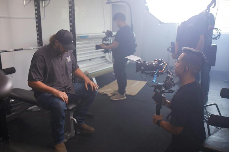
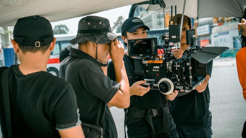
The success of real estate aerial videography heavily relies on utilizing cutting-edge equipment and technology that can deliver high-quality footage while ensuring safety and compliance. Aerial videographers typically employ a combination of advanced drones, stabilized camera systems, and sophisticated imaging tools to capture compelling visuals that enhance property listings.
Modern drones designed for professional videography are equipped with high-resolution cameras capable of shooting in 4K and sometimes higher formats. These cameras often feature gimbals that provide stabilization during flight, resulting in smooth, cinematic footage that highlights the property's unique features from various angles. The use of high-dynamic range (HDR) imaging offers better clarity and color accuracy, ensuring the footage authentically represents the property's appearance under different lighting conditions.
Filmmakers also incorporate intelligent flight technology, such as GPS waypoint navigation and obstacle avoidance sensors. These features enable precise flight paths and diminish the risk of collisions with structures or natural obstacles. Beyond hardware, software tools like flight planning apps help map out optimal routes, set altitude parameters, and thread through restricted zones, improving efficiency and safety during shoots.
In addition to drones, post-production editing software such as Adobe Premiere Pro or Final Cut Pro is essential for polishing footage. These tools allow editors to correct colors, stabilize shaky clips, add branding elements, and compose seamless video narratives that captivate viewers. Incorporating aerial footage with ground-level shots or interior videos can create comprehensive marketing content that effectively showcases the property’s features.
Choosing the right combination of equipment depends on factors such as property size, location, and desired cinematic quality. A knowledgeable production team invests in state-of-the-art tools to ensure every shot is technically flawless and visually engaging, ultimately elevating the property's market appeal.
Equipment and Technology Used in Aerial Videography
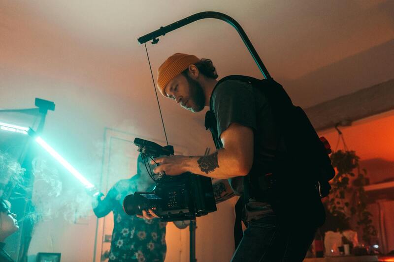
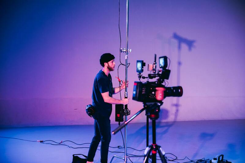
To capture stunning real estate aerial videos that highlight the unique features of a property, professional videographers rely on a sophisticated array of equipment and cutting-edge technology. The foundation of high-quality aerial videography begins with the selection of drones equipped with high-resolution cameras capable of capturing crisp, detailed footage from varying altitudes and angles. These cameras often feature gimbals—mechanical stabilization systems that prevent shaky images and ensure smooth, cinematic motion, even in challenging conditions.
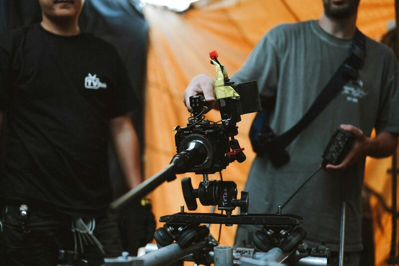
Modern drones are integrated with advanced flight controller systems, which include GPS stabilization, waypoint navigation, and obstacle avoidance sensors. These features allow the drone to follow predetermined flight paths accurately while avoiding trees, power lines, or other obstructions, ensuring both safety and efficiency during filming. Additionally, intelligent flight planning software helps videographers map optimal routes before shooting, setting parameters for altitude, speed, and restricted zones to maximize footage quality and compliance.
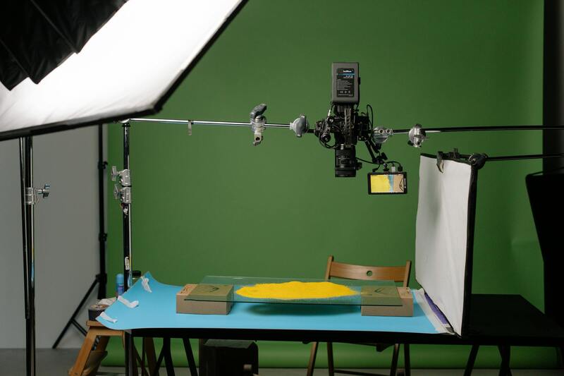
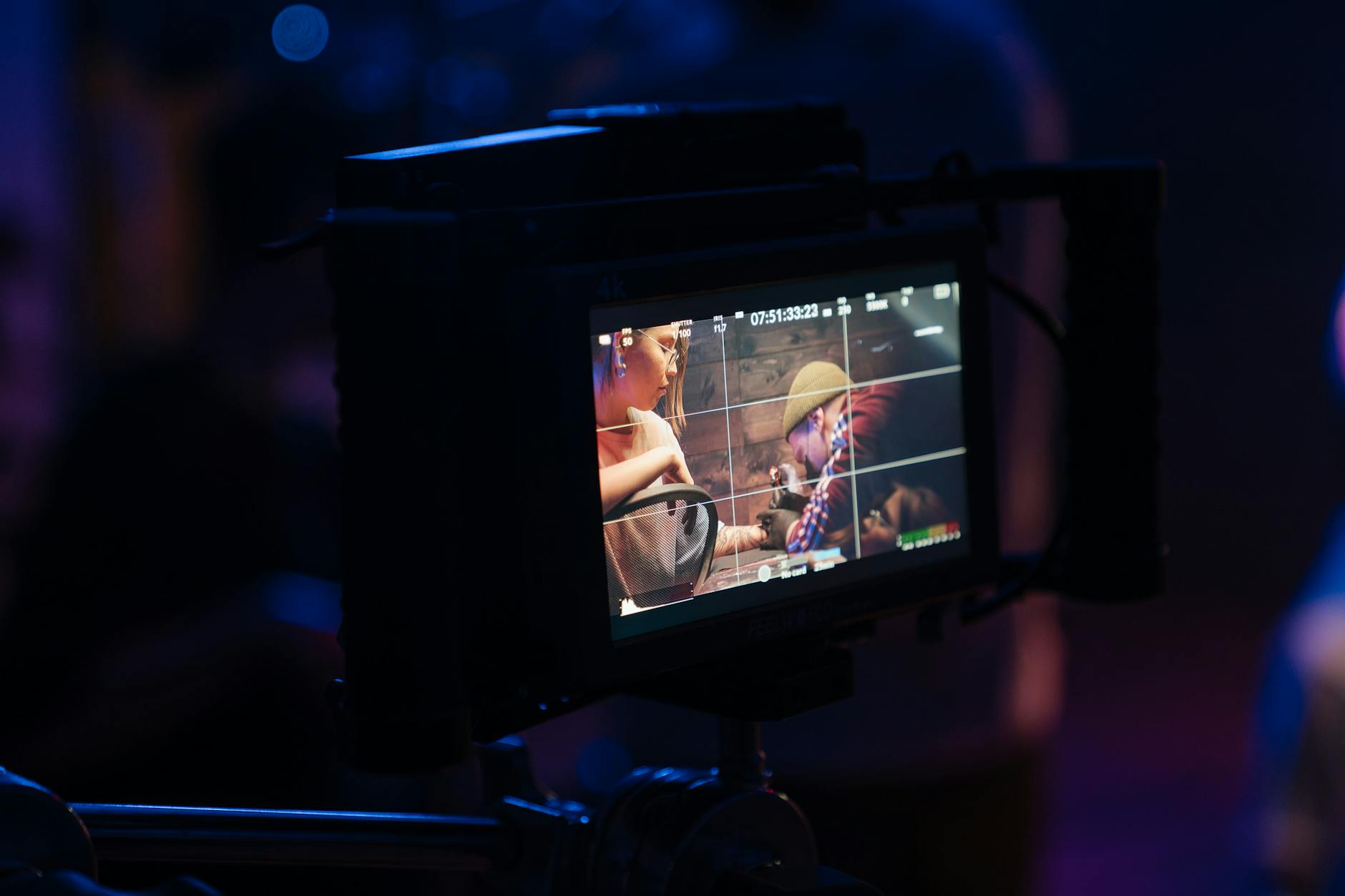
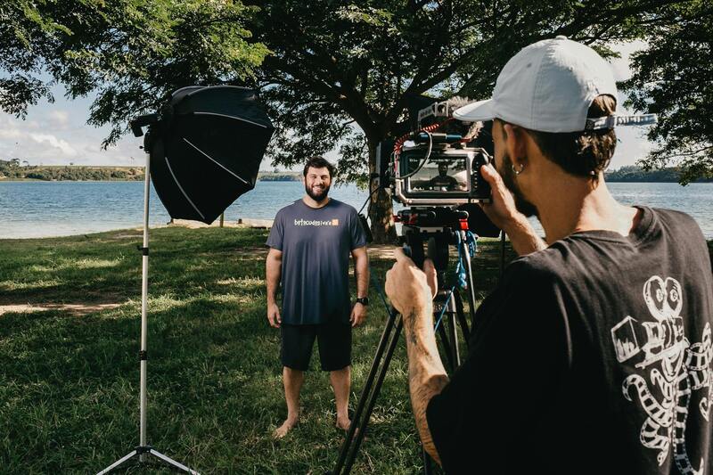
Beyond drones, ground-based stabilization systems like Steadicams and gimbals are used to incorporate ground-level shots, providing dynamic contrast and context within the property video. High-definition monitors and real-time telemetry systems allow operators to monitor camera angles and footage quality instantly, making necessary adjustments during the shoot for optimal results.
Lighting and Shooting Equipment
Achieving professional-grade footage involves carefully considering lighting equipment. Portable LED lights and reflectors are often used to illuminate interiors or shadowed exterior features without overpowering natural light. When filming in variable weather or during golden hour, filters and diffusers help regulate exposure and enhance the visual appeal.
Post-Production Software and Enhancements
The integration of advanced editing software like Adobe After Effects and DaVinci Resolve is critical for refining raw footage. Color correction enhances the vibrancy and realism of the visuals, while stabilization tools eliminate any residual camera shake. Additionally, multi-layer editing allows the integration of ground shots, interior tours, and animated graphics to craft a compelling property showcase.
Investing in these state-of-the-art tools and technology is fundamental for delivering aerial videography that not only elevates property listings but also builds trust with clients through professionalism, consistency, and visual excellence.
Official Methods for Aerial Videography Near Miami
To ensure the highest standards of quality and compliance in real estate aerial videography within Miami, professionals strictly adhere to established protocols and methodologies. These methods encompass detailed planning, certified operational procedures, and use of authorized equipment, all aligned with regional guidelines that are recognized by the industry. Properly conducting aerial shoots starts with comprehensive site assessments, including determining optimal flight paths, identifying potential obstacles, and scheduling shoots during favorable weather conditions to avoid interruptions or safety hazards.
Equipment selection is paramount. Licensed operators utilize certified UAVs equipped with high-resolution cameras and stabilization systems to guarantee sharp, fluid footage. These UAVs are maintained regularly and calibrated to meet operational standards, ensuring consistent performance during each shoot. By employing advanced GPS and telemetry systems, operators can precisely control flight paths, ensuring comprehensive coverage of the property while minimizing risks associated with inadvertent intrusions or violations of airspace restrictions.
Filming operations are conducted following detailed checklists that include pre-flight inspections, calibration, and risk assessments. All flights are performed within permitted airspace, avoiding restricted zones and respecting privacy boundaries. Aerial operators maintain real-time communication with ground support teams and local authorities as needed, documenting flight plans and obtaining necessary clearances ahead of time to facilitate smooth operations.
Technological Innovations and Post-Production Standards
Modern aerial videography integrates cutting-edge tools and software to produce compelling visual narratives. High-definition cameras capable of recording in 4K ensure sharp, detailed imagery that appeals to discerning clients. Additionally, advanced post-production workflows involve meticulous color grading, stabilization correction, and seamless integration of ground-level footage, which are all performed using industry-leading software. This rigorous process guarantees visuals that are both visually stunning and consistent with property branding.
While the equipment and software are sophisticated, the core focus remains on adherence to proven procedures that uphold safety, quality, and visual excellence. Continual training and professional development for operators enhance their expertise, ensuring they are well-versed in both the technical and regulatory aspects of aerial videography. As technology advances, the integration of automated flight planning and obstacle avoidance further enhances operational efficiency and safety.
Ensuring Quality and Compliance in Miami
Operators and production companies committed to excellence employ a comprehensive framework for executing aerial shoots, including obtaining all necessary permissions from local authorities and following specific flight restrictions established for urban areas like Miami. They utilize documented workflows, including pre-flight briefs, supervision during the shoot, and detailed post-flight reports to verify adherence to standards. This disciplined approach ensures that every project not only meets clients’ expectations but also aligns with regional operational guidelines.