Overview of Realtor Drone Photography
Realtor drone photography has rapidly transformed the way properties are marketed in Miami’s competitive real estate market. By utilizing advanced aerial imaging technology, real estate professionals can showcase properties from unique perspectives that ground-level photography cannot achieve. This innovative approach enables realtors to present properties in a way that captures their full scope and surrounding environment, which is especially advantageous in Miami’s vibrant neighborhoods and scenic landscapes.
Employing drone technology enhances property listings by providing high-quality, captivating images that draw potential buyers’ attention immediately. These aerial shots reveal key features such as expansive gardens, views of nearby water bodies, architectural details, and the layout of large estate grounds. Such visual content not only increases listing visibility but also helps buyers assess a property’s scale and setting in a more comprehensive manner.
Furthermore, drone photography contributes significantly to the storytelling aspect of property promotion. It allows realtors to create immersive visual narratives that highlight a property’s best attributes, lifestyle appeal, and location advantages. This approach is particularly effective in Miami, where waterfront views, modern architecture, and outdoor living spaces are highly sought after. High-quality imagery generated through drone photography enhances the perceived value of a property and can expedite the sales process by attracting serious buyers early on.
Beyond aesthetic enhancement, drone photography also offers practical benefits. It provides detailed, accurate representations of a property's exterior, helping settle buyer inquiries with high-quality visuals that reflect reality. This reduces the likelihood of misunderstandings or unmet expectations during viewings, ultimately fostering trust and confidence between realtors and clients.
In Miami, where properties often boast strategic locations, lush landscapes, and scenic vistas, drone photography helps real estate professionals stand out. It provides a competitive edge by showcasing properties in the most appealing manner, making listings more engaging and memorable. As the real estate industry increasingly relies on digital marketing strategies, the integration of professional drone photography becomes an essential component for realtors aiming to reach a broader audience and close deals more efficiently.
Legal and Regulatory Considerations in Miami
Real estate professionals utilizing drone photography in Miami must adhere to specific procedures designed to ensure safe and responsible operation. These regulations are established to manage airspace use and protect privacy rights, fostering a professional environment for aerial imaging. Compliance begins with understanding the necessary permits and approvals required before deploying drones for commercial purposes. Obtaining authorization typically involves submitting application details to relevant local authorities and ensuring operators meet specific competency standards. In Miami, commercial drone use, including realtor drone photography, often necessitates registration with the Federal Aviation Administration (FAA). This registration process verifies that operators understand the rules governing drone flights and possess the necessary knowledge to operate safely. Additionally, drone pilots must follow established altitude limits, maintain visual line-of-sight during flights, and avoid restricted zones such as airports or military installations. These precautions help prevent unauthorized or hazardous operations. Beyond federal requirements, Miami-specific ordinances may impose restrictions on flying over certain neighborhoods, parks, or private properties. Real estate agents and photographers should always seek permission from property owners prior to capturing aerial footage, respecting residents' privacy and ensuring mutual trust. Establishing clear communication channels with local authorities or property owners helps streamline the process and reduces the risk of misunderstandings. In practice, realtors should collaborate with licensed drone service providers who are familiar with local protocols and hold current certifications. Such providers typically have a comprehensive understanding of Miami's airspace regulations and ensure all necessary permits are obtained in advance. Maintaining detailed records of flight plans and permissions not only demonstrates compliance but also facilitates smooth operations during busy real estate periods. In sum, adherence to established legal guidelines and proactive planning are vital to leveraging drone photography responsibly. This commitment ensures that promotional activities remain professional, effective, and in harmony with Miami's vibrant real estate landscape, ultimately supporting a seamless property marketing experience for both agents and clients.
Technical Aspects of Drone Photography for Realtors
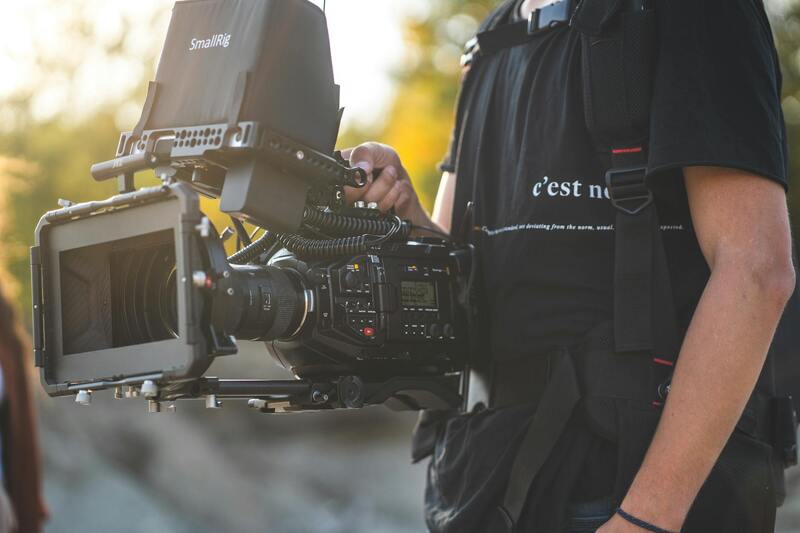
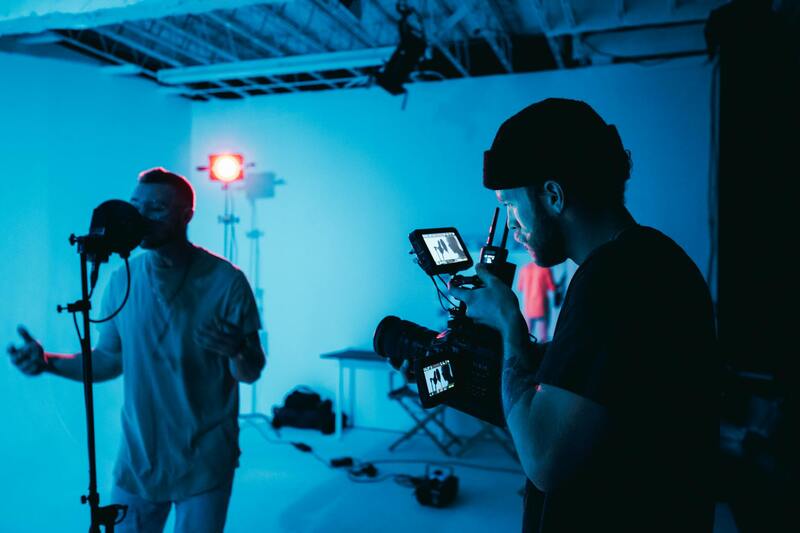
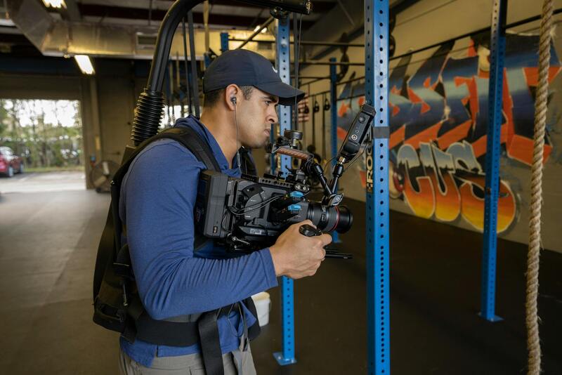
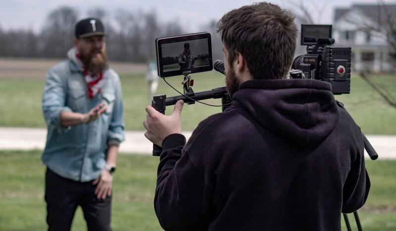
Achieving professional-grade footage requires a deep understanding of the technical elements involved in drone photography. Realtors aiming to elevate their property listings should prioritize acquiring drones equipped with high-resolution cameras capable of capturing detailed imagery from various altitudes. These cameras typically feature 4K or higher video capabilities and adjustable settings that allow for optimal exposure, focus, and frame rate adjustments. Such versatility ensures that aerial shots effectively showcase a property's exterior, surrounding landscape, and unique architectural features.
Proper camera settings are crucial for producing vibrant, clear imagery. Key parameters include ISO, shutter speed, and aperture, which must be adjusted based on lighting conditions. For instance, during bright daylight, lowering ISO and increasing shutter speed can prevent overexposure and motion blur. Additionally, shooting in RAW format preserves maximum image data, facilitating post-processing adjustments for color correction and enhancement.
Effective shooting techniques involve planning flight paths and capturing a variety of angles to provide comprehensive views of the property. Utilizing grid or waypoint flight modes ensures consistent coverage and stability, especially when capturing high-resolution images or videos. For dynamic videos, smooth camera movements and transitions are achieved through gimbal stabilization systems, which reduce vibrations and keep footage steady.
Realtors should also be attentive to lighting conditions, timing their shoots during the golden hour for warm, soft lighting that enhances visual appeal. Respectful and safe flight practices include maintaining line of sight with the drone, avoiding overflying crowds or private properties without consent, and adhering to altitude restrictions to prevent unwanted disturbances.
Investing in quality equipment, mastering camera settings, and applying precise shooting techniques collectively contribute to producing compelling visual content. This level of professionalism not only enhances property appeal but also reinforces the realtor's reputation as a trustworthy and innovative real estate professional.
Legal and Regulatory Considerations in Miami
When integrating drone photography into real estate marketing strategies, it's essential to adhere to established standards and guidelines that govern drone operations within Miami. While possessing advanced drone equipment and technical skills is crucial, understanding the frameworks that shape drone activity ensures smooth and professional execution of each project. These guidelines encompass aircraft altitude limits, restricted zones, privacy protocols, and operational licensing, all designed to promote safe and respectful drone use in densely populated and high-traffic areas like Miami.
In practice, realtors and drone operators should conduct comprehensive site assessments before each shoot to identify any temporary flight restrictions or sensitive areas. This proactive approach minimizes the risk of inadvertent violations and demonstrates a commitment to responsible operation. Moreover, obtaining necessary clearances when flying over certain properties or near private estates ensures that the visual content created remains compliant with local standards and regulations.
Operational safety is another critical aspect. Maintaining line-of-sight with the drone at all times, adjusting flight paths to avoid crowded spaces, and respecting the privacy of residents and neighboring properties adhere to best practices that safeguard both the operator and the community. Pilot certifications or proof of qualifications may also be required, depending on the scope of the drone activities and local mandates.
Additionally, staying informed about recent changes in drone legislation, airspace classifications, and related ordinances enables real estate professionals to adapt their marketing approaches swiftly. This vigilance fosters trust with clients and aligns marketing efforts with community standards, ultimately reinforcing the reputation of the realtor as a responsible and credible service provider.
By integrating official operational methods with professional expertise, realtors in Miami can maximize the benefits of drone photography while upholding best practices that respect regulations, enhance safety, and preserve community integrity. This balanced approach ensures sustainable and effective use of drone technology in the competitive real estate market.
The Technical Aspects of Drone Photography for Realtors
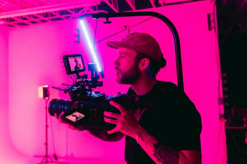
Effective realtor drone photography hinges on several technical factors that ensure the visual content stands out while maintaining clarity, safety, and professionalism. High-resolution cameras are essential, capable of capturing sharp details that highlight key features of a property, both indoors and outdoors. The choice of drone models often includes features such as stabilized gimbals, which help produce smooth, cinematic footage free of jitters and vibrations, creating an immersive viewing experience.
Flight planning is a critical component. Professional drone operators utilize sophisticated software that calculates optimal flight paths, angles, and altitudes tailored to each property. This planning ensures comprehensive coverage of the property’s exterior, landscaping, and neighboring features, providing potential buyers with a well-rounded perspective.
Lighting plays a significant role in drone photography. Schedule flights during optimal lighting conditions—typically during golden hours shortly after sunrise or before sunset—to capture warm, inviting images that enhance the property’s appeal. During overcast days or low-light conditions, supplementary lighting techniques may be employed to highlight architectural details without overpowering the natural ambiance.
Image composition remains vital. Drone pilots carefully frame shots to emphasize property size, unique features, and the surrounding neighborhood. Utilizing techniques like panoramic shots, 360-degree views, or establishing shots from various altitudes can create engaging visuals that tell a compelling story about the property’s lifestyle appeal.

Technical Aspects of Drone Photography for Realtors
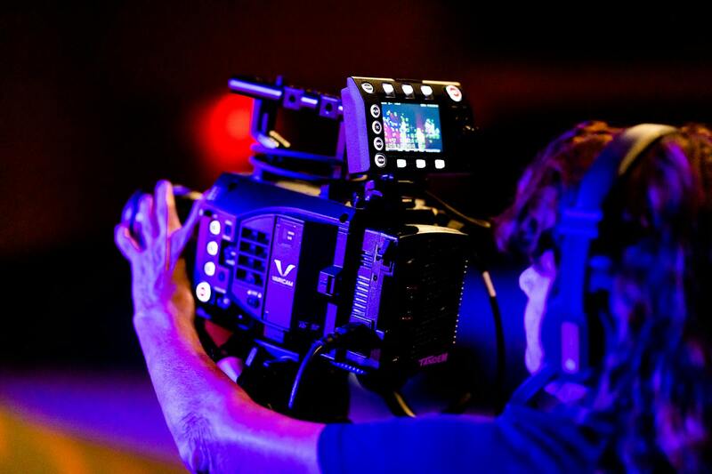
Employing drone technology for real estate requires a solid understanding of the technical specifications and operational techniques that ensure high-quality visual content. The choice of drone model, camera type, and stabilization technology directly influences the clarity, resolution, and overall aesthetic of the footage. For realtors aiming to showcase properties effectively, selecting drones equipped with high-resolution cameras capable of capturing images at 4K or higher is essential for detailed visual presentation. Learning to operate these devices with precision minimizes the risk of motion blur and distortion, producing smooth, professional shots.
Stabilization systems such as gimbal mounts are critical components that keep footage steady, especially during complex maneuvers or in windy conditions typical of outdoor environments. A gimbal works by counteracting drone movements, ensuring sharp images regardless of external factors. Properly planning flight paths and camera angles is equally vital; strategic positioning allows for highlighting key property features, such as expansive front views, backyard amenities, or unique architectural details.
Lighting plays a pivotal role in drone photography. Shooting during the golden hour—shortly after sunrise or before sunset—produces warm, inviting images that accentuate the property’s appeal. Overcast conditions can also be advantageous, providing diffuse light that reduces shadows and highlights intricate details without harsh contrasts. For particular architectural features or landscape features, supplementary lighting or reflectors might be employed to enhance visibility without detracting from natural aesthetic qualities.
Post-flight processing further refines the footage. Skilled editors adjust color grading, correct perspective distortions, and enhance clarity through software tools. This attention to detail transforms raw footage into compelling visual narratives that can significantly improve property listings.
Technical Aspects of Drone Photography for Realtors
In the realm of realtor drone photography, leveraging state-of-the-art technology ensures the delivery of high-quality visual content that captivates potential buyers. High-resolution cameras mounted on drones enable capturing expansive property views, detailed architectural features, and surrounding landscapes from multiple angles. The choice of camera specifications influences the clarity and detail of the images, making it vital to select drones equipped with advanced sensors capable of capturing sharp, vibrant footage in various lighting conditions.
Stabilization is a fundamental component in producing professional-grade images. Gimbal systems stabilize the camera during flight, counteracting drone movements and external forces such as wind. This stabilization results in smooth, distortion-free footage that effectively showcases the property’s attributes. Proper gimbal calibration and maintenance are essential for consistent performance and image quality.
The flight planning process involves meticulously designing routes that optimize coverage and highlight key property features. Pre-programmed flight paths, combined with real-time adjustments, enable capturing footage from ideal angles and heights. Equipment like GPS modules ensures precision navigation, allowing for repeatable shots and consistent results across various listings.
Lighting conditions dramatically impact the quality of drone imagery. Filming during the golden hour—shortly after sunrise or before sunset—provides warm, inviting tones that enhance the property’s curb appeal and create emotionally engaging visuals. Overcast days offer diffuse lighting, reducing shadows and preserving intricate architectural details. Additionally, supplemental lighting techniques may be utilized to illuminate shaded areas, ensuring comprehensive visual representation.
Post-processing is the final stage where raw footage undergoes refinement. Professional editors adjust color balance, correct perspectives, and enhance clarity to produce polished visuals. Such editing amplifies the aesthetic appeal and ensures the images align with branding and marketing goals, ultimately leading to more compelling property listings.
Utilizing Drone Photography for Exceptional Property Showcase
As the demand for immersive visual representations of properties continues to escalate within Miami’s competitive real estate market, the strategic application of realtor drone photography plays a pivotal role in establishing a property’s market presence. High-quality drone imagery not only accentuates the architectural details and surrounding landscapes but also provides prospective buyers with a comprehensive perspective that traditional photography often cannot deliver.
To maximize the effectiveness of drone imagery, real estate professionals prioritize capturing images during the optimal lighting windows—namely, the early morning or late afternoon—often referred to as the golden hour. This timeframe imparts a warm glow that enhances the visual appeal of the property’s exterior, making it more inviting to viewers. Overcast days are also utilized to produce soft, even lighting that reduces harsh shadows, which helps in accurately showcasing architectural nuances and landscaping features.
Consistent and high-quality imagery stems from meticulous planning of drone flight paths, ensuring comprehensive coverage from various angles. Pre-programmed routes combined with real-time adjustments facilitate ideal framing and shot composition. Advanced GPS navigation technology underpins this process, allowing for precise positioning and repeatability of shots across multiple listings, thereby maintaining brand consistency and professional standards.
Professional post-processing refines raw footage, where skilled editors correct perspective distortions, adjust color grading, and sharpen images. This stage elevates the visual narrative, ultimately leading to compelling marketing material that captures the attention of potential buyers and investors alike. Such polished visuals enable realtors to differentiate their listings and foster quicker engagement.
Integrating Innovative Technologies for Future-Ready Marketing
Emerging trends in realtor drone photography are revolutionizing how properties are marketed in Miami. The integration of 3D mapping equipment allows for creating detailed property models, offering potential buyers immersive virtual experiences. Virtual tour technology, combined with high-resolution drone footage, enhances remote viewing experiences, allowing prospective clients to explore a property from anywhere in the world.
These technological advancements complement traditional video and photographic content, providing a layered approach to property presentation. As tools become more refined, realtors can craft comprehensive visual stories that highlight the unique features of Miami properties—be it a waterfront mansion or a modern downtown condo.
To leverage these cutting-edge techniques effectively, choosing a reputable drone service provider that understands the latest innovations and adheres to industry standards is crucial. Skilled operators with a strong portfolio in real estate aesthetics will ensure that each capture aligns with the property’s selling points while maintaining safety and quality benchmarks.
Optimizing Visual Content for Diverse Marketing Platforms
The versatility of drone imagery extends to multiple marketing channels. High-resolution images and videos can be integrated into property websites, social media campaigns, email marketing, and virtual open houses. Tailoring content to fit each medium maximizes audience reach and engagement, turning passive viewers into active buyers.
For example, aerial videos that showcase neighborhood amenities and proximity to key locations can be used to highlight the lifestyle benefits of a property. Still images emphasizing architectural details, landscaping, and panoramic views encourage viewers to imagine themselves within the space. A strategic blend of these visuals ensures comprehensive storytelling that resonates with diverse buyer personas.
With Miami’s vibrant real estate landscape rapidly evolving, realtor drone photography serves as an essential component in crafting visually compelling narratives that set listings apart. By adopting innovative technologies and meticulous content strategies, real estate professionals can significantly enhance their marketing impact and accelerate transaction timelines.