Introduction to Aerial Real Estate Video
In recent years, aerial real estate video has become an integral component of sophisticated property marketing strategies, particularly in vibrant markets like Miami. This innovative approach harnesses the power of drone technology and high-quality videography to provide prospective buyers with a comprehensive view of properties and their surrounding environments. The popularity of aerial footage in Miami's competitive real estate scene stems from its ability to showcase properties from unique vantage points, emphasizing features such as expansive lawns, attractive waterfronts, and strategic location advantages that are often hidden from traditional ground-level images.
High-quality aerial videos serve as a compelling visual narrative, offering potential buyers an immersive experience that static images or standard videos may not capture effectively. As Miami continues to attract luxury developments, commercial investments, and innovative residential projects, the demand for visually engaging, professionally produced aerial real estate videos has surged. These videos do not just serve as marketing tools but also elevate a property's perceived value, generate greater engagement, and swiftly create a 'wow' factor that sets listings apart in a crowded market.
Key Components of Aerial Real Estate Videography
- High-definition drone footage capturing expansive property views
- Strategic shot composition highlighting property features and landscape
- Seamless camera movements creating engaging visual narratives
- Inclusion of contextual environment such as water access, proximity to amenities, and neighborhood features
Employing aerial real estate videos aligns with an advanced marketing approach that adapts to digital trends and buyer expectations. These visuals facilitate a more comprehensive understanding of property potential, encouraging quicker decision-making and fostering increased engagement from remote or international buyers seeking Miami properties. As technology advances and the quality of drone footage improves, the reliance on aerial videos in real estate marketing is poised to grow even further, setting new standards for property promotion in Miami's competitive landscape.
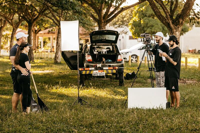
Technical Aspects of Creating Aerial Real Estate Videos
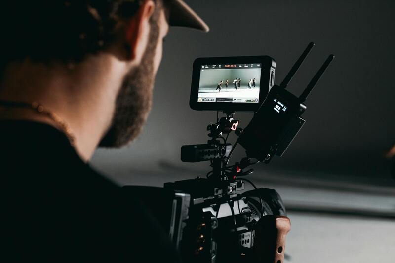
Producing high-quality aerial real estate videos requires meticulous attention to technical details that ensure clarity, stability, and visual appeal. The choice of equipment plays a crucial role in capturing compelling footage. Modern drones equipped with 4K or higher resolution cameras allow for crisp imagery that reveals property details and surroundings with remarkable precision. Additionally, gimbal stabilization technology minimizes vibrations and jitters, resulting in smooth, cinematic shots critical for showcasing upscale properties.
Pre-flight planning is equally important. Comprehensive site assessments help identify optimal flight paths, potential obstacles, and safety considerations. This planning involves evaluating wind conditions, obstacle clearance, and flight altitude regulations, which directly influence footage quality and safety compliance.
Capture techniques involve strategic shot composition and movements. For instance, establishing shots of the entire property from various angles provide viewers a comprehensive overview, while close-up shots highlight key features such as swimming pools, outdoor kitchens, or landscaping details. Gentle, deliberate camera movements—like slow ascents, descents, or lateral slides—add a dynamic storytelling element, enhancing viewer engagement.
Post-production also plays a vital role. Color grading and image stabilization tools refine footage, ensuring consistency and visual coherence. Incorporating aerial shots into a well-edited sequence helps craft a compelling narrative that guides potential buyers through the property's features and surroundings seamlessly.
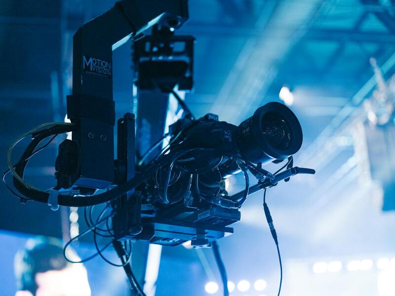
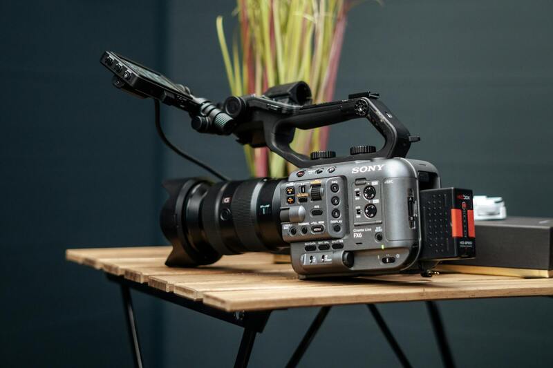
 igurecaption> Capturing steady, high-definition footage with advanced drone technology is essential for professional real estate videos.
Legal Considerations and Permits in Miami
Creating aerial real estate videos in Miami involves adhering to a structured process to obtain necessary permissions and ensure compliance with city regulations. The highly regulated nature of drone operations means that professionals must secure specific authorizations before flights commence, especially in residential, commercial, or protected areas.
Registration of drone operators with the Federal Aviation Administration (FAA) is mandatory for commercial flights, including real estate videography. This registration confirms that pilots are knowledgeable about airspace rules and safety procedures. For flights within Miami, local authorities may impose additional requirements, such as land use permits or no-fly zone restrictions, particularly near airports, government buildings, or wildlife reserves.
Obtaining a drone flight permit typically involves submitting detailed plans including flight boundaries, times, and safety measures. It is crucial to work closely with authorized agencies to ensure all regulations are met to prevent interference with other airspace users and to uphold safety standards.
Moreover, respecting privacy concerns is essential. Avoiding flights over private properties without consent and limiting camera angles to public areas help maintain ethical standards while capturing stunning imagery.
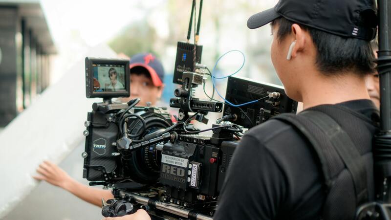
Different Drone Equipment for Capturing Aerial Real Estate Footage
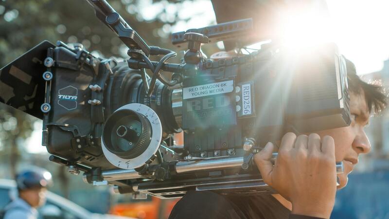
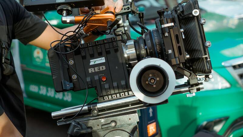
Selecting the appropriate drone equipment is fundamental to producing high-quality aerial real estate videos. Reliable drones equipped with advanced stabilization technology, high-resolution cameras, and long-lasting batteries are vital for capturing sweeping exterior shots, detailed property features, and panoramic views.
High-definition cameras, with capabilities of 4K resolution or greater, ensure crisp, clear visuals that highlight property details and surrounding landscapes. Gimbal stabilization systems are essential to keep footage steady, eliminating jitters caused by wind or drone movement, thus delivering smooth, professional-looking videos.
Moreover, drones fitted with intelligent flight modes such as orbit, waypoint navigation, or follow-me functions streamline the shooting process, allowing videographers to create dynamic footage with precision and efficiency. For comprehensive coverage, multiple drone models may be employed—from smaller, agile units suited for tight spaces to larger drones capable of longer flight times and carrying heavier camera equipment.
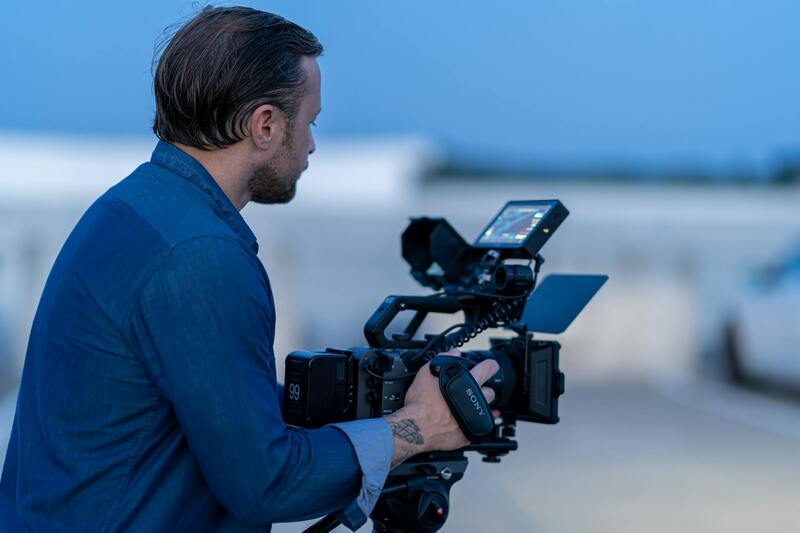
Optimal Flight Planning and Shooting Techniques
Effective flight planning is critical to capturing compelling aerial footage. This involves mapping out flight paths that maximize property visibility while maintaining safety and adherence to regulations. Pre-visualization of shots, including exterior property shots, driveway approaches, and surrounding neighborhood scenes, helps create a comprehensive visual narrative.
Utilizing predefined waypoints and automated flight modes allows for consistent, repeatable shots, which are especially useful in marketing campaigns where uniformity across multiple listings is desirable. It’s important to consider natural lighting, weather conditions, and the time of day to enhance visual appeal and highlight architectural features.
Post-flight, footage should be reviewed for quality and coherence. Editing raw clips to produce fluid, engaging videos involves color correction, stabilization adjustments, and enhancing visual effects, ensuring that the final production aligns with branding standards and marketing goals.
Safety and Compliance During Drone Operations
Safe drone operation requires adherence to established flight protocols, including maintaining line-of-sight, avoiding restricted zones, and respecting privacy boundaries. Conducting pre-flight safety checks of equipment and surveying the site beforehand reduces risks and ensures smooth operations.
Operators should remain aware of environmental factors such as wind speed, obstacles, and aircraft traffic. Maintaining a safe distance from power lines, trees, and any structures is crucial. Engaging with local authorities or property owners when necessary helps facilitate coordinated efforts and avoid misunderstandings.
While capturing stunning visuals, maintaining a professional approach to operation and respect for property rights creates a positive experience for clients and preserves the reputation of the service provider.
Legal Considerations and Permits in Miami
Executing aerial real estate videos within Miami requires adherence to established land and air space regulations that govern drone operations. Property owners and content creators should be thoroughly familiar with the official procedures for securing authorization to fly drones over private and public properties. These procedures typically involve obtaining permits from relevant municipal or state agencies, ensuring that flights comply with designated altitude limits, and respecting no-fly zones within the city. Such zones often include areas near airports, government facilities, and critical infrastructure. Navigating these requirements proactively helps prevent disruptions during filming and safeguards against potential liabilities.
Professionals engaged in aerial videography should also familiarize themselves with Miami's specific privacy policies. Respecting the privacy of residents and neighboring properties involves avoiding intrusive flight paths and maintaining a safe distance from inhabited structures. Developing a comprehensive flight plan that incorporates environmental considerations, such as wind patterns and obstacles, enhances operational safety and protects the integrity of the footage.
Engaging with local authorities and obtaining the necessary permits before initiating drone flights not only ensures operations are within legal boundaries but also demonstrates professionalism and commitment to safety. In Miami, collaborating with licensed drone operators knowledgeable about municipal regulations and aerial filming standards significantly minimizes the risk of penalties or project delays. Additionally, maintaining detailed records of permits, flight plans, and safety checks can be advantageous for future projects and client transparency.
Technical Aspects of Creating Aerial Real Estate Videos
Producing high-quality aerial real estate videos necessitates a careful balance of technical expertise and creative vision. The foundation begins with selecting the appropriate equipment tailored for specific project requirements. High-resolution drones equipped with stabilized gimbals ensure smooth footage that highlights the property's architecture and surrounding landscape perfectly. Calibration of camera settings, such as shutter speed, ISO, and aperture, ensures optimum image clarity and color accuracy regardless of external lighting conditions.
Pre-flight planning is crucial for capturing comprehensive and compelling shots. This involves designing a detailed flight path that maximizes the property's visual appeal while adhering strictly to regulatory guidelines. Flight plans should delineate camera angles, altitudes, and focal points to capture a variety of perspectives — from sweeping panoramas to close-up views of unique features like pools, gardens, or detailed facades. Mapping out these movements helps prevent obstacles and ensures consistent footage quality.
Lighting is another critical factor in aerial videography. The optimal time for filming is typically during golden hour — shortly after sunrise or before sunset — when natural light lends a warm, inviting tone to the visuals. However, professionals must also prepare for varying weather conditions, as wind, rain, or fog can impede drone operation and degrade footage quality. Adjustments in altitude or camera angle may be necessary to mitigate these challenges while maintaining visual clarity.
Post-production enhances raw footage through color grading, stabilization, and sometimes cinematic effects. Proper editing ensures that the final video aligns with the client's branding and appeals to prospective buyers. Incorporating movement within the scenes — such as slow pans or reveals — can emphasize the property's best features and create an immersive viewer experience.
- Use of high-quality stabilization technology to minimize shakes and vibrations
- Strategic camera angles to showcase property layout and surroundings
- Incorporation of time-lapse sequences for dynamic storytelling
- Consistent color correction to ensure visual uniformity
Advanced editing techniques, including adding graphics, labels, or virtual walk-throughs, can further elevate the appeal of the aerial video. These elements help potential buyers understand property dimensions, highlights, and unique selling points in a visually engaging manner.
Ultimately, creating impactful aerial real estate videos demands a combination of technical mastery, strategic planning, and artistic sensibility. When executed correctly, these visual tools profoundly influence buyers’ perceptions, enabling real estate professionals to showcase properties in their best light and reach a wider audience with compelling digital content.
Legal Considerations and Permits in Miami
When producing aerial real estate videos in Miami, understanding the necessary procedural steps is vital to ensure smooth operation and adherence to local standards. Miami's vibrant real estate market often necessitates the use of drone technology to capture visually compelling footage; however, this also requires obtaining specific clearances prior to flight. Engaging with local authorities involves submitting detailed flight plans and safety protocols, ensuring that aerial activities do not interfere with restricted zones or violate privacy expectations.
Depending on the location, certain landmarks, parks, or private properties may have restrictions that mandate special permissions from municipal agencies or property owners. For instance, neighborhoods with strict homeowner association rules might require prior approval before drone operations commence. Additionally, certain airspace regions around Miami International Airport or designated no-fly zones are reserved for governmental or commercial aviation, necessitating alternative approaches or elevated clearance processes.
Proactively coordinating with Miami's aviation and municipal authorities can streamline the filming schedule and mitigate potential delays. Prior planning includes applying for permits well in advance of the project timeline, especially when filming involves multi-location shots or complex maneuvers near sensitive areas. It’s also important to comply with Miami-Dade County's regulations on privacy, noise levels, and operational times to ensure that filming activities do not disrupt the community.
 igure>
Maintaining transparent communication with local authorities and property owners not only helps secure the necessary permits but also builds professional credibility. When all regulatory requirements are meticulously followed, operators reduce the risk of penalties or project shutdowns, allowing for the production of high-quality, impactful visual content. This thorough approach underscores a commitment to professionalism, aligning with best practices in aerial videography within dynamic urban environments like Miami.
Legal Considerations and Permits in Miami
Executing aerial real estate videos in Miami involves meticulous planning around the operational framework established by local aviation and municipal authorities. Securing appropriate permissions prior to any filming activity is essential for maintaining compliance with city regulations and operational standards. This process typically entails submitting detailed flight plans, safety protocols, and proof of operator qualifications to relevant authorities well before scheduled shoots. The process aims to ensure that aerial operations do not interfere with other airspace users or pose risks to public safety.
Operators must be familiar with Miami's designated no-fly zones, which include those around major airports such as Miami International Airport, as well as military installations, government buildings, and certain designated urban airspace sectors. Awareness of these zones, along with understanding local restrictions on altitude and flight times, helps avoid inadvertent violations. Working within these parameters allows for the planning of shoot schedules that optimize creative vision while respecting municipal and federal airspace management directives.
In addition to geographic considerations, Miami enforces specific rules related to privacy, noise, and operational hours. Filming activities should be scheduled during hours that minimize disruption to residents and local businesses. Utilizing technology such as automated geofencing ensures compliance by preventing drones from entering restricted areas automatically. Additionally, it’s advisable to establish clear communication channels with local authorities and property owners. This proactive approach helps address any concerns and facilitates smoother permit approval processes.
While navigating these regulatory layers, it’s vital to prepare comprehensive documentation. This includes detailed flight plans, safety risk assessments, insurance coverage proof, and operator certifications. Submitting these documents in a timely manner can expedite approval procedures and reduce the risk of delays. Establishing a rapport with licensing agencies and demonstrating adherence to all operational standards underline a professional commitment to responsible aerial operations.
Adhering strictly to Miami’s regulatory requirements not only minimizes legal and operational risks but also enhances the safety and quality of the final visual product. This disciplined approach underscores the importance of professionalism in aerial videography, fostering trust with clients and stakeholders. When the necessary permissions are obtained, aerial content can be produced confidently, reflecting the high standards expected within Miami's vibrant real estate market and dynamic urban environment.
Legal and Regulatory Considerations for Aerial Real Estate Video Production in Miami
Producing aerial real estate videos in Miami necessitates a thorough understanding of the permits, regulations, and operational protocols designed to ensure safe and responsible drone usage. These frameworks are vital to maintain an organized process that safeguards both aerial videographers and the surrounding community. While specific permit processes may vary, adherence to the established procedural standards guarantees a streamlined workflow from planning through execution.
Essential steps begin with detailed planning that includes preparing comprehensive documentation such as structured flight plans, safety risk assessments, and proof of operator certifications. These documents not only demonstrate professionalism but also facilitate obtaining necessary approvals from regulatory bodies and local authorities. The process typically involves submitting applications well in advance of scheduled shoots and engaging directly with licensing agencies to clarify project details and address any concerns.
Key Components of Permit Applications
- Detailed flight path descriptions, including altitude and geographic boundaries
- Safety protocols related to property and public safety, especially in urban areas with high foot traffic
- Proof of drone operation certifications and operator training
- Insurance documentation covering aerial activities
- Coordination plans with property owners, especially for exclusive or sensitive sites
The importance of maintaining ongoing communication with Miami's regulatory agencies cannot be overstated. Establishing a good rapport can serve to clarify any ambiguities and expedite the review process. Demonstrating a commitment to safety and compliance enhances the trust and confidence of stakeholders, making the entire operation smoother and more efficient.
Operational Best Practices within Regulatory Frameworks
Beyond obtaining permits, integrating operational best practices secures smooth filming sessions and ensures adherence to all local standards. These practices include maintaining line-of-sight drone operation, respecting no-fly zones such as airports and emergency zones, and avoiding flight over crowds or private properties without explicit permission. Using current geofencing technologies can assist pilots by automatically preventing drones from entering restricted areas, thereby reducing risks.
Additionally, establishing clear communication channels with property owners, local authorities, and aerial team members minimizes misunderstandings and forestalls potential disruptions. Conducting pre-flight briefings and establishing emergency protocols also contribute to a safe operating environment. These steps uphold the professionalism expected in Miami’s vibrant real estate landscape and reflect a responsible approach to aerial videography.
Importance of Staying Updated with Regulatory Changes
Regulations regarding drone operations frequently evolve, often influenced by advancements in technology and changes in urban development policies. Staying informed about recent updates from Miami’s transportation and aviation authorities is crucial. Continuous education and engagement with industry associations or regulatory workshops can provide valuable insights into new compliance requirements and emerging best practices.
By proactively adapting to regulatory changes, professionals can ensure they remain compliant and capable of delivering high-quality aerial content without interruptions. Moreover, these practices contribute to a safer environment while showcasing Miami’s scenic and dynamic real estate properties through captivating, regulation-compliant aerial videos.