Overview of Commercial Property Aerial Photography
Commercial property aerial photography involves capturing high-quality images of real estate assets from an elevated perspective, typically utilizing drones, helicopters, or fixed-wing aircraft. This specialized branch of aerial imaging is extensively used in property marketing, appraisal, and site analysis. The unique vantage point provided by aerial photography enables investors, developers, and real estate professionals to showcase the entirety of a property and its surroundings in a compelling and visually impactful manner.
In the context of commercial real estate, aerial images serve as powerful tools to highlight key features such as building layouts, parking facilities, landscaping, nearby infrastructure, and accessibility. These images are instrumental for creating detailed marketing materials, conducting site assessments, and facilitating investment decisions. The visual depth and clarity afforded by aerial shots allow stakeholders to gain a comprehensive understanding of the property's physical context and its relationship within the broader environment.
Effective commercial property aerial photography plays a critical role in differentiating listings in a competitive market, providing an expansive perspective that traditional ground-level photos often cannot achieve. This approach enhances investor confidence and attracts prospective tenants or buyers by presenting a professional, transparent, and engaging visual narrative of the property’s attributes.
Furthermore, aerial imagery aids in strategic planning, construction monitoring, and assessing site conditions over time, making it an indispensable asset for comprehensive property management. As technological advancements continue to evolve, the importance of high-resolution aerial photography in the commercial real estate sector is set to increase, offering more detailed and dynamic visual content for various professional applications.
Legal and Regulatory Considerations in Miami
When executing commercial property aerial photography in Miami, adhering to established protocols ensures smooth operation and high-quality results. This process involves complying with specific regulations that govern the use of aerial platforms, including drones and other unmanned aircraft systems. The Federal Aviation Administration (FAA) oversees the airspace, mandating strict standards for drone operations that impact commercial photography pursuits. Operators are required to obtain proper certifications, adhere to designated flight altitudes, and follow safety guidelines to avoid interference with manned aircraft or restricted zones.
In addition to federal mandates, Miami's local jurisdiction introduces its own set of restrictions that further influence aerial photography activities. These include zoning restrictions, designated no-fly zones around sensitive areas such as airports, government buildings, and densely populated zones. Permits obtained from city authorities or specific approvals from Miami-Dade County may be necessary before commencing aerial shoots. Securing these permissions minimizes disruptions and affirm the legality of each operation.
Operational planning must also incorporate assessments of weather conditions, local air traffic, and other environmental factors that could influence safety and image quality. In scenarios where drone use is restricted or unsuitable, alternative methods such as manned aircraft or high-altitude photography from specially equipped aircraft can be considered, always ensuring compliance with relevant regulations. Maintaining detailed documentation of permits and operational plans is essential for accountability and can streamline any inspection or review processes.
Professional aerial photographers in Miami often collaborate with legal and regulatory experts to stay current with evolving laws. This proactive approach helps them navigate the complex regulatory landscape, ensuring each project aligns with all required standards. The importance of expertise in legal compliance cannot be overstated, as it safeguards the investment in high-quality visual content, enhances operational efficiency, and sustains the reputation of professionals within this specialized field.
Types of Equipment and Technology Used
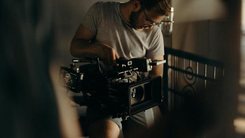
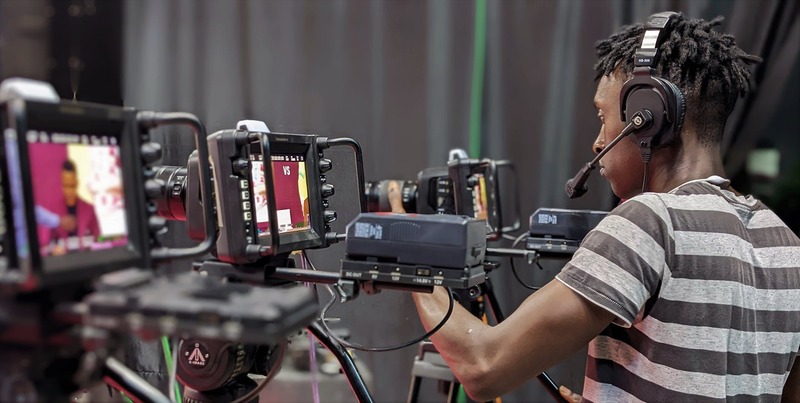
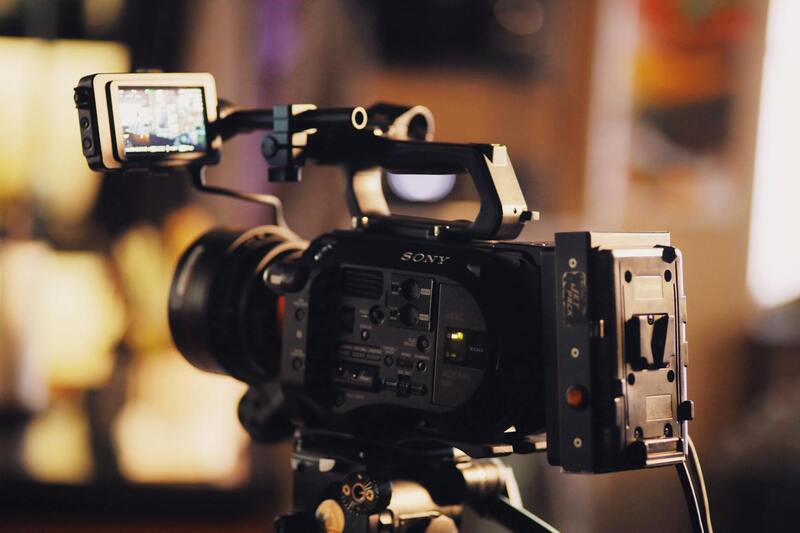
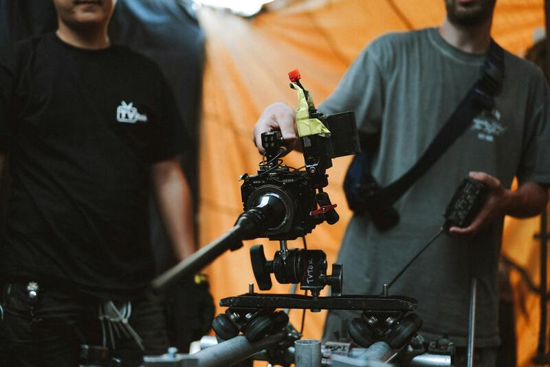
For commercial property aerial photography, the selection of equipment plays a crucial role in capturing high-resolution, detailed images that accurately represent the property from above. Modern drone technology is at the forefront of this field, offering professionals a versatile and efficient way to gather compelling visual content. Drones equipped with high-end DSLR or mirrorless cameras provide crisp, vibrant images with excellent detail, which are essential for marketing, inspection, and documentation purposes.
Stabilization systems, including gimbal mounts, are vital to ensure smooth, shake-free footage, especially when capturing images from varying altitudes and angles. These stabilization tools compensate for drone movement, resulting in sharp images free from blurring. Multi-axis gimbals allow for precise control, enabling photographers to maintain consistent framing and high image quality even in challenging wind conditions.
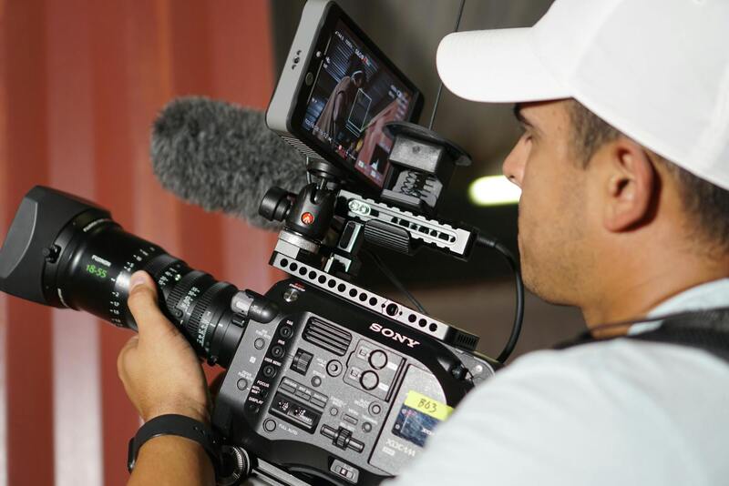
Camera choice is another important aspect. Wide-angle lenses are commonly used to capture expansive views of large commercial sites, while zoom capabilities can focus on specific details such as signage or entry points. High dynamic range (HDR) imaging is frequently utilized to ensure clarity in high-contrast lighting scenarios, which are prevalent during midday shoots or in urban settings with shadowed areas.
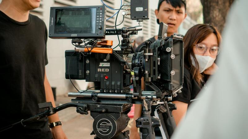
In addition to drones, manned aircraft such as small planes or helicopters equipped with high-resolution cameras are employed for large-scale projects or when access restrictions limit drone use. These aircraft provide the ability to cover extensive areas with superior stability and slower flight speeds, allowing for meticulous framing and detailed imagery. Specially outfitted aerial platforms can also include specialized sensors like thermal imaging cameras for inspections and environmental assessments, expanding the scope of commercial property applications.
The integration of emerging technologies such as multispectral sensors, 3D mapping, and photogrammetry further enhances the capabilities of aerial photography. These tools provide valuable data for assessing property conditions, planning development projects, or creating detailed 3D models used in virtual tours or construction planning. Ultimately, combining advanced equipment with skilled operators ensures the production of high-quality, valuable visual assets tailored to commercial property needs.
Legal and Regulatory Considerations in Miami
When executing commercial property aerial photography in Miami, practitioners must adhere to specific regulations and guidelines to ensure safety, compliance, and the preservation of privacy. Miami’s urban landscape, bustling development zones, and proximity to airports necessitate a thorough understanding of aerial operation protocols. These include maintaining appropriate flight altitudes, acquiring necessary permits, and respecting restricted airspace zones, particularly around sensitive infrastructure and recreational areas.
Operators are required to coordinate with aviation authorities to obtain relevant authorizations before conducting flights. This often involves submitting flight plans for review, especially when operating beyond visual line-of-sight (BVLOS) or in densely populated regions. Permits can also include waivers for night operations or flights over densely populated areas, which require detailed risk assessments and mitigation strategies.
In addition, Miami’s local ordinances may impose additional restrictions related to privacy and noise pollution, reinforcing the importance of working with licensed professionals who are familiar with city-specific stipulations. This ensures that aerial photography sessions do not interfere with public safety or infringe upon individuals’ privacy rights.
Operational sites must also consider environmental regulations, especially when capturing images of ecologically sensitive areas or waterfront properties. Certain zones may require additional environmental assessments or additional permits to avoid disrupting local habitats.
Maintaining comprehensive documentation of permits, flight logs, and safety procedures is crucial for accountability and to streamline ongoing or future projects. Working with experienced aerial photography firms that stay updated with Miami’s evolving regulations helps mitigate risks and ensures seamless project execution.
Types of Equipment and Technology Used
Commercial property aerial photography relies on a diverse array of sophisticated equipment designed to capture high-resolution images from various altitudes and angles. The selection of appropriate technology ensures clarity, detail, and adaptability to different environmental conditions and property types. Among the most prominent tools utilized are unmanned aerial vehicles (UAVs), commonly known as drones, which offer flexibility and precision for detailed shots of commercial sites.
Advanced drone models are equipped with high-definition cameras capable of capturing ultra-clear images in both standard and HDR formats. These cameras often feature gimbal stabilization systems that reduce vibration and motion blur, resulting in sharp images even during movement. Some drones incorporate thermal imaging sensors to highlight heat variations, useful in assessing energy efficiency or identifying structural issues on large commercial rooftops.
Beyond drones, traditional aerial photography relies on manned aircraft, including helicopters and light planes, especially for expansive properties or when aerial shots require coverage of large geographical areas. These aircraft are fitted with state-of-the-art digital cameras and stabilization platforms that facilitate high-altitude shots, even under challenging weather conditions.
Emerging technological trends are integrating artificial intelligence (AI) and machine learning algorithms to automatically analyze captured footage, identify property boundaries, and generate detailed 3D models. This allows for more comprehensive assessments of property features and facilitates precise planning, valuation, and marketing strategies. Moreover, the advent of multispectral sensors expands capabilities for environmental monitoring and utility assessments, adding further value to commercial aerial imagery.
All equipment used is paired with robust stabilization and control systems to ensure safety and image consistency. High-end navigation and obstacle avoidance technologies enable drones to operate safely in complex environments, especially around densely built urban areas like Miami, where airspace congestion is common. The integration of these advanced devices and systems provides clients with detailed, accurate, and visually engaging representations of their commercial properties, supporting better decision-making and promotional efforts.
Types of Equipment and Technology Used
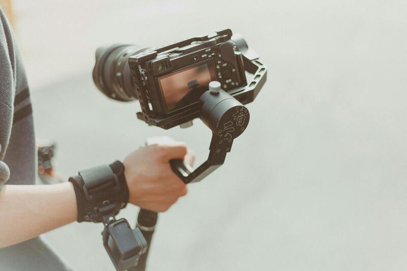
In the realm of commercial property aerial photography, the choice of equipment and technology plays a pivotal role in delivering high-quality results that meet both operational and marketing needs. The industry predominantly relies on a combination of sophisticated drones, stabilized camera systems, and cutting-edge imaging devices to capture comprehensive visuals of expansive properties from various altitudes and angles.
Unmanned aerial vehicles (UAVs), commonly known as drones, are fitted with high-resolution digital cameras capable of capturing detailed images that reveal intricate property details otherwise difficult to showcase through ground-level photography. These drones are equipped with GPS navigation, auto-hover, and obstacle avoidance systems, enabling precise flight control even in complex and dense urban environments such as Miami's bustling commercial districts.
Stabilization technology is essential for maintaining image clarity. Gimbals—motorized stabilization mounts—are used to counteract drone movement and vibrations, ensuring smooth and sharp visuals during flight. For instances requiring even higher precision, professional-grade stabilized camera rigs are employed, often mounted on larger aircraft or tethered systems to produce wide-angle shots suitable for large-scale commercial properties.
The evolution of imaging technology has led to the integration of multispectral sensors, thermal imaging, and high dynamic range (HDR) photography. Multispectral sensors can capture data across various spectral bands, which is valuable for environmental assessments, utility inspections, and landscape analysis—particularly important in Miami’s diverse urban and natural environments. Thermal imaging is used to evaluate energy efficiency, detect heat leaks, or identify infrastructure issues, providing additional layers of utility insights.
Artificial intelligence (AI) and machine learning algorithms are increasingly embedded into aerial photography workflows. These systems automatically analyze huge datasets, identifying property boundaries, structural features, and landscape elements. The software can generate 3D models and orthomosaic maps that assist developers, investors, and property managers in making data-driven decisions. Such technological integration streamlines workflows, enhances precision, and reduces processing time, thereby supporting strategic planning and marketing efforts.
Benefits of Aerial Photography for Commercial Properties
Utilizing sophisticated equipment and technologies offers numerous advantages for commercial real estate stakeholders. High-resolution aerial images provide a bird’s-eye view that captures the full extent of property boundaries, infrastructure, and surrounding amenities. These views offer unparalleled insights into property layouts, access points, and site conditions, which are crucial during due diligence, site planning, and legal documentation.
Moreover, aerial imagery significantly enhances promotional materials, making property listings more appealing with engaging visuals that highlight unique selling points. For larger developments or complex sites, drone-captured images facilitate better visualization of project progress, site maintenance, and environmental impacts. They also support remote property assessments, minimizing the need for physical inspections, especially during times when site visits are restricted or challenging.
Beyond marketing, aerial photography supports operational decisions such as construction monitoring, infrastructure inspections, and utility management. High-altitude imagery enables quick identification of potential issues like drainage problems, structural damages, or encroachment, allowing for timely interventions. The availability of detailed, up-to-date visuals also aids in compliance documentation and land-use planning, ensuring projects adhere to local zoning and development standards.
Best Practices for Capturing Effective Aerial Images
Achieving high-quality aerial photographs requires meticulous planning and execution. It begins with conducting comprehensive site assessments to identify optimal flight paths that maximize coverage while avoiding obstacles. Flight plans should consider weather conditions, lighting, and airspace regulations to ensure safety and optimal image quality.
Pre-flight preparations include calibrating equipment, verifying drone stability, and setting appropriate camera parameters—such as shutter speed, aperture, and ISO—to accommodate lighting variations. Capturing images during optimal times of daylight, typically mid-morning or late afternoon, produces softer shadows and more evenly lit visuals, enhancing detail visibility.
Operational techniques such as overlapping images at around 60-80% ensure effective image stitching for panoramic views and 3D reconstructions. Consistent altitude control and precise GPS-based navigation allow for accurate spatial referencing. Post-flight, image processing software is used to refine visuals, correct distortions, and generate detailed 3D models or orthomosaics.
Legal and Regulatory Considerations in Miami
Engaging in commercial property aerial photography within Miami necessitates adherence to a set of established procedures that govern the use of aerial platforms and imaging equipment. Operators must ensure all flights are conducted in compliance with the airspace regulations set forth by local authorities and federal agencies. This includes obtaining appropriate authorizations for drone operations, especially when capturing images over densely populated or restricted zones, to avoid interference with other airspace users.
Prior to executing any aerial photography session, professionals should verify the operational limits and guidelines related to altitude restrictions, distances from airports, and no-fly zones. Additionally, securing any necessary permits or clearances from municipal authorities ensures that the activity aligns with city-specific ordinances designed to safeguard public safety and privacy concerns.
Effective communication with local authorities and stakeholders not only streamlines the process but also demonstrates responsible operation within the community. This proactive approach helps mitigate potential conflicts or delays, facilitating smooth execution of projects and maintaining the integrity of the process.
Moreover, understanding privacy considerations is essential when capturing images across various urban and private spaces. While drone operations are advantageous for encompassing large areas swiftly, ensuring that images do not infringe on personal privacy rights is paramount. Employing techniques such as avoiding close-up shots of private residences or sensitive infrastructure can help uphold responsible photography standards.
Importance of Informed Flight Planning
Thorough planning involves consulting updated charts, weather forecasts, and air traffic data to optimize flight safety and image quality. A detailed flight plan that accounts for potential obstacles, such as tall buildings or power lines, ensures minimal risk during operation. Accuracy in pre-flight preparations, including calibration of equipment and setting appropriate camera parameters, contributes significantly to capturing clear, accurate visuals for commercial property assessment.
This disciplined approach not only guarantees the safety of aerial photography activities but also results in precise, actionable images that support decision-making processes related to property development, management, and marketing initiatives.
Advanced Techniques and Equipment for Top-Tier Commercial Property Aerial Photography
Achieving high-quality aerial images of commercial properties in Miami necessitates the adoption of sophisticated technologies and specialized equipment. This commitment to utilizing cutting-edge tools ensures the delivery of detailed, precise visuals that meet the specific needs of property developers, investors, and managers.
Utilization of High-Resolution Drones and Camera Systems
Modern unmanned aerial vehicles (UAVs) equipped with high-resolution cameras are essential for capturing sharp, detailed imagery from various altitudes and angles. These drones are capable of recording in 4K or higher resolutions, allowing viewers to discern architectural details, signage, and surrounding landscape intricacies vital for assessments and marketing efforts. Advanced stabilization systems reduce motion blur, ensuring clarity and sharpness in every shot.

Incorporating LIDAR and Photogrammetry Technologies
For comprehensive site surveys and volumetric analyses, integrating Light Detection and Ranging (LIDAR) sensors with aerial platforms provides accurate 3D data of structures and terrain. Photogrammetry software processes overlapping images to generate highly detailed orthomosaic maps, offering invaluable insights for construction planning, zoning compliance, and infrastructure management.
Advanced Flight Autonomy and Image Processing Software
Robust autopilot systems enable precise navigation around complex urban environments, avoiding obstacles such as skyscrapers, power lines, and trees. Coupled with sophisticated image processing algorithms, these systems enhance image quality and facilitate the creation of virtual walkthroughs and immersive models for stakeholders.
Integration with Geographic Information Systems (GIS)
The seamless integration of aerial imagery into GIS platforms empowers users to overlay property data, zoning layers, and infrastructure maps. This synergy enhances spatial analysis, optimizing decision-making processes related to property development, marketing, and asset management.
Professional Ground Support and Data Management
Professional-grade ground control stations and data management systems ensure accurate georeferencing of images. Secure storage solutions and efficient data processing pipelines guarantee that high-resolution files can be accessed and analyzed swiftly, supporting timely project iterations and strategic planning.
Adherence to Industry Standards and Certification
Operators employing these advanced tools adhere to industry standards, ensuring consistent image quality and operational safety. Certification programs for drone pilots and equipment validate their expertise, underpinning the credibility of aerial imaging services provided to clients.
Conclusion: State-of-the-Art Technologies Elevating Commercial Property Imaging
Implementing these advanced equipment and techniques in Miami’s commercial real estate landscape enables stakeholders to obtain unparalleled visual documentation. Whether for marketing, development evaluation, or management, leveraging the latest tools facilitates comprehensive insights, ultimately resulting in more informed business decisions and optimized property utilization.