Overview of Residential Drone Photography
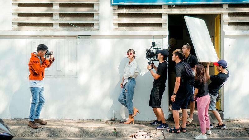
Residential drone photography has rapidly gained popularity within the real estate industry, especially in vibrant markets like Miami. This innovative approach involves using unmanned aerial vehicles (UAVs) equipped with high-resolution cameras to capture expansive, detailed images and videos of residential properties from various vantage points. The ability to showcase entire neighborhoods, landscaped yards, swimming pools, and architectural features from aerial perspectives offers a compelling advantage for homeowners, real estate agents, and investors.
In the Miami real estate market, where luxury homes and expansive properties are prevalent, drone photography provides a comprehensive visual narrative that traditional photography cannot match. It allows potential buyers to experience the scale and surroundings of a property, including nearby amenities, waterfront views, and scenic landscapes, all from the comfort of their current location. This method not only enhances online listings but also streamlines the property viewing process by offering an immersive first impression.
Common uses of residential drone photography extend beyond real estate listings. It includes promotional videos for luxury homes, real estate portfolio development, virtual tours, and documentation of property development progress. The technology’s advantages lie in its ability to produce high-quality, dynamic content that captures the essence of a property quickly and efficiently. This visual advantage often translates into faster sales, higher visibility, and more engaging presentations for prospective buyers or investors.
As drone technology continues to advance, the scope of its application in residential property marketing expands, making it an essential tool for real estate professionals aiming to differentiate their listings in a competitive market. For homeowners, leveraging professional drone photography can significantly increase property appeal, attract a broader audience, and achieve better sale outcomes. The evolving landscape of drone applications ensures that residential drone photography will remain a key component of modern property marketing strategies in Miami and beyond.
Equipment and Technology Used
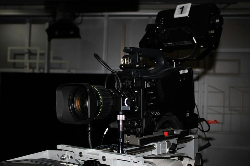
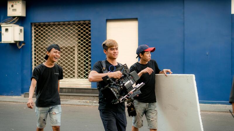
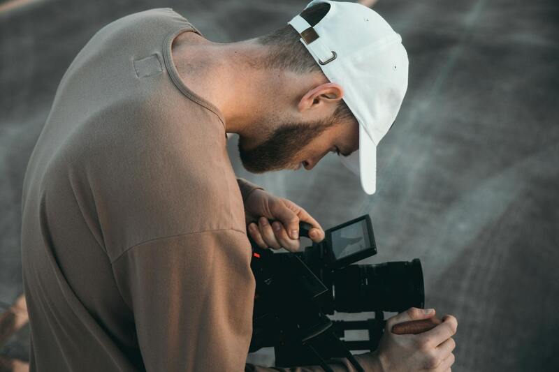
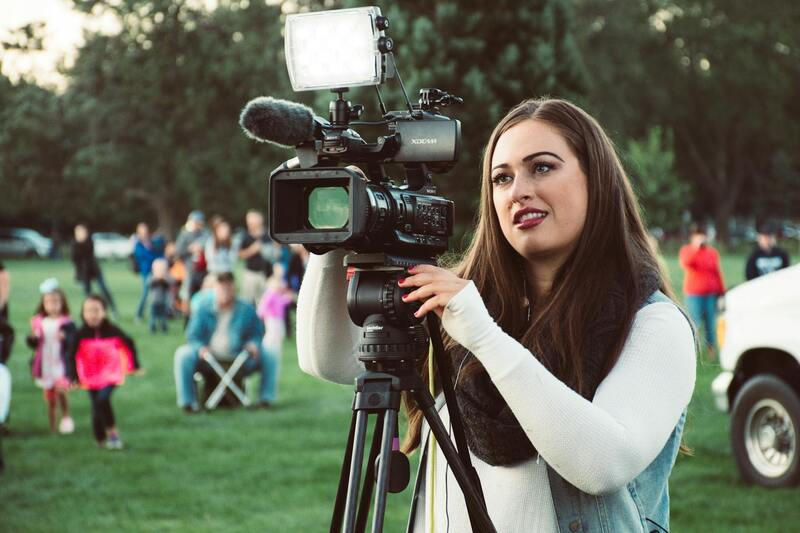
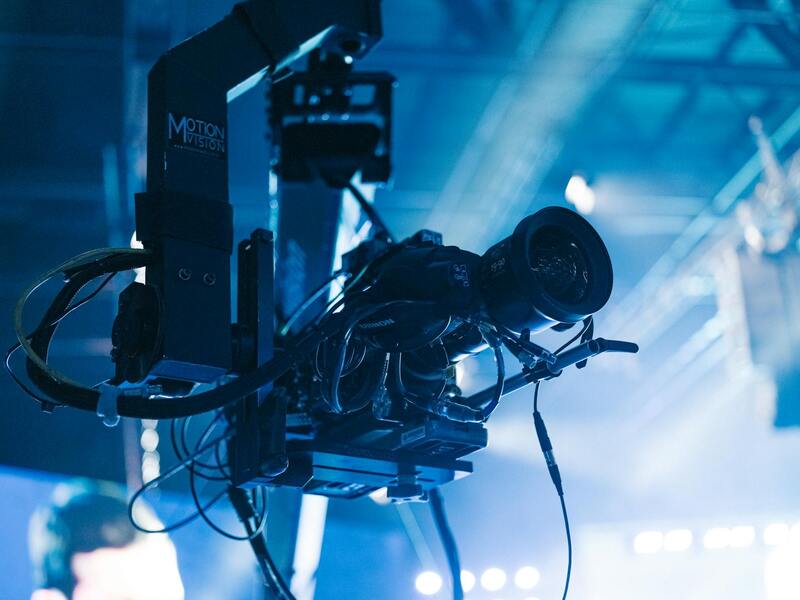
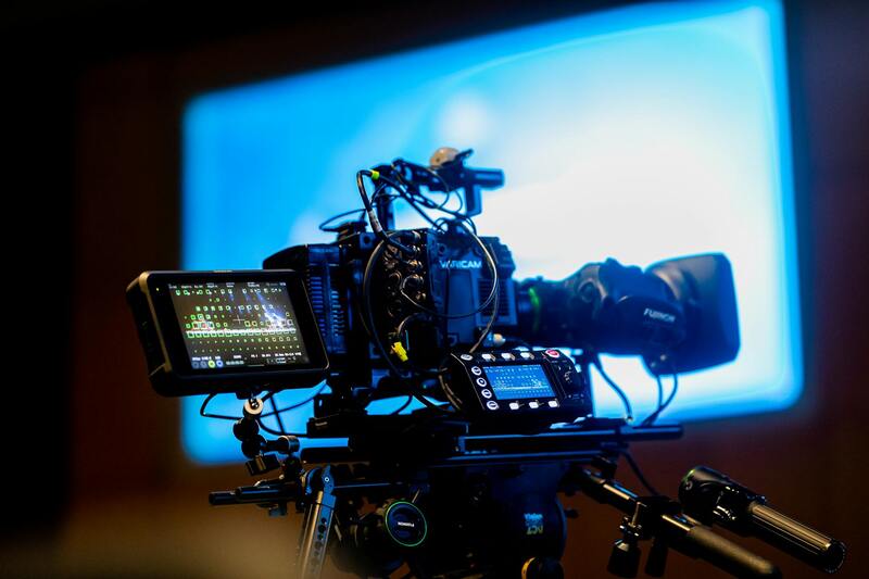
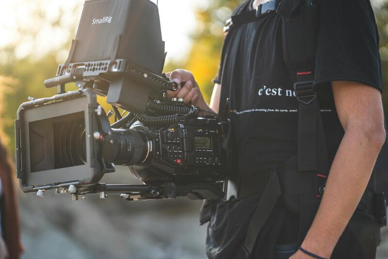
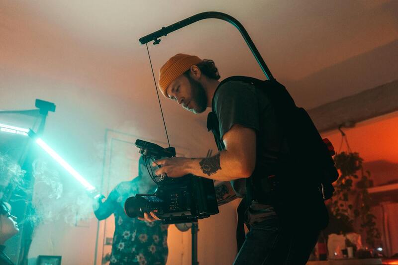
High-quality residential drone photography demands the use of advanced equipment tailored to capture detailed, stable, and visually striking images. Modern professional drones are equipped with high-resolution cameras, often ranging from 20 to 50 megapixels, enabling crisp, vibrant captures of entire properties and surrounding landscapes. These cameras are typically stabilized through gimbal systems, which eliminate vibrations and ensure smooth, clear footage even in windy conditions.
Beyond the camera quality, drone operators utilize sophisticated flight control systems that allow precise navigation and stable positioning, essential for capturing consistent angles and panoramic shots. Automated flight planning software is often employed to map out optimal flight paths, ensuring comprehensive coverage of the property from multiple perspectives.
For lighting, some operators augment natural light with reflectors or additional lighting setups, particularly when capturing interiors or areas with challenging shadows. In some cases, infrared or thermal imaging sensors are used to highlight specific property features, such as rooftop conditions or landscaping details.
Post-processing tools are equally important, with software like Adobe Photoshop and Lightroom used for color correction, image sharpening, and adding finishing touches. Editing enhances the raw footage, ensuring that each image accurately represents the property’s appeal.
Advancements like autonomous flight modes and obstacle detection have significantly increased the safety and efficiency of residential drone photography. These technological improvements allow operators to execute complex shot sequences with minimal risk, ensuring comprehensive coverage without compromising safety.
Understanding the Regulatory Framework and Permit Requirements in Miami
For homeowners and real estate professionals seeking high-quality residential drone photography services in Miami, adherence to approved operational procedures is essential. While there are specific guidelines to follow, the primary goal remains to ensure that drone flights are conducted safely, efficiently, and with respect to community standards.
In Miami, drone operators typically need to coordinate flight activities within designated airspace parameters. This process may involve obtaining clearances or notifications from local authorities, especially when operating in densely populated or sensitive areas. Pre-flight planning includes assessing the location for potential obstacles such as high-rise buildings, power lines, and trees, to prevent accidents and ensure smooth flight execution.
Operators are encouraged to use approved flight plans that specify altitude limits, flight paths, and safety buffers. These plans help mitigate any disruptions and facilitate a seamless shooting process. Moreover, ensuring that operations are scheduled during times that minimize disturbance to residents and neighbors enhances community cooperation.
During the planning phase, drone firms must verify that their equipment complies with industry standards, including maintenance and calibration protocols. This guarantees the generation of crisp, clear visuals that accurately represent the property while maintaining safety standards throughout the flight process.
For professionals offering these services, staying informed about local aviation regulations and any updates related to drone operations is crucial. Many firms participate in ongoing training programs and industry workshops to maintain compliance, ensuring their service remains reliable and within authorized operational bounds. Engaging with local authorities proactively helps streamline the process, fostering cooperation and facilitating timely project completion.
Ultimately, selecting a drone service provider that understands these regulatory parameters guarantees a smooth experience, prevents potential delays, and yields high-caliber visual assets for property marketing or personal use.
Techniques for Effective Residential Drone Photography
Achieving high-quality residential drone images requires meticulous attention to technical details and strategic planning. Optimal results are rooted in proper flight planning, camera calibration, and shot composition, all tailored to capture the unique appeal of each property. When executed correctly, these techniques produce striking visuals that elevate property marketing and showcase homes in their best light.
Flight Planning for Optimal Shots
Careful flight planning is essential for securing comprehensive and compelling aerial imagery. This involves selecting safe and strategic flight paths that encompass the property’s key features while avoiding obstacles such as trees, power lines, or neighboring structures. Establishing clear altitude limits ensures that images are detailed yet safe, providing aerial perspectives that highlight the property's layout, landscaping, and surrounding environment.
Timing also plays a crucial role. Shooting during the golden hour—shortly after sunrise or before sunset—can infuse images with natural warmth and attractive lighting conditions, enhancing textures and colors. Planning around weather conditions to avoid overcast skies or high winds further ensures stability and image clarity.
Camera Settings and Equipment Optimization
Selecting appropriate camera settings is vital for capturing crisp, vivid images. Professionals typically employ high-resolution settings, with adequate ISO, shutter speed, and aperture adjustments tailored to lighting conditions. Using RAW format provides greater flexibility during post-processing, enabling fine-tuning of exposure, color balance, and dynamic range without sacrificing image quality.
Besides camera settings, the choice of drone and lens can make a significant difference. High-end drones equipped with stabilized gimbals and wide-angle lenses facilitate sharp, distortion-free shots. Regular maintenance and calibration of equipment ensure consistent performance and superior visual output.
Shot Composition and Creative Angles
Effective composition techniques enhance visual storytelling and highlight the property's best features. Framing the home within its surroundings, using leading lines, and incorporating natural elements like trees or water bodies add depth and interest to images. Various angles should be explored—overhead, oblique, and diagonal views—to showcase different perspectives and architectural details.
Incorporating foreground elements can add context and scale, making the home appear more inviting and substantial. It's also beneficial to plan for multiple shots from different heights and orientations, creating a diverse portfolio of visuals that appeal to potential buyers or viewers.
Post-Production Enhancements
Post-processing plays a part in polishing drone images. Adjustments to brightness, contrast, and color balance can accentuate the home's features, while cropping and perspective corrections improve framing and composition. Professional editing ensures the visuals are vibrant and true to life, significantly enhancing marketing materials.

Official Methods for Conducting Residential Drone Photography in Miami
Implementation of residential drone photography requires adherence to established procedures that ensure safety, quality, and compliance with local practices. Professionals typically utilize industry-standard protocols for preparing and executing drone flights over private properties within Miami, emphasizing systematic planning and rigorous documentation.
Effective planning begins with comprehensive site assessments, which involve evaluating the property layout, flight zones, and potential obstacles such as trees, utility poles, or neighboring structures. This preliminary step safeguards against accidents and guarantees smooth operation. A detailed flight plan, including specific takeoff and landing points, flight altitude, and camera angles, is meticulously developed. Such planning helps in capturing consistent, high-quality imagery aligned with the property's unique features.
Pre-flight preparations are crucial and include securing all necessary authorizations, performing thorough equipment checks, and calibrating the drone’s sensors and cameras. This ensures optimal functioning, minimizes technical issues, and sustains high-image fidelity. Operators utilize calibrated GPS devices and obstacle avoidance systems integrated within advanced drones to maintain precise positioning and safe navigation during flights.
During flight execution, professionals adhere to strict operational procedures such as maintaining line-of-sight contact with the drone, monitoring battery life, and adjusting for environmental factors like wind speed or changing light conditions. Continuous communication and real-time data monitoring are fundamental components of responsible flight operations. Post-flight, comprehensive data collection and storage protocols are followed to document all activities and footage securely.
Post-shoot processes involve verifying image quality, reviewing footage for completeness, and conducting necessary adjustments or re-shoots if required. High-resolution images are then carefully organized for subsequent editing and presentation. Proven practices in drone operation—such as maintaining detailed logs and adhering to standardized safety protocols—are essential in fostering trustworthy and effective residential drone photography services within Miami.
Advanced Techniques to Enhance Residential Drone Imagery
To achieve superior results in residential drone photography, professionals employ a variety of advanced techniques aimed at capturing the property's unique characteristics and appealing features. One such method involves the strategic use of altitude variations and camera angles, which can emphasize the property’s size, architectural details, and surrounding landscape. Adjusting drone altitude judiciously allows for both expansive wide-angle shots and close-up visuals that showcase intricate design elements.
Moreover, the application of dynamic flight paths—such as circular surveys around key features or linear transects along the property perimeter—ensures comprehensive coverage. These systematic routes facilitate the creation of immersive, multimedia presentations, including virtual tours or detailed mosaics of the property. Utilizing waypoints and pre-planned flight plans allows operators to automate precise movements, reducing human error and ensuring consistency across multiple shots.
In conjunction with flight planning, the integration of high-quality cameras equipped with wide dynamic range sensors and adjustable apertures significantly impacts image clarity and color accuracy. Adjusting camera settings based on lighting conditions helps mitigate issues like overexposure or shadows, resulting in well-balanced photographs that highlight the property's best features under various lighting scenarios.
Post-Processing and Image Optimization
Post-processing plays a crucial role in elevating raw drone footage into captivating visual content. Skilled editors utilize professional software to enhance image sharpness, correct color imbalances, and optimize contrast levels. Techniques such as HDR (High Dynamic Range) processing help bring out details in both shadows and highlights, ensuring the final images accurately reflect the property's true appearance.
Additionally, stitching multiple images into seamless panoramas can provide panoramic views that give potential buyers a comprehensive sense of the property's surroundings. Properly formatted and optimized images also improve load speeds and visual impact on digital listings, making them more attractive to prospective homeowners or investors.
Quality Assurance and Best Practices
Maintaining high standards throughout the drone photography process necessitates meticulous quality assurance protocols. These include detailed review of all captured footage before delivery, cross-checking images for clarity, proper framing, and exposure consistency. Implementing standardized procedures for calibration—such as regularly updating camera firmware and conducting sensor tests—ensures equipment consistently performs at an optimal level.
Furthermore, establishing clear communication channels with clients provides opportunities for feedback and revisions. This collaborative approach guarantees the final set of images aligns with client expectations, highlighting the property’s most appealing aspects while adhering to professional standards.
Advanced Techniques for Capturing High-Quality Residential Drone Photos
To maximize the visual impact of residential drone photography, professionals employ a range of advanced techniques that highlight a property’s most appealing features while ensuring consistency and clarity across images. One common approach involves strategic flight planning, which includes pre-mission site assessments to identify optimal angles, lighting conditions, and the best time of day to shoot. This careful planning minimizes shadows and glare, resulting in clearer, more vibrant images.
Moreover, operators utilize multi-pass shooting methods—capturing multiple images from different altitudes and angles. These images are then meticulously stitched together through high-resolution stitching software to create detailed panoramas. Such panoramic visuals provide prospective buyers with comprehensive views of the property and its surroundings, often conveying a more immersive experience than traditional photography allows.
In addition, techniques such as HDR (High Dynamic Range) processing are employed to capture the full spectrum of light within a scene, from bright reflections off windows to shadowed garden areas. By combining multiple exposures, HDR ensures details are preserved across all lighting conditions, producing images that reflect the true vibrancy and depth of the property.
Maintaining image sharpness is crucial, especially when shooting at varying altitudes. Techniques such as adjusting focus before flight, using stabilized gimbals, and calibrating the drone’s camera ensure each shot is crisp and clear. Consistent color calibration is also vital; color correction profiles are applied during post-processing to maintain color fidelity, especially when images are viewed across different display types.
Utilization of Post-Processing and Image Enhancement
Post-processing plays an integral role in elevating raw drone footage to showcase a property’s best features. This includes color grading, contrast adjustments, and sharpness enhancements. Particular attention is given to ensuring that the images accurately represent on-site conditions, thus providing potential buyers with reliable visuals. Advanced editing software allows professionals to remove minor distortions, correct exposure inconsistencies, and enhance details that might be less visible even in high-resolution captures.
Implementing Consistent Quality Assurance Protocols
Ongoing quality control measures help sustain high standards in residential drone photography. Before final delivery, images and footage are reviewed for clarity, exposure, framing, and overall aesthetic appeal. Calibration routines, such as updating camera firmware and sensor testing, are conducted regularly to prevent equipment drift that could compromise image quality. Clear communication channels facilitate client feedback and support necessary revisions, ensuring the final product aligns with client expectations and property features.
Enhancing Residential Drone Photography with Industry Best Practices
Optimizing Flight Planning for Superior Visuals
Efficient flight planning is fundamental to capturing the full potential of residential drone photography. This involves conducting detailed site analysis beforehand, considering factors such as property layout, surrounding landscape, and natural light conditions. Advanced software tools allow pilots to create comprehensive flight paths that maximize coverage while maintaining safe distances from obstacles like trees, power lines, and neighboring structures. By setting specific altitude parameters and waypoint markers, pilots ensure consistent framing across multiple shots, which is critical for property portfolios requiring uniform visual standards.
Camera Settings and Post-Processing Excellence
Achieving pristine imagery in residential drone photography hinges on precise camera settings, including aperture, ISO, shutter speed, and white balance tailored to lighting conditions. Utilizing high-resolution camera sensors facilitates capturing detailed visuals that highlight a property's architectural features and surrounding environment. Post-processing workflows integrate advanced editing software for fine-tuning, encompassing color correction, HDR blending, and perspective adjustments. These steps bolster the visual appeal of images, ensuring they accurately reflect on-site conditions while emphasizing key selling points, such as spacious yards or scenic views.
Consistent calibration routines and adherence to standardized color profiles during editing help maintain visual consistency across diverse property listings. This meticulous approach ensures potential buyers experience a true representation of the residence, fostering trust and engagement.
Continual Quality Assurance and Client Collaboration
Implementing rigorous quality assurance protocols before final delivery guarantees that all imagery meets stringent standards. This process includes reviewing shots for clarity, proper exposure, and framing accuracy. Regular firmware updates for drone equipment and sensor testing are vital to prevent performance drift, ensuring consistent image quality over time. Establishing clear communication channels with clients facilitates feedback loops, enabling adjustments and refinements to meet specific expectations.
Such collaborative efforts cultivate professional relationships, foster trust, and contribute to a portfolio of high-caliber residential drone photography that aligns with market best practices.