Overview of 3d Drone Photography
3D drone photography has emerged as a revolutionary technique in the realm of visual data collection, combining high-resolution aerial imaging with advanced 3D modeling technology. By utilizing unmanned aerial vehicles equipped with sophisticated cameras and sensors, professionals can capture detailed spatial data from multiple angles. These images are then processed using specialized software to generate accurate three-dimensional models of physical environments. This method offers unparalleled precision, making it exceptionally valuable for a variety of applications, including urban planning, real estate development, construction monitoring, and environmental assessment.
The fundamental advantage of 3D drone photography lies in its ability to produce high-detail visual representations without the need for traditional ground-based surveying methods, which can be labor-intensive and time-consuming. Drones can access hard-to-reach areas, deliver rapid data collection, and facilitate the creation of comprehensive digital twins of sites or structures. This technology enhances decision-making processes by providing stakeholders with a clear, interactive understanding of terrain, building layouts, and landscape features—an essential asset for industries where spatial accuracy and detailed visualization are paramount.
At the core of 3D drone photography is the integration of sophisticated flight dynamics, sensor technology, and computational processing. Modern drones are equipped with high-precision GPS units, inertial measurement units (IMUs), and high-resolution cameras that work in tandem to ensure accurate data capture. These devices are programmed with precise flight paths and altitude controls, allowing for systematic scanning of large areas or complex structures. Once the images are collected, they are processed using photogrammetry software, which identifies common points across multiple images to construct a 3D point cloud. This data is then refined to create detailed meshes, textured models, and accurate geographic representations.
Overall, 3D drone photography stands as a cutting-edge solution that combines aerial imaging precision with the versatility of digital modeling. It streamlines the visualization of complex environments, enhances project planning, and offers a dynamic approach to spatial analysis—fundamentally transforming how industries understand and interact with their physical surroundings.
Technology and Equipment Used
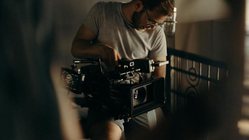
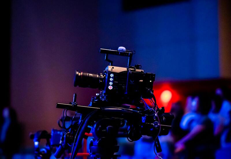
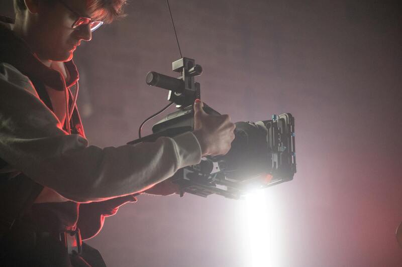
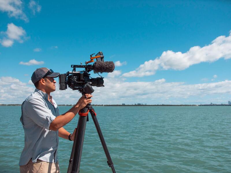
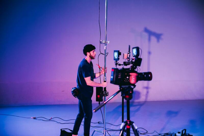
The foundation of high-quality 3D drone photography lies in the deployment of advanced technological equipment designed for precision and reliability. Industry-leading drones are equipped with state-of-the-art flight controllers that enable stable, accurate maneuvering during data collection. These drones often feature automated flight planning systems that follow pre-determined paths, ensuring comprehensive coverage of the target area without gaps or overlaps.
Camera technology is a critical component in capturing detailed imagery required for 3D modeling. High-resolution aerial cameras with up to 50 megapixels, combined with adjustable focal lengths, facilitate sharp image acquisition over diverse terrain and structures. Some systems integrate multispectral or LiDAR sensors, providing additional data layers for enhanced rendering and analysis.
On the processing side, photogrammetry software utilizes sophisticated algorithms that analyze overlapping images to generate point clouds and meshes with millimeter-level precision. These tools often incorporate AI-driven features to automate feature detection, improve texture mapping, and accelerate the creation of accurate 3D models. Cloud-based processing platforms enable real-time collaboration and streamline project workflows, ensuring timely delivery of detailed visualizations.
The combination of cutting-edge hardware and software solutions helps professionals achieve detailed, accurate, and reliable 3D representations of complex environments, making these tools indispensable for industries that demand spatial precision and comprehensive visualization capabilities.
Process and Methodology
Executing a successful 3D drone photography project involves a systematic approach that ensures high-quality outcomes and comprehensive spatial data collection. The process begins with meticulous flight planning, where the project scope, target areas, and desired data resolution are clearly defined. This entails selecting optimal flight paths that maximize coverage while maintaining safety and efficiency, often utilizing advanced flight planning software. Such software considers factors like altitude, overlap between images, and environmental conditions to configure an ideal flight plan.
Once the flight parameters are established, the next phase is image capture. During this stage, the drone executes predetermined routes, capturing overlapping high-resolution images from multiple angles. Consistent overlap, typically around 70-80% front and side, is critical to facilitate accurate 3D reconstruction. The drone's stability and precision control mechanisms ensure sharp, blur-free images, even in challenging weather conditions.
After completing the data acquisition, images are transferred to processing software where photogrammetry algorithms analyze the overlaps. This software constructs dense point clouds by triangulating common features in multiple images, which form the foundation for detailed 3D meshes. The software further refines these models by applying texture mapping to create realistic, accurate representations of the surveyed environment.
Throughout the process, quality control measures are integrated to verify data precision and model accuracy. It is essential to review the initial outputs closely, identifying any gaps or errors that may require additional data collection or adjustments in processing. Advanced processing platforms enable teams to collaborate in real-time, streamline workflows, and deliver comprehensive 3D models efficiently.
The holistic methodology—from initial planning to final modeling—ensures that 3D drone photography projects meet rigorous standards, providing stakeholders with detailed visual insights suitable for analysis, planning, and decision-making.
Legal and Ethical Considerations
When implementing 3D drone photography services, especially in a vibrant and densely populated area like Miami, adhering to established protocols and industry standards is essential. Responsible drone operation involves understanding and following official procedures that ensure safety, privacy, and respect for local regulations.
Operators must conduct comprehensive site assessments prior to flight to identify potential hazards, such as pedestrian areas, restricted zones, or sensitive infrastructure. This proactive approach minimizes risks and promotes smooth execution of drone missions. Maintaining clear and consistent communication with local authorities and property owners is also crucial, ensuring all parties are informed and their concerns are addressed.
It is equally important to implement data management practices that uphold privacy standards. Securing permissions where needed, anonymizing sensitive information, and ensuring data integrity throughout the process uphold the professionalism of the operation. Using only approved and certified equipment guarantees optimal performance and adherence to industry best practices.
By prioritizing these principles, professionals can deliver high-quality 3D imaging while respecting community standards and fostering trust with clients and stakeholders. Each project benefits from transparent workflows and documented procedures, reinforcing confidence in the capabilities and integrity of the service provider.
Legal and Ethical Considerations in 3D Drone Photography
When engaging in 3D drone photography within Miami, it is essential to adhere to established practices that promote respect for individual privacy, property rights, and community standards. Operators must ensure that they obtain all necessary permissions prior to conducting aerial surveys or imaging projects. This involves clear communication with property owners and relevant authorities to confirm authorization for drone flights over private or sensitive areas.
Proper planning includes identifying no-fly zones and restricted areas that might encompass government infrastructure, airports, or other protected sites. Maintaining a safe distance from these zones not only aligns with operational best practices but also minimizes potential disruptions or unintended violations of airspace regulations. Consistent documentation of permissions and flight plans helps enhance transparency and accountability, reinforcing the professional integrity of the project.
Enforcing data protection protocols is equally vital. This includes anonymizing any personally identifiable information captured during high-resolution imaging sessions. Secure data storage and restricted access help prevent unauthorized use or distribution of sensitive content. Clients and operators alike benefit from establishing clear data management policies that safeguard the privacy interests of individuals and organizations involved.
Additionally, compliance with local ordinances and industry standards should be a fundamental aspect of every project. By utilizing certified equipment operated by trained professionals, companies demonstrate their commitment to responsible practice. Regular training and updates on evolving regulations ensure that safety and ethical standards remain paramount throughout the workflow.
Adhering to these principles underscores a dedication to responsible aerial imaging, fostering trust among clients, regulatory bodies, and the public. It also promotes a culture of professionalism that highlights the importance of respecting privacy, property rights, and community well-being during 3D drone photography projects.
Enhancing 3d Drone Photography with Advanced Methods
Achieving precise and high-quality 3D drone imagery involves employing sophisticated techniques that enhance accuracy and detail. One of the key strategies includes the integration of photogrammetric methods, where multiple overlapping images captured from different angles are processed through specialized software to construct detailed three-dimensional models. This approach allows for highly accurate representations of terrains, structures, and urban environments, making it invaluable for applications such as urban planning and infrastructure inspections in Miami.
Another vital aspect involves the use of terrestrial control points, which serve as reference markers in the footage to improve georeferencing accuracy. These control points, placed strategically within the drone’s flight area, facilitate precise alignment of the 3D models with real-world coordinates, ensuring data integrity and consistency.
To augment data collection, software solutions equipped with powerful algorithms for point cloud generation and mesh reconstruction are utilized. These tools analyze captured datasets to produce dense point clouds that form the foundation of detailed 3D models. Such models can be used for volumetric analysis, environmental studies, and architectural visualizations in Miami’s dynamic urban landscape.
Moreover, multi-sensor payloads, including LiDAR (Light Detection and Ranging) sensors, are increasingly integrated into drone systems, providing superior depth perception and capturing more comprehensive data than traditional imaging alone. This technology is particularly beneficial in environments with dense foliage or complex architectural structures where optical imagery might fall short.
Post-flight data processing is equally critical, involving meticulous filtering, alignment, and modeling to produce clean, accurate 3D visualizations. Skilled operators and analysts ensure this process adheres to strict quality standards, transforming raw data into actionable insights for clients across different sectors in Miami.
In essence, the fusion of advanced photogrammetric techniques, control point utilization, high-resolution sensors, and robust processing workflows underpins the professional execution of 3D drone photography projects. These methods guarantee comprehensive and reliable spatial data, empowering clients with detailed visualizations tailored for their unique needs in Miami's diverse environments.
Legal and Ethical Considerations
Ensuring responsible use of 3D drone photography involves adherence to established standards and practices designed to protect privacy and safety. When operating drones for capturing detailed 3D models, professionals typically follow industry best practices that emphasize transparency with stakeholders regarding data collection methods and intended use. This approach fosters trust and aligns with the expectations of clients and the community.
Operators are trained to manage drone flight plans that respect property boundaries and avoid interference with private spaces. Utilizing geofencing technology can help restrict drone operation to designated areas, minimizing potential privacy concerns. Additionally, clear communication with property owners and local authorities is a common step to demonstrate professionalism and respect for individual rights.
Certification and ongoing training are integral to maintaining high standards in 3D drone photography. Operators are often certified by relevant authorities and participate in continuous education programs that keep them updated on emerging regulations and safe flying practices. This proactive approach ensures that each project is executed within accepted operational parameters, reinforcing the integrity of the service.
Data security measures also play a critical role. Professionals implement secure data storage solutions and controlled access protocols to safeguard sensitive information obtained during scanning and modeling processes. By adopting robust cybersecurity practices, they protect client data from unauthorized access or breaches.
Ethical practices encompass honesty about the capabilities and limitations of drone technology, providing clients with accurate expectations and transparent service agreements. This honesty extends to post-processing and final delivery, ensuring that all outputs meet the agreed-upon standards without misrepresentation.
Legal and Ethical Considerations in 3D Drone Photography
Ensuring responsible practice in 3D drone photography involves adherence to established guidelines that prioritize respect for individual privacy and property rights. Professionals employ best practices such as obtaining explicit consent from property owners before capturing images or creating detailed models. This transparent approach fosters trust and prevents misunderstandings that could arise from unauthorized data collection.
Additionally, clear communication with relevant stakeholders, including local authorities and community members, helps in coordinating operations smoothly and avoiding disruptions. Professionals often provide detailed project plans outlining flight paths, data collection methods, and safety protocols. This transparency underscores their commitment to ethical standards and operational integrity.
Another critical aspect involves data security and privacy protections. Implementing secure storage solutions for sensitive data, along with controlled access measures, ensures that client information remains confidential. Professionals often utilize encrypted data transfer methods and secure cloud storage to safeguard collected assets, minimizing the risk of unauthorized access.
Moreover, transparency about the capabilities and limitations of drone technology enhances professional credibility. Providing clients with comprehensive insights regarding image accuracy, resolution, and modeling capabilities ensures realistic expectations. Ethical practices extend into post-processing stages, where professionals deliver final outputs that precisely reflect the captured data without undue manipulation or misrepresentation.
Upholding these standards not only maintains trust but also demonstrates a commitment to responsible service delivery. It ensures that 3D drone photography in Miami aligns with the highest professional ethics, supporting sustainable growth and positive community relationships.