Understanding Aerial Real Estate Photography
Aerial real estate photography involves capturing high-quality aerial images and videos of properties from an elevated perspective, typically using specialized equipment like drones or helicopters. This approach provides a comprehensive view of a property and its surroundings, highlighting features that cannot be easily accessed from ground level. Aerial photographs are instrumental in showcasing expansive landscapes, architectural details, property boundaries, and proximity to nearby amenities, making them an invaluable asset in property marketing.
The significance of aerial photography in real estate marketing continues to grow as buyers increasingly rely on high-resolution visual content to guide their purchasing decisions. By providing a bird's-eye view, agents and sellers can generate more engaging and informative listings, enhancing the property's appeal and standing out in competitive markets.

The evolution of technology has made aerial photography more accessible and cost-effective. Drones equipped with high-definition cameras now allow for precise, stable, and high-quality aerial shots that were once only possible with large aircraft. This accessibility has revolutionized real estate marketing, enabling agents to present properties more comprehensively and professionally.
Successful aerial real estate photography requires careful planning, knowledge of aerial equipment, and adherence to safety protocols. Skilled operators understand how to frame shots that emphasize a property's strengths while providing context with its geographic location. When executed correctly, aerial photography elevates property listings, fostering greater interest and faster sales.
The Importance of Aerial Photography in Property Marketing
In today’s highly visual real estate market, the inclusion of aerial imagery significantly enhances listing presentations. These images not only give potential buyers a sense of spatial relationships but also help them visualize the property's placement within its environment. Aerial shots are particularly beneficial for large estates, commercial properties, and developments where comprehensive views are essential for appreciating the full scope of the property.
Professional aerial photography also facilitates better online engagement. Listings with captivating aerial images tend to attract more clicks, longer viewing durations, and increased interest. Real estate agents in Miami who incorporate high-quality aerial content into their marketing strategies position themselves as innovative and attentive to client needs, ultimately leading to more successful transactions.
Furthermore, aerial images help in marketing developments and new constructions, providing potential buyers and investors with a clear understanding of the project's scale and context within its environment. As the demand for immersive marketing tools continues to grow, aerial real estate photography remains an essential component of effective property promotion in Miami and beyond.
Types of Aerial Equipment Used
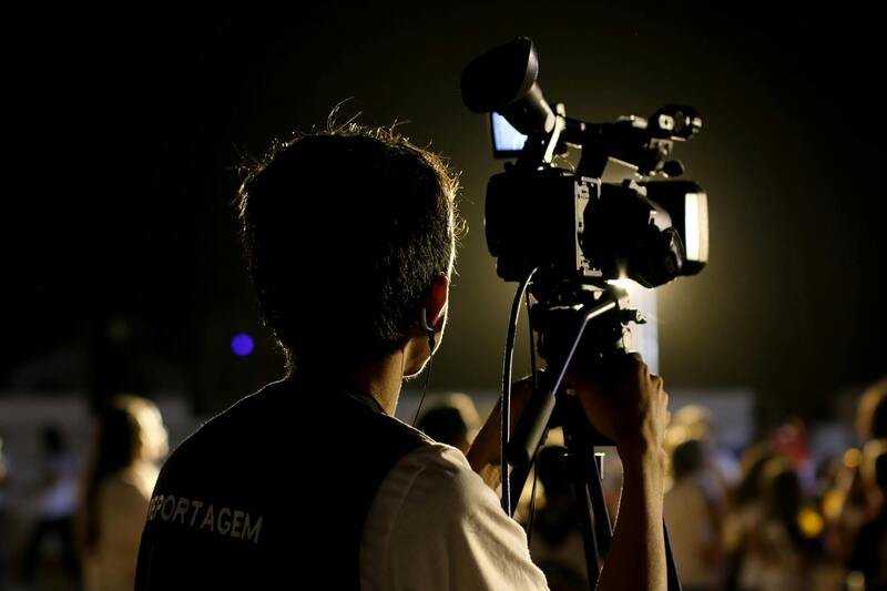
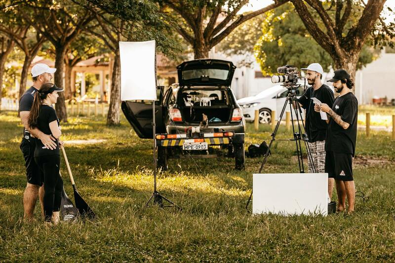
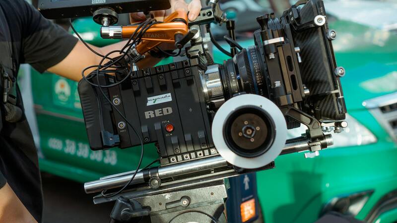
In the realm of aerial real estate photography, the choice of equipment is paramount to capturing images that truly reflect the property's stature and surroundings. The most common tools employed include drone-mounted cameras, which offer versatility and the ability to access hard-to-reach angles without disturbance. These drones are equipped with high-resolution sensors capable of capturing detailed photographs and videos that showcase both the property’s architecture and its landscape.
Beyond consumer-grade drones, professional-grade UAVs (Unmanned Aerial Vehicles) used by experienced operators are essential for producing high-quality content. These advanced drones provide stability, adjustable flight parameters, and advanced camera controls, ensuring crisp, clear aerial shots even in challenging lighting conditions.
Stabilization gimbals are integral to delivering smooth footage, preventing shaky images that can detract from visual appeal. High-definition cameras with wide-angle lenses are preferred for capturing expansive views that encompass the entire property and its environment in a single frame.
 igure>
While helicopters or fixed-wing aircraft were historically used for aerial photography, their use is now largely reserved for large-scale commercial projects due to costs and logistical challenges. Drones have revolutionized this space by providing a cost-effective, flexible, and efficient method suitable for most residential and commercial listings.
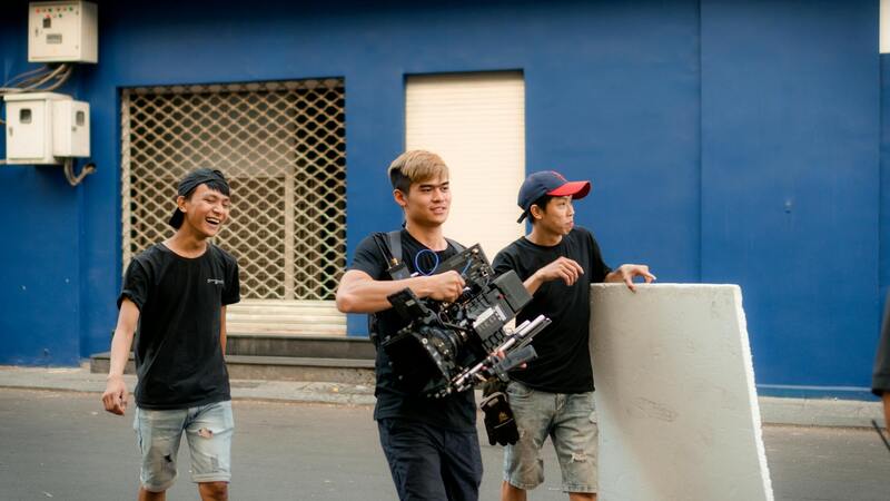
Once the equipment selection is made, it’s equally important to consider the expertise of the operator. Certified drone pilots with knowledge of airspace regulations and advanced flying skills ensure the safety of operations and the quality of photographs captured. Proper training and equipment maintenance are crucial components that influence the final visual output in aerial real estate marketing.
Types of Aerial Equipment Used
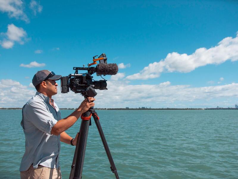
In professional aerial real estate photography, the selection of equipment directly impacts the quality and effectiveness of the visual content. The most commonly employed devices include multi-rotor drones equipped with high-resolution cameras that can capture detailed images in various weather conditions and lighting scenarios. These drones often feature stabilizing gimbals to ensure smooth footage, minimizing vibrations and jitters that can distort the image.
Beyond standard drones, specialized aerial cameras mounted on fixed-wing aircraft or helicopters are used for expansive property portfolios, large-scale commercial developments, or projects requiring extremely high-resolution imagery. These setups often utilize panoramic cameras or multi-lens systems to provide comprehensive views of extensive areas.
 igure>
Moreover, some advanced setups incorporate thermal imaging cameras or 3D mapping tools, enhancing the detail and analytical capabilities of aerial photographs. The integration of GPS and real-time image stabilization further refines the quality, enabling precise framing and steady shots even when operating in challenging environments.
Each piece of equipment is chosen based on the project scope, desired image resolution, and environmental factors. Ensuring optimal performance requires not only selecting the right tools but also maintaining them properly and operating within prescribed safety and operational protocols.
Understanding Aerial Real Estate Photography
Aerial real estate photography has transformed property marketing by providing unparalleled perspectives that ground-level images cannot offer. This specialized discipline involves capturing high-altitude shots of properties, neighborhoods, and surrounding landscapes, offering prospective buyers a comprehensive view of the area and the property’s placement within its environment. Leveraging advanced UAV (Unmanned Aerial Vehicle) technology, professional photographers utilize a range of sophisticated equipment designed to produce sharp, vivid, and impactful visuals. These images afford a strategic advantage in real estate marketing by highlighting features such as expansive grounds, architectural details, and the property’s proximity to nearby amenities or natural features.
Effective aerial photography begins with selecting the appropriate equipment. Modern multi-rotor drones equipped with high-resolution cameras are standard tools, capable of capturing detailed images even in challenging lighting and weather conditions. These drones often include stabilizing gimbals which keep cameras steady during flight, resulting in crisp, professional images free from jitters or blurring. In scenarios demanding larger coverage or higher detail, fixed-wing aircraft or helicopters might be employed. These platforms can traverse broader areas and provide wider, more comprehensive perspectives, which are particularly beneficial for expansive commercial developments or extensive acreage properties.
Beyond basic imaging, the integration of advanced tools such as thermal cameras, 3D mapping systems, and panoramic lens configurations further enhances the analytical depth and visual richness of aerial captures. GPS-enabled stabilization and real-time image processing ensure the accuracy and clarity of each shot, regardless of environmental challenges. Selecting the right equipment aligns closely with project scope—balancing resolution needs, area size, and environmental factors to achieve optimal results. Proper maintenance and safe operation protocols are essential to maximize equipment lifespan and ensure safety during flight operations.
This technological sophistication allows real estate professionals to craft compelling visual narratives of their properties that captivate potential buyers and distinguish their listings in competitive markets. When one considers the enduring impact of a visually striking aerial shot, it is evident that investing in top-tier equipment and skilled operation yields significant returns in visibility and engagement.
Benefits of Aerial Photography for Real Estate Listings
Utilizing aerial imagery in property marketing delivers multiple advantages, transforming traditional listing methods into dynamic, engaging presentations. The key benefits include:
- Enhanced Visual Appeal: Elevated angles showcase the entire property, highlighting landscaping, outdoor amenities, and architectural features that ground-level photos may fail to capture effectively.
- Greater Context and Scale: Prospective buyers gain a realistic sense of the property’s size, layout, and surroundings, which helps in visualizing their future home or investment.
- Increased Engagement: Listings enhanced with aerial images tend to attract more views and inquiries, as they stand out visually and provide comprehensive insights at a glance.
- Better Storytelling: Aerial shots can narrate a property's story—focusing on unique features like swimming pools, gardens, or proximity to parks and waterways, thereby appealing emotionally to buyers.
- Marketing Consistency: High-quality aerial photographs integrate well into various digital platforms, including websites, social media, and virtual tours, maintaining a professional and consistent marketing presence.
In an era where digital engagement is paramount, imagery plays a crucial role in forming perceptions and influencing decisions. Aerial photography services, through high-resolution imagery and strategic framing, facilitate a compelling visual narrative that traditional ground-level images simply cannot achieve.
Furthermore, aerial imagery can highlight features and property advantages that might otherwise be overlooked, such as the property's relationship with adjoining developments or natural features. This broader perspective helps prospective buyers understand the full scope and potential of the property, fostering informed decision-making and boosting overall marketing effectiveness.
Understanding Aerial Real Estate Photography
Aerial real estate photography involves capturing high-quality images of properties from an elevated perspective using specialized equipment such as drones, helicopters, or fixed-wing aircraft. This approach provides a comprehensive view of the property and its surroundings, showcasing features that are difficult to convey through traditional ground-level photos. The strategic use of aerial imaging allows real estate professionals to present properties in a manner that highlights their unique characteristics, spatial relationships, and the environment, thereby aiding prospective buyers in making informed decisions.
High-resolution aerial photography relies on advanced camera technology mounted on drones or aircraft. These images help in illustrating the property's dimensions, layout, accessibility, and proximity to local amenities. Such visuals are increasingly integral to comprehensive property listings, virtual tours, and marketing campaigns, as they provide an immersive experience that static ground images cannot replicate. Effective aerial shots can reveal details like landscaping, exterior features, and the property's relationship with neighboring developments, creating a compelling narrative for potential buyers.
Benefits of Aerial Photography for Real Estate Listings
- Enhanced Visual Appeal: Aerial images stand out among standard photos, capturing attention and increasing listing engagement.
- Broader Property Representation: Showcase entire estates, outdoor amenities, and landscape features from a single shot, providing clarity on property size and layout.
- Location Context: Emphasize proximity to attractions, waterways, parks, or commercial areas, aiding buyers in understanding the locale.
- Time-Efficient Viewing: Enable prospective buyers to assess property scope quickly, reducing the need for multiple showings.
- Competitive Marketing: Elevate marketing materials with high-quality visuals, helping listings stand out in a crowded market.
Types of Aerial Equipment Used
The choice of equipment influences the quality, safety, and feasibility of aerial photography. Key types include:
- Unmanned Aerial Vehicles (Drones): Most commonly used for residential and commercial properties, offering agility and cost efficiency. Drones equipped with stabilized gimbals and high-resolution cameras can capture sharp, stable images from various angles.
- Helicopters: Suitable for larger estates or commercial properties, providing extensive coverage and the ability to access hard-to-reach areas. Helicopter imaging offers high-altitude shots with minimal movement disturbances.
- Fixed-Wing Aircraft: Ideal for expansive properties or regions requiring longer flight times. These aircraft can cover large areas swiftly, making them suitable for regional or development-scale projects.

Legal and Safety Considerations in Miami
The dynamic urban landscape of Miami necessitates adherence to strict operational standards when conducting aerial real estate photography. While engaging an aerial imaging service, professionals comply with local ordinances that govern drone operations, including altitude restrictions, flight zones, and privacy considerations. Pre-flight risk assessments are essential to identify potential hazards, such as power lines, tall structures, or congested airspace, ensuring safe and efficient missions.
Operators are trained to manage equipment responsibly, maintaining line-of-sight control and avoiding interference with manned aircraft. Additionally, they implement safety protocols to safeguard both personnel and property, such as weather assessments to prevent flight in adverse conditions. Clear communication with property owners and neighbors is crucial for neighborhood awareness and minimizing disruptions during shoots.
In Miami, many service providers also coordinate with local authorities and follow FAA guidelines for drone use, ensuring operations are compliant with federal regulations. This collaborative approach guarantees that aerial photography captures the desired imagery while respecting privacy and safety mandates, maintaining professionalism and integrity throughout each project.
Understanding Aerial Real Estate Photography
For real estate professionals and property owners, aerial real estate photography offers an innovative means to showcase properties from unique perspectives. This approach captures expansive views of the property and its surroundings, including neighboring landscapes, amenities, and infrastructural elements that ground-level photographs cannot effectively portray. By utilizing high-resolution imagery taken from drones or specialized aircraft, agents can highlight a property's size, layout, and outdoor features with a level of detail that enhances listing appeal.
Aerial photographs play a crucial role in providing context, especially for large estates, commercial complexes, or properties with significant land components. These images facilitate a comprehensive visual understanding for prospective buyers, fostering emotional engagement and enabling better-informed decisions. Moreover, aerial imagery can be seamlessly integrated into virtual tours and marketing campaigns, increasing exposure across digital platforms.
Employing the appropriate equipment and techniques ensures the captured images are not only visually stunning but also informative. Proper planning, including weather considerations and flight timings, optimizes the quality of the aerial visuals. Advanced software post-processing further refines these images, ensuring they meet professional standards for marketing materials.
Benefits of Aerial Photography for Real Estate Listings
- Enhanced property visibility through striking visuals
- Ability to showcase property scale and layout comprehensively
- Attracts a broader audience by providing detailed, immersive views
- Supports virtual tours, social media marketing, and online listings
- Distinguishes listings in competitive markets, generating faster sales
Types of Aerial Equipment Used
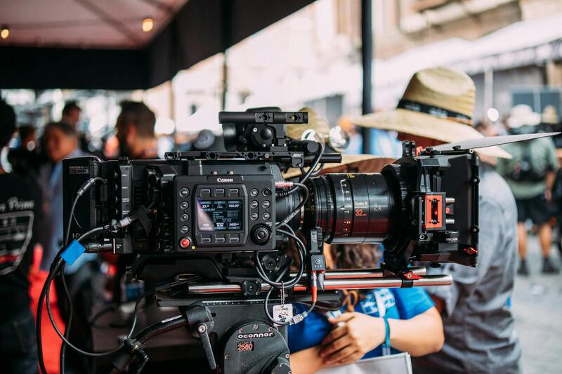
Several platforms are employed in aerial real estate photography, each selected based on project scope and required image quality. Multirotor drones are most common for their agility, ease of use, and high-resolution camera integrations. Fixed-wing aircraft, though less portable, are utilized for large-scale properties or expansive terrains, providing extended flight durations and coverage.
Camera payloads vary from standard high-resolution DSLR systems to advanced thermal or multispectral sensors for specialized applications. Gimbals are used to stabilize cameras during flight, ensuring sharp images despite movement or atmospheric disturbances. Stabilization and GPS positioning enhance the precision and repeatability of aerial shots, vital for creating consistent marketing visuals.
Understanding the capabilities and limitations of each aerial platform allows providers to tailor their services, ensuring clients receive images that truly highlight the property's standout features. For instance, multirotor drones excel in tight spaces and complex urban areas like Miami's downtown, while fixed-wing aircraft are suited for open land and large estates.
Legal and Safety Considerations in Miami
Operating aerial equipment in Miami requires adherence to a set of strict protocols designed to ensure safe and responsible conduct. While these operations are conducted within a framework of established regulations, professionals take proactive measures to avoid potential issues. This involves conducting pre-flight assessments, mapping out flight zones to circumvent restricted or congested airspace, and maintaining clear communication with local authorities and property owners.
Operators receive specialized training encompassing airspace regulations, risk management, and emergency procedures. Weather conditions are closely monitored to prevent flights in inclement conditions that could compromise safety or image quality. Equipment inspections precede each flight to verify functionality, stability, and adherence to operational standards.
Respect for privacy and property is prioritized, with clear protocols for obtaining necessary permissions and informing affected parties. Many Miami service providers collaborate with local authorities to ensure their activities align with regional guidelines, leveraging both federal and city-specific regulations for drone operations. This comprehensive approach guarantees that aerial photography efforts are conducted smoothly, ethically, and professionally, delivering superior results without compromising safety or community standards.
By incorporating these practices, providers uphold the highest standards in aerial real estate photography, capturing stunning imagery that accentuates properties while ensuring all activities are compliant with local policies.
Understanding Aerial Real Estate Photography
Aerial real estate photography involves capturing high-quality images of properties from elevated perspectives using specialized equipment. This approach offers a comprehensive view of a property’s layout, surrounding landscape, and neighborhood context, providing potential buyers with a more immersive understanding that traditional ground-level photos cannot deliver. Utilizing drones or helicopters equipped with advanced cameras, real estate professionals can highlight key features such as expansive yards, waterfront access, or architectural details, creating compelling listings that stand out in a competitive market.

The technology behind aerial photography has advanced significantly, allowing for precise control, stability, and clarity. Modern equipment offers high-definition imaging capabilities, including 4K video and panoramic shots, contributing to a polished presentation across multiple marketing channels. These images are particularly effective in listing websites, social media campaigns, and virtual tours, where visual appeal directly impacts customer engagement and interest.
The Role of Professional Expertise
Professional aerial photographers possess the technical skills required to operate sophisticated equipment safely and efficiently. They understand flight planning, optimal shooting angles, and image composition, ensuring each shot emphasizes the property’s best features. Skilled operators also have a keen awareness of environmental conditions and airspace restrictions, which are crucial for obtaining high-quality images while adhering to operational standards.

Effective aerial imagery not only improves property aesthetics but also influences prospective buyers’ decision-making. The comprehensive perspective aids in marketing homes more efficiently, often reducing time on market and increasing the likelihood of attracting serious offers. An investment in high-caliber aerial photography, executed by experienced professionals, is a strategic move for real estate agents aiming to maximize a property’s market appeal.
Operational and Ethical Standards
Fidelity to operational protocols ensures that aerial photography adheres to safety and quality benchmarks. Operators undertake detailed flight planning, including site surveys and risk assessments, to minimize hazards. They also communicate with property owners and local authorities, securing necessary permissions and establishing clear parameters for flight paths.
This disciplined approach guarantees not only the safety of personnel and property but also the consistent delivery of professional-grade visuals. Collateral benefits include the preservation of community trust and the avoidance of disruptions, fostering a seamless integration of aerial imagery within the broader real estate marketing strategy.
Optimizing Aerial Imagery for Effective Property Marketing
Integrating aerial photographs into a comprehensive marketing strategy extends beyond simply capturing stunning images. It involves strategic placement, consistency, and complementary content that maximizes engagement and attracts prospective buyers. High-quality aerial visuals can be used across various platforms—from online listings and social media campaigns to email marketing and print brochures—to create a cohesive and compelling narrative about a property.
To achieve this, real estate professionals should ensure that aerial images are optimized for different formats and resolutions. This includes resizing to ensure fast load times on websites without sacrificing clarity, as well as ensuring that images are correctly oriented to maximize visual impact. For online listings, compelling aerial photos should be paired with detailed property descriptions and other media assets, such as floor plans and interior photos, to provide a holistic view of the property and its surroundings.

Incorporating aerial photos into virtual tours and 3D walkthroughs is also an effective way to elevate the property's presentation. These technologically advanced marketing tools allow potential buyers to explore the property remotely, gaining a better understanding of its layout, landscape, and proximity to local amenities. When combined with professional aerial photography, they create an immersive experience that significantly influences purchasing decisions.
Furthermore, leveraging aerial imagery in targeted advertising campaigns enhances visibility among niche markets. Geotargeted social media ads, for instance, can precisely reach interested buyers based on location and demographics, amplifying the property’s appeal to the most relevant audience. Consistent branding and high-quality visuals reinforce the professionalism of the marketing efforts, establishing credibility and fostering trust among potential clients.
Measuring Impact and Adapting Strategies
Tracking the performance of marketing initiatives that feature aerial photography provides insights into their effectiveness. Metrics such as engagement rates, click-through ratios, and inquiries can inform future content strategies, allowing real estate agents and marketers to refine their approaches continually. Feedback from prospective buyers may reveal preferences for certain angles or styles, guiding the development of a distinctive visual identity for each property.
Emerging technologies in data analytics and artificial intelligence are beginning to influence how aerial imagery is utilized in real estate marketing. These innovations enable better segmentation and targeted outreach, ensuring that aerial visuals reach the right audiences with tailored messaging. By staying informed of these advancements, Miami-based real estate professionals can maintain a competitive edge and deliver compelling visual storytelling that resonates with buyers.